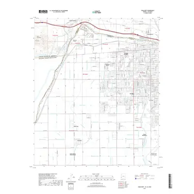
2018 Map of Yuma West
USGS Topo · Published 2018About this map
The Colorado River defines this landscape near the international border, where the United States of America Estados Unidos Mexicanos boundary meets the complex irrigation and drainage systems of the valley. Centered on Yuma, Arizona, the map reveals a highly structured agricultural and residential grid south of the river, supported by an extensive network of waterways including the Main Outlet Drain, Cooper Lateral, and Central Canal. These features demonstrate the intensive water management necessary for the region's productivity, with residential clusters such as Donovan Estates and Padre Ranchitos filling the spaces between larger municipal and military footprints like the Yuma Marine Corps Air Station/Yuma International Airport. In the northwest, Pilot Knob and Pilot Knob Mesa provide a contrast to the flat valley floor, while infrastructure like the Rockwood Heading and Steam rail line underscore the area's role as a transportation and water-control hub.
Find a feature on this map
151 named features on this map. Tap any name to fly to it.
Don’t see what you’re looking for? This feature index may not catch every label — zoom into the map to look around manually.
Map Details
Editions of this 2018 Yuma West Map
This is the sole edition of this map. No revisions or reprints were ever made.
Other maps of this area

1903 · Yuma
USGS Topo · 1:125,000

1905 · Yuma
USGS Topo · 1:125,000

1940 · Yuma
USGS Topo · 1:62,500

1942 · Yuma
USGS Topo · 1:250,000

1945 · Picacho Peak
USGS Topo · 1:62,500

1945 · Yuma
USGS Topo · 1:62,500

1951 · Picacho Peak
USGS Topo · 1:62,500

1952 · Araz
USGS Topo · 1:24,000

1952 · Yuma East
USGS Topo · 1:24,000

1952 · Yuma West
USGS Topo · 1:24,000