2023 Map of Zanesfield
USGS Topo · Published 2023About this map
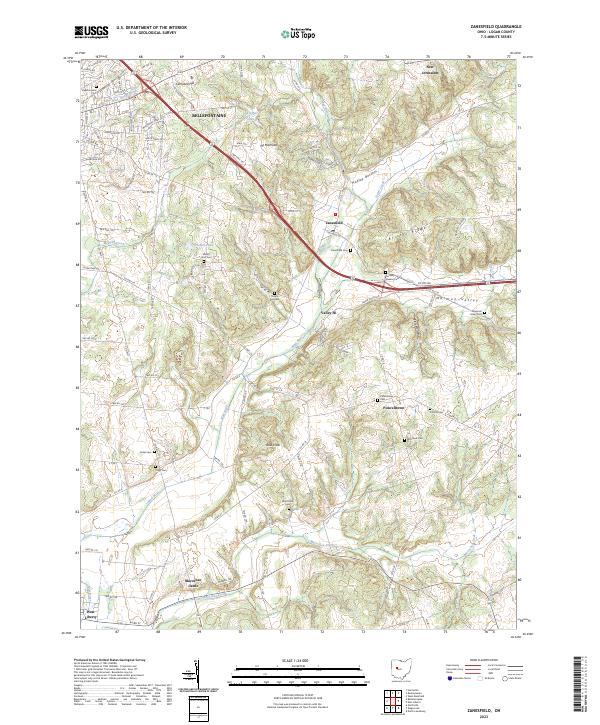
Campbell Hill and the ridges of Logan County dominate this survey of the Zanesfield area, where the Mad River and its tributaries like Macochee Creek have carved a complex landscape of valleys and bottoms. The map reveals a dense network of local history, anchored by the Macochee Castle near the southern boundary and numerous small family or community burial grounds such as the Goshen Quaker Cem and Mount Zion Cem. Regional settlement patterns are visible through established towns like Bellefontaine and smaller nodes like Pickrelltown, connected by a web of township and county roads. Topographical landmarks with evocative names, including Mt Miserable and Bald Knob, punctuate the terrain between the agricultural stretches of Hadley Bottom and the elevated Bristol Ridge, offering a clear view of the rural geography and land use in this part of western Ohio.
Find a feature on this map
89 named features on this map. Tap any name to fly to it.
Don’t see what you’re looking for? This feature index may not catch every label — zoom into the map to look around manually.
Map Details
Editions of this 2023 Zanesfield Map
This is the sole edition of this map. No revisions or reprints were ever made.
Historical Maps of New Jerusalem Through Time
Featured Locations
- Bellefontaine, OH
- Valley Hi, OH
- Zane Township, OH
- Zanesfield, Jefferson Township
- West Liberty, Liberty Township