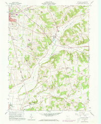
1960 Map of Zanesfield
USGS Topo · Published 1973About this map
Campbell Hill, the highest point in the state, overlooks this landscape of glacial valleys and prominent ridges in Logan County. The topography is defined by the Mad River and its tributaries, including Macochee Creek, which flows past the unique architectural landmarks of Macochee Castle and Macocheek Castle. The area reflects a complex heritage of land distribution, situated near the Virginia Military District boundary.
Find a feature on this map
43 named features on this map. Tap any name to fly to it.
Don’t see what you’re looking for? This feature index may not catch every label — zoom into the map to look around manually.
Map Details
Editions of this 1960 Zanesfield Map
3 editions found
Other maps of this area

1913 · Bellefontaine
USGS Topo · 1:48,000

1913 · East Liberty
USGS Topo · 1:62,500

1914 · St. Paris
USGS Topo · 1:62,500

1914 · Mechanicsburg
USGS Topo · 1:62,500

1915 · Bellefontaine
USGS Topo · 1:62,500

1915 · East Liberty
USGS Topo · 1:62,500

1916 · Mechanicsburg
USGS Topo · 1:62,500

1916 · St. Paris
USGS Topo · 1:62,500

1944 · East Liberty
USGS Topo · 1:62,500

1944 · Mechanicsburg
USGS Topo · 1:62,500