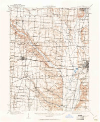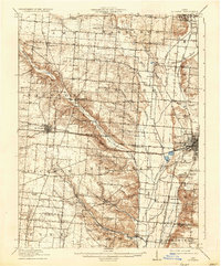
1916 Map of St. Paris
USGS Topo · Published 1936About this map
The Mad River and its numerous tributaries, including Nettle Creek and Bogles Run, dominate this rural landscape in West Central Ohio during the early twentieth century. This survey documents a dense network of nineteenth-century infrastructure, particularly visible in the clustering of one-room schoolhouses like the Apple School, Prince School, and Speece School that served the agricultural townships of Adams, Johnson, and Concord. The intersection of rail and river commerce is evident where the Detroit Toledo and Ironton RR and the Ohio Electric Ry cross the fertile plains near St Paris and Westville.
Find a feature on this map
80 named features on this map. Tap any name to fly to it.
Don’t see what you’re looking for? This feature index may not catch every label — zoom into the map to look around manually.
Map Details
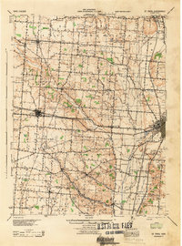
Editions of this 1916 St. Paris Map
This is the sole edition of this map. No revisions or reprints were ever made.
Historical Maps of Urbana Through Time
3 maps found