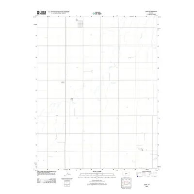
2012 Map of Zook
USGS Topo · Published 2012About this map
Zook serves as the focal point of this Pawnee County landscape, illustrating the grid-based agricultural organization typical of the Kansas plains. The terrain is defined by the meandering courses of Pickle Cr and Hubbard Cr, which provide the primary drainage through the sectioned fields. For genealogists and local historians, the Pleasant Valley Cem stands as a notable landmark along the rural roadways, while the Benson Oil and Gas Field in the southeastern quadrant points to the region's energy production history. The map detail highlights a network of local transit including Co RD-6 and NW 30th ST, reflecting the enduring infrastructure of this rural community during the early twenty-first century.
Find a feature on this map
7 named features on this map. Tap any name to fly to it.
Don’t see what you’re looking for? This feature index may not catch every label — zoom into the map to look around manually.
Map Details
Editions of this 2012 Zook Map
This is the sole edition of this map. No revisions or reprints were ever made.
Other maps of this area

1889 · Larned
USGS Topo · 1:125,000

1889 · Kinsley
USGS Topo · 1:125,000

1891 · Great Bend
USGS Topo · 1:125,000

1891 · Larned
USGS Topo · 1:125,000

1892 · Kinsley
USGS Topo · 1:125,000

1892 · Pratt
USGS Topo · 1:125,000

1893 · Great Bend
USGS Topo · 1:125,000

1894 · Kinsley
USGS Topo · 1:125,000

1894 · Pratt
USGS Topo · 1:125,000

1955 · Great Bend
USGS Topo · 1:250,000