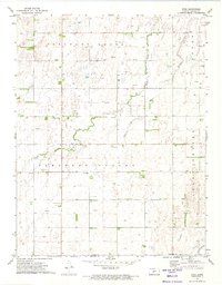
1972 Map of Zook
USGS Topo · Published 1974About this map
The small settlement of Zook serves as the focal point for this Pawnee County landscape in the early 1970s. Located along the county line where it meets Edwards Co, the area is defined by a dense network of energy infrastructure. Numerous Gas Wells and an expansive Gas and Oil Field are plotted across the section lines, indicating the intensive subsurface development that shaped the local economy.
Find a feature on this map
16 named features on this map. Tap any name to fly to it.
Don’t see what you’re looking for? This feature index may not catch every label — zoom into the map to look around manually.
Map Details
Editions of this 1972 Zook Map
This is the sole edition of this map. No revisions or reprints were ever made.
Other maps of this area

1889 · Larned
USGS Topo · 1:125,000

1889 · Kinsley
USGS Topo · 1:125,000

1891 · Great Bend
USGS Topo · 1:125,000

1891 · Larned
USGS Topo · 1:125,000

1892 · Kinsley
USGS Topo · 1:125,000

1892 · Pratt
USGS Topo · 1:125,000

1893 · Great Bend
USGS Topo · 1:125,000

1894 · Kinsley
USGS Topo · 1:125,000

1894 · Pratt
USGS Topo · 1:125,000

1955 · Great Bend
USGS Topo · 1:250,000