Old Maps of Sumidero, Aguas Buenas for Hiking & Exploration
Hike through history with 16 historic maps of Sumidero. Explore old trails, ghost towns, and forgotten backroads — perfect for outdoor adventurers and local explorers.
- Rediscover forgotten places: Map out old mining camps, roads, and footpaths that no longer exist on modern maps.
- Layer with modern tools: Combine with LiDAR or satellite views to plan hikes through historical terrain.
- Made for exploration: Popular among hikers, overlanders, and local history lovers.
Use these maps to find adventure and explore the hidden past of Sumidero.
Sumidero, Aguas Buenas maps
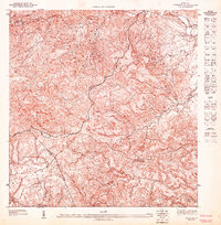
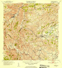
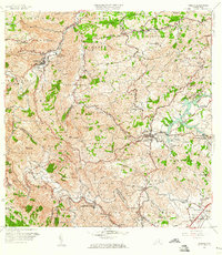
(16)- 1946 Map of Aguas Buenas
 1946 Aguas Buenas1946 Print · USGSCovers Sumidero, including Guaynabo, Trujillo Alto, and other nearby areas3 unique versions available
 - 1946 Map of Comerio
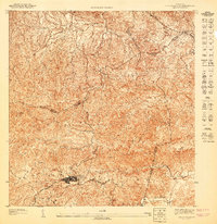
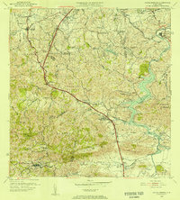
 1946 Comerio1946 Print · USGSCovers Sumidero, including Cidra, Comerío, and other nearby areas3 unique versions available
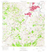
 - 1946 Map of Caguas
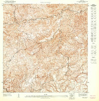
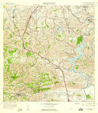
 1946 Caguas1946 Print · USGSCovers Sumidero, including Caguas, Sector Doña Munda, and other nearby areas
 - 1947 Map of Caguas NO
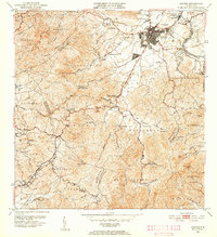
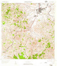
 1947 Caguas NO1947 Print · USGSCovers Sumidero, including Sector Doña Munda, Sector Almena, and other nearby areas
 - 1947 Map of Aguas Buenas SO
 1947 Aguas Buenas SO1947 Print · USGSCovers Sumidero, including Aguas Buenas, Sector Pueblo Santo, and other nearby areas
 - 1947 Map of Comerio NE, 1948 Print
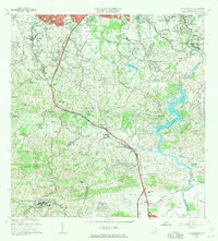
 1947 Comerio NE1948 Print · USGSCovers Sumidero, including La Península, Comunidad Los Delgado, and other nearby areas
 - 1952 Map of Aguas Buenas, 1953 Print
 1952 Aguas Buenas1953 Print · USGSCovers Sumidero, including Guaynabo, Trujillo Alto, and other nearby areas2 unique versions available
 - 1952 Map of Caguas, 1953 Print
 1952 Caguas1953 Print · USGSCovers Sumidero, including Caguas, Sector Doña Munda, and other nearby areas2 unique versions available
 - 1953 Map of Comerio
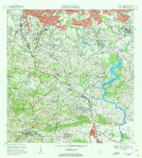
 1953 Comerio1953 Print · USGSCovers Sumidero, including Cidra, Comerío, and other nearby areas
 - 1955 Map of Aguas Buenas, 1956 Print
 1955 Aguas Buenas1956 Print · USGSCovers Sumidero, including Guaynabo, Trujillo Alto, and other nearby areas
 - 1957 Map of Aguas Buenas, 1959 Print
 1957 Aguas Buenas1959 Print · USGSCovers Sumidero, including Guaynabo, Trujillo Alto, and other nearby areas
 - 1957 Map of Caguas, 1959 Print
 1957 Caguas1959 Print · USGSCovers Sumidero, including Caguas, Sector Doña Munda, and other nearby areas
 - 1957 Map of Comerio, 1960 Print
 1957 Comerio1960 Print · USGSCovers Sumidero, including Cidra, Comerío, and other nearby areas5 unique versions available
 - 1964 Map of Caguas, 1966 Print
 1964 Caguas1966 Print · USGSCovers Sumidero, including Caguas, Sector Doña Munda, and other nearby areas4 unique versions available
 - 1964 Map of Aguas Buenas, 1966 Print
 1964 Aguas Buenas1966 Print · USGSCovers Sumidero, including Guaynabo, Trujillo Alto, and other nearby areas
 - 1969 Map of Aguas Buenas, 1972 Print
 1969 Aguas Buenas1972 Print · USGSCovers Sumidero, including Guaynabo, Trujillo Alto, and other nearby areas4 unique versions available
End of results
Showing maps 1-16 of 16
Frequently asked questions
- What are the different types of historical maps available for Sumidero?
- What is the oldest map of Sumidero?
- Where can I purchase historical maps of Sumidero for my home or office?
- Where can I download high-res historical maps of Sumidero?
- Are there historical topographic maps available for Sumidero?
- Is there historical aerial imagery available for Sumidero?
- Where are historical maps of Sumidero sourced from?