1960s Maps of Arecibo
Explore 2 historic maps of Arecibo from the 1960s. These maps offer a rare glimpse into what life looked like during the 1960s — showing old roads, neighborhoods, homes, and landmarks that have changed or disappeared over time.
Whether you're researching your family's past, planning a metal detecting trip, or studying how Arecibo's landscape evolved across the 1960s, these high-resolution maps are a powerful tool for exploring the history of this region.
- Focus on a specific era: All maps on this page are from the 1960s, giving you a focused view of this time period.
- See what’s changed: Compare century-old streets, trails, and buildings to today's modern landscape using overlays and satellite layers.
- Research with precision: Use these maps for genealogy, historical research, land use analysis, or educational projects.
- View, download, or print: Maps are fully viewable online in high resolution, and can be downloaded or printed for your own records.
Start exploring Arecibo's history through authentic maps from the 1960s. This is your window into the past.
Arecibo maps
(2)- 1964 Map of Arecibo, 1968 Print
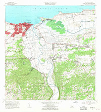 1964 Arecibo1968 Print · USGSMid-century Arecibo transitions from its historic coastal port to a bustling regional hub during the 1960s. Trace family roots and local industry through landmarks like Central Cambalache, the Faro, and the Aeropuerto de Arecibo.4 unique versions available
 - 1969 Map of Barceloneta, 1973 Print
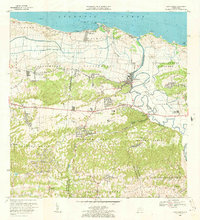 1969 Barceloneta1973 Print · USGSNorthern Puerto Rico's coastal sugar country is detailed here in the late sixties, showing the transition from the Atlantic shore to the interior hills. Genealogists can locate family homes near Central Plazuela, Escuela José Cordero, or the community of Garrochales.3 unique versions available
End of results
Showing maps 1-2 of 2
Frequently asked questions
- What are the different types of historical maps available for Arecibo?
- What is the oldest map of Arecibo?
- Where can I purchase historical maps of Arecibo for my home or office?
- Where can I download high-res historical maps of Arecibo?
- Are there historical topographic maps available for Arecibo?
- Is there historical aerial imagery available for Arecibo?
- Where are historical maps of Arecibo sourced from?