Old Maps of Sabana Hoyos, Arecibo for Academic Research
Study the evolution of Sabana Hoyos with 21 high-resolution historic maps. Whether you're teaching, researching, or modeling changes in land use, these maps provide essential visual documentation of urban, environmental, and geographic change.
- Analyze long-term change: Track patterns in development, transportation, and natural features.
- Ideal for environmental or urban studies: Support academic projects with primary historical map data.
- Use in the classroom or lab: Educators and researchers rely on these maps to bring historical context to life.
These maps are a powerful tool for teaching, research, and visualizing how Sabana Hoyos has changed over the decades.
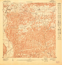
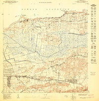
Sabana Hoyos, Arecibo maps
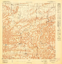
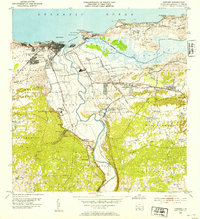
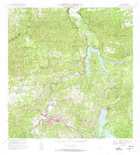
(21)- 1942 Map of Arecibo
 1942 Arecibo1942 Print · USGSCovers Sabana Hoyos, including Arecibo, Reparto Capitolio, and other nearby areas
 - 1942 Map of Barceloneta
 1942 Barceloneta1942 Print · USGSCovers Sabana Hoyos, including Barceloneta, Allende, and other nearby areas
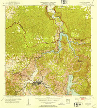
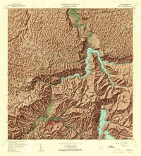
 - 1943 Map of Utuado NE
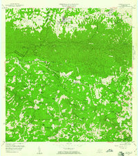
 1943 Utuado NE1943 Print · USGSCovers Sabana Hoyos, including El Valle, Las Caninas II, and other nearby areas
 - 1946 Map of Barceloneta
 1946 Barceloneta1946 Print · USGSCovers Sabana Hoyos, including Barceloneta, Allende, and other nearby areas
 - 1946 Map of Utuado
 1946 Utuado1946 Print · USGSCovers Sabana Hoyos, including Utuado, Sector Campo Alegre, and other nearby areas2 unique versions available
 - 1946 Map of Arecibo
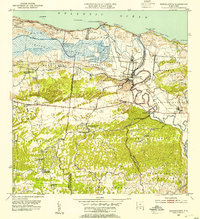
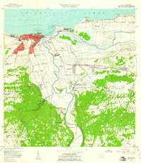
 1946 Arecibo1946 Print · USGSCovers Sabana Hoyos, including Arecibo, Reparto Capitolio, and other nearby areas3 unique versions available
 - 1946 Map of Florida
 1946 Florida1946 Print · USGSCovers Sabana Hoyos, including Florida, Montaña, and other nearby areas2 unique versions available
 - 1947 Map of Barceloneta SO
 1947 Barceloneta SO1947 Print · USGSCovers Sabana Hoyos, including Allende, Asomante, and other nearby areas
 - 1947 Map of Arecibo SE
 1947 Arecibo SE1947 Print · USGSCovers Sabana Hoyos, including Ballajá, Biáfara, and other nearby areas
 - 1950 Map of Arecibo NE
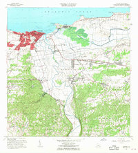
 1950 Arecibo NE1950 Print · USGSCovers Sabana Hoyos, including Reparto Capitolio, Reparto Los Maestros, and other nearby areas
 - 1952 Map of Utuado, 1953 Print
 1952 Utuado1953 Print · USGSCovers Sabana Hoyos, including Utuado, Sector Campo Alegre, and other nearby areas
 - 1952 Map of Florida, 1953 Print
 1952 Florida1953 Print · USGSCovers Sabana Hoyos, including Florida, Montaña, and other nearby areas
 - 1953 Map of Arecibo, 1954 Print
 1953 Arecibo1954 Print · USGSCovers Sabana Hoyos, including Arecibo, Reparto Capitolio, and other nearby areas
 - 1953 Map of Barceloneta, 1954 Print
 1953 Barceloneta1954 Print · USGSCovers Sabana Hoyos, including Barceloneta, Allende, and other nearby areas
 - 1957 Map of Utuado
 1957 Utuado1957 Print · USGSCovers Sabana Hoyos, including Utuado, Sector Campo Alegre, and other nearby areas4 unique versions available
 - 1957 Map of Barceloneta, 1961 Print
 1957 Barceloneta1961 Print · USGSCovers Sabana Hoyos, including Barceloneta, Allende, and other nearby areas
 - 1957 Map of Florida, 1961 Print
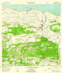
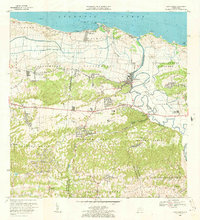
 1957 Florida1961 Print · USGSCovers Sabana Hoyos, including Florida, Montaña, and other nearby areas4 unique versions available
 - 1957 Map of Arecibo, 1961 Print
 1957 Arecibo1961 Print · USGSCovers Sabana Hoyos, including Arecibo, Reparto Capitolio, and other nearby areas
 - 1964 Map of Arecibo, 1968 Print
 1964 Arecibo1968 Print · USGSCovers Sabana Hoyos, including Arecibo, Reparto Capitolio, and other nearby areas4 unique versions available
 - 1969 Map of Barceloneta, 1973 Print
 1969 Barceloneta1973 Print · USGSCovers Sabana Hoyos, including Barceloneta, Allende, and other nearby areas3 unique versions available
 - 1972 Map of Utuado, 1974 Print
 1972 Utuado1974 Print · USGSCovers Sabana Hoyos, including Utuado, Sector Campo Alegre, and other nearby areas5 unique versions available
End of results
Showing maps 1-21 of 21
Frequently asked questions
- What are the different types of historical maps available for Sabana Hoyos?
- What is the oldest map of Sabana Hoyos?
- Where can I purchase historical maps of Sabana Hoyos for my home or office?
- Where can I download high-res historical maps of Sabana Hoyos?
- Are there historical topographic maps available for Sabana Hoyos?
- Is there historical aerial imagery available for Sabana Hoyos?
- Where are historical maps of Sabana Hoyos sourced from?