Old Maps of Pasto, Coamo for Metal Detecting
Plan your next treasure hunt with 31 historic maps of Pasto. Find old homesites, ghost towns, trails, and gathering spots that may be lost to time — perfect for identifying promising metal detecting locations.
- Locate forgotten sites: Uncover places like long-lost settlements, abandoned rail lines, or gathering spots.
- Plan better hunts: Use map overlays combined with LiDAR or satellite views to narrow in on historically rich areas.
- Made for detectorists: Thousands of hobbyists use these maps to discover relics, coins, and hidden history.
Use these historic maps to boost your research and find new opportunities beneath the surface of Pasto.
Pasto, Coamo maps
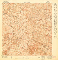
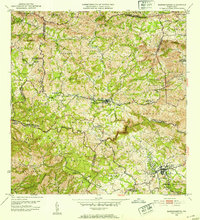
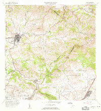
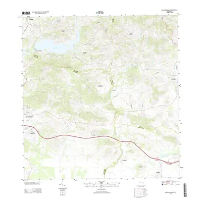
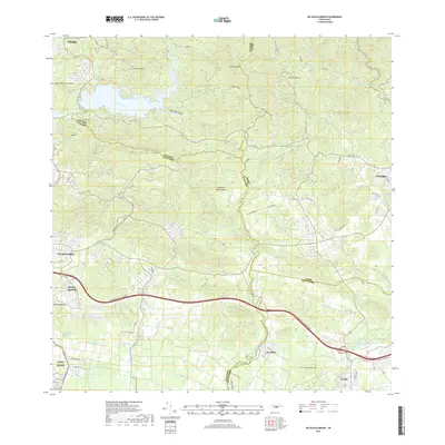
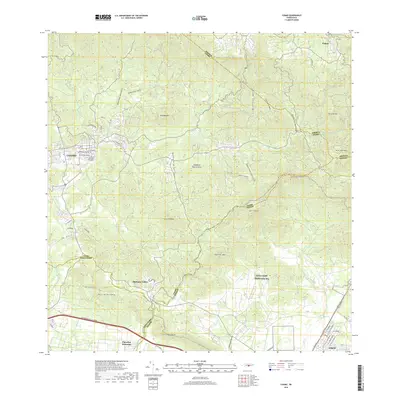
(31)- 1945 Map of Rio Descalabrado
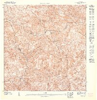
 1945 Rio Descalabrado1945 Print · USGSSanta Isabel and the surrounding southern foothills appear here in the final year of the war, showcasing a landscape of traditional haciendas and emerging rural schools. Trace ancestral roots through named estates like Hacienda Miranda or follow the waters of Lago Coamo and the Rio Descalabrado.3 unique versions available
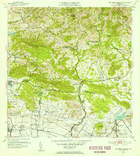
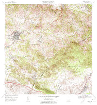
 - 1946 Map of Coamo
 1946 Coamo1946 Print · USGSThe town of Coamo and its surrounding haciendas are captured in the mid-1940s just as the historic mountain roads were modernizing. Genealogists and local historians can locate family estates like Hacienda Esmeralda and Hacienda San José or trace the route to Baños de Coamo.
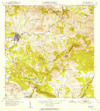
 - 1946 Map of Barranquitas
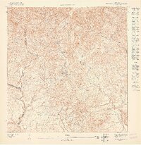
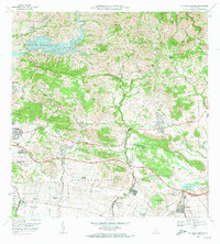
 1946 Barranquitas1946 Print · USGSCentral Puerto Rico during the mid-1940s reveals a landscape of high-elevation settlements and mountain agriculture. Trace rural family roots at Hacienda Córcega or through numerous local schools like Escuela Segunda Unidad de Botijas No 2.3 unique versions available
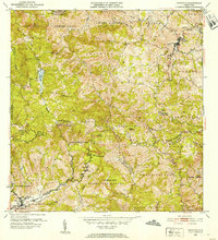
 - 1946 Map of Orocovis
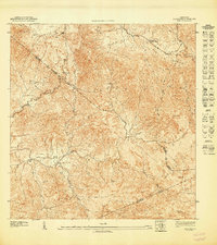
 1946 Orocovis1946 Print · USGSThe Puerto Rican highlands are captured here in the mid-1940s, showing the ridge-top settlements and deep river valleys of the interior. Researchers can trace the rural infrastructure of the era, from the Lago de Matrullas reservoir to landmarks like the Capilla de San José and Hacienda Limón.3 unique versions available
 - 1947 Map of Orocovis SE
 1947 Orocovis SE1947 Print · USGSThe central mountains of Puerto Rico in the mid-1940s are shown here as a landscape of steep ridges and rural watersheds. Genealogists and historians can trace family locations along the Rio Toa Vaca, the heights of Cerro El Malo, and the trails of the Cordillera Central.
 - 1947 Map of Rio Descalabrado NE
 1947 Rio Descalabrado NE1947 Print · USGSThe mountainous interior of Puerto Rico near the Villalba and Coamo borders is documented here just after the war. Local historians can trace early rural life through features like the Escuela Segunda Unidad de Santa Catalina and the Zanja Blanca settlement.
 - 1947 Map of Coamo NE
 1947 Coamo NE1947 Print · USGSThe Puerto Rican interior in the late 1940s is shown here along the high ridges of the Cordillera Central. Trace rural life near the Escuela Federico Degetau and the settlements of Jácana and La Guaba before modern development altered the valley floors.
 - 1947 Map of Coamo NO
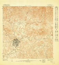 1947 Coamo NO1947 Print · USGSThe mountain town of Coamo is captured in the mid-1940s, showing a traditional street grid and surrounding agricultural settlements. Genealogists and historians can trace the early footprints of San Diego and Cacao or the paths of the Rio Coamo.
 - 1947 Map of Barranquitas SO
 1947 Barranquitas SO1947 Print · USGSThe rural highlands of Coamo and Barranquitas are captured here in the late 1940s as agricultural life centered around family estates and mountain schools. Researchers can trace the grounds of Hacienda Córcega and locate regional landmarks like Cerro Pulguillas or the Escuela Segunda Unidad de Helechal.
 - 1952 Map of Rio Descalabrado, 1953 Print
 1952 Rio Descalabrado1953 Print · USGSSouthern Puerto Rico's coastal plains and mountain foothills are captured here during the early fifties, showing a landscape defined by military and agricultural life. Researchers can trace the layout of Campo Losey, locate sugar industry landmarks like Central Las Marias, or find family estates such as Hacienda Miranda.2 unique versions available
 - 1952 Map of Coamo, 1953 Print
 1952 Coamo1953 Print · USGSMid-century Puerto Rico is captured here during a period of transition between its historic hacienda economy and modern development. Researchers can trace family roots through named estates like Hacienda Esmeralda or visit the famous thermal springs at Baños de Coamo.2 unique versions available
 - 1952 Map of Orocovis, 1953 Print
 1952 Orocovis1953 Print · USGSThe central Puerto Rican highlands appear in great detail during the early fifties, documenting the complex network of barrio boundaries and mountain roads. Genealogists and historians can trace local landmarks like Hacienda Limon, the Capilla de San Jose, and the Escuela Segunda Unidad de Bauta.2 unique versions available
 - 1953 Map of Barranquitas, 1954 Print
 1953 Barranquitas1954 Print · USGSThe heart of the Puerto Rican interior is revealed in the early fifties as a landscape of mountain barrios and growing towns. Researchers can locate dozens of rural landmarks, from Hacienda Córcega to numerous schools like Escuela Segunda Unidad de Botijas No. 2.2 unique versions available
 - 1957 Map of Barranquitas, 1960 Print
 1957 Barranquitas1960 Print · USGSThe central mountains of Puerto Rico are shown here in the mid-fifties, featuring a dense network of rural schools and traditional barrios. Genealogists and historians can trace family roots through the numerous school districts and settlements like Helechal, Hacienda Ortega, and Robles.5 unique versions available
 - 1957 Map of Orocovis, 1960 Print
 1957 Orocovis1960 Print · USGSThe central cordillera of Puerto Rico comes alive in the late fifties, showcasing the intricate mountain topography surrounding Orocovis. Genealogists and historians can trace family locations near Hacienda Limón, Villalba, and landmarks like Lago de Matrullas.3 unique versions available
 - 1960 Map of Rio Descalabrado, 1962 Print
 1960 Rio Descalabrado1962 Print · USGSCoastal plains and foothills near Santa Isabel and Juana Díaz are captured here during a period of agricultural and military significance. Researchers can trace historic estate boundaries at Hacienda Miranda and Hacienda Altura or locate local centers like Paso Seco.2 unique versions available
 - 1960 Map of Coamo, 1962 Print
 1960 Coamo1962 Print · USGSThe southern foothills of the Cordillera Central come into focus in the early sixties, centered on the growing town of Coamo. Researchers can locate historic agricultural sites like Hacienda Buena Vista or trace the boundaries of the Salinas Training Area.2 unique versions available
 - 1972 Map of Coamo, 1973 Print
 1972 Coamo1973 Print · USGSThe town of Coamo sits at the edge of the Cordillera Central in the early seventies, showing a landscape of traditional haciendas and modern military training grounds. Genealogists can locate family names and sites like Hacienda Buena Vista, San Diego, and the Escuela Federico Degetau.3 unique versions available
 - 1972 Map of Rio Descalabrado, 1974 Print
 1972 Rio Descalabrado1974 Print · USGSSouthern Puerto Rico in the early seventies shows a transition from traditional sugarcane estates to modern infrastructure. Researchers can trace the boundaries of historic haciendas like Hacienda Amelia or locate the Fort Allen Naval Radio Station and Lago Coamo.4 unique versions available
 - 2013 Map of Coamo, 2013 Print
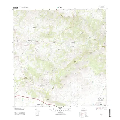 2013 Coamo2013 Print · USGSCovers Pasto, including Coamo, Cayures, and other nearby areas
 - 2013 Map of Rio Descalabrado, 2013 Print
 2013 Rio Descalabrado2013 Print · USGSCovers Pasto, including Sector Sierrita, Sector Villa Pote, and other nearby areas
 - 2013 Map of Orocovis, 2013 Print
 2013 Orocovis2013 Print · USGSCovers Pasto, including Villalba, Orocovis, and other nearby areas
 - 2013 Map of Barranquitas, 2013 Print
 2013 Barranquitas2013 Print · USGSCovers Pasto, including Aibonito, Barranquitas, and other nearby areas
 - 2018 Map of Rio Descalabrado, 2018 Print
 2018 Rio Descalabrado2018 Print · USGSCovers Pasto, including Sector Sierrita, Sector Villa Pote, and other nearby areas
 - 2018 Map of Coamo, 2018 Print
 2018 Coamo2018 Print · USGSCovers Pasto, including Coamo, Cayures, and other nearby areas
Showing maps 1-25 of 31
Frequently asked questions
- What are the different types of historical maps available for Pasto?
- What is the oldest map of Pasto?
- Where can I purchase historical maps of Pasto for my home or office?
- Where can I download high-res historical maps of Pasto?
- Are there historical topographic maps available for Pasto?
- Is there historical aerial imagery available for Pasto?
- Where are historical maps of Pasto sourced from?