
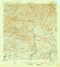
1945 Map of Rio Descalabrado
USGS Topo · Published 1945About this map
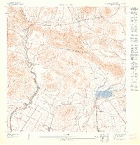
Agricultural haciendas and small settlements define the coastal plains and rising foothills of southern Puerto Rico during the mid-1940s. The landscape transitions from the southern coastline toward the interior cordillera, with the Rio Descalabrado serving as a central drainage feature. Large landholdings like Hacienda Miranda, Hacienda Amelia, and Hacienda Ursula suggest the enduring importance of the plantation economy in this region. To the west, a portion of a U. S. Military Reservation occupies the flats near Pastillito, reflecting the strategic significance of the island during the World War II era.
Find a feature on this map
39 named features on this map. Tap any name to fly to it.
Don’t see what you’re looking for? This feature index may not catch every label — zoom into the map to look around manually.
Map Details
Editions of this 1945 Rio Descalabrado Map
3 editions found
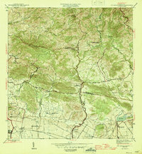
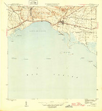
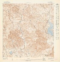
Other maps of this area

1944 · Santa Isabel
USGS Topo · 1:30,000

1945 · Playa De Ponce
USGS Topo · 1:30,000

1945 · Ponce
USGS Topo · 1:30,000
1945 · Salinas
USGS Topo · 1:30,000

1946 · Coamo
USGS Topo · 1:30,000

1946 · Barranquitas
USGS Topo · 1:30,000

1946 · Jayuya
USGS Topo · 1:30,000

1946 · Orocovis
USGS Topo · 1:30,000
1947 · Ponce NE
USGS Topo · 1:10,000
1947 · Rio Descalabrado SE
USGS Topo · 1:10,000
Featured Places
- Comunidad Johnny Tosco, Coamo
- Quintas del Llano, Coamo
- Villa Geraldina, Juana Díaz
- Sector Sierrita, Coamo
- Sector Verdún, Coamo