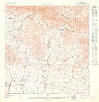
1947 Map of Rio Descalabrado SE
USGS Topo · Published 1947About this map
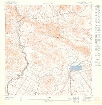
Poblado Rio Cañas Arriba and Los Llanos sit within a landscape of early 1940s agricultural development and complex water management. This map illustrates the intersection of three administrative districts: Municipio de Juana Diaz, Municipio de Coamo, and Municipio de Santa Isabel. The Canal de Juana Diaz is a prominent engineering feature, cutting through the terrain south of Cerro del Muerto to support the local agrarian economy. Along the eastern edge, Lago Coamo is fed by the Rio Coamo, while the Rio Descalabrado winds through the western valley near Las Ollas. Smaller agricultural nodes like Hacienda Altura and clusters such as Poblado Magueyes show the distribution of labor and housing during this period. The transportation network is anchored by the Central Carretera and local routes like Camino Gayeres, which connected these rural poblados to larger regional markets.
Find a feature on this map
18 named features on this map. Tap any name to fly to it.
Don’t see what you’re looking for? This feature index may not catch every label — zoom into the map to look around manually.
Map Details
Editions of this 1947 Rio Descalabrado SE Map
This is the sole edition of this map. No revisions or reprints were ever made.
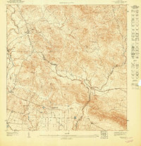
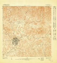
Other maps of this area

1944 · Santa Isabel
USGS Topo · 1:30,000

1945 · Rio Descalabrado
USGS Topo · 1:30,000
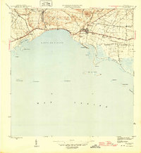
1945 · Salinas
USGS Topo · 1:30,000

1946 · Coamo
USGS Topo · 1:30,000
1947 · Rio Descalabrado NE
USGS Topo · 1:10,000
1947 · Santa Isabel NO
USGS Topo · 1:10,000
1947 · Rio Descalabrado SO
USGS Topo · 1:10,000
1947 · Coamo SO
USGS Topo · 1:10,000
1947 · Coamo NO
USGS Topo · 1:10,000
1947 · Rio Descalabrado NO
USGS Topo · 1:10,000
Featured Places
- Valle Paraíso, Coamo
- Comunidad Johnny Tosco, Coamo
- Quintas del Llano, Coamo
- Sector Villa Pote, Santa Isabel
- Coamo