
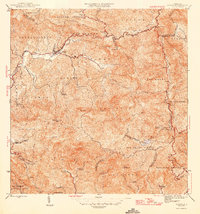
1946 Map of Jayuya
USGS Topo · Published 1946About this map
High-altitude coffee and sugar estates dominate the Cordillera Central in this mid-century survey of the Puerto Rican interior. The town of Jayuya sits at the confluence of the Río Grande de Jayuya and the Río Saliente, serving as a central hub for the numerous surrounding agricultural estates. Industrial processing is centered at the Central Santa Barbara sugar mill and the Planta Hidroelectrica Toro Negro No. 2, indicating the area's role in the island's energy and commodity production. The terrain is marked by extreme vertical relief, including the summit of Cerro de Punta, the highest peak in Puerto Rico. Genealogists and local historians can trace specific family-held lands through the dozens of named haciendas, such as Hacienda Gripina and Hacienda Los Planes, many of which were historically vital to the regional economy. The landscape is also defined by modern infrastructure of the era, such as the Lago El Guineo reservoir.
Find a feature on this map
44 named features on this map. Tap any name to fly to it.
Don’t see what you’re looking for? This feature index may not catch every label — zoom into the map to look around manually.
Map Details
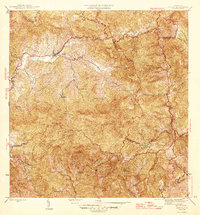
Editions of this 1946 Jayuya Map
3 editions found
Other maps of this area

1945 · Ponce
USGS Topo · 1:30,000

1945 · Rio Descalabrado
USGS Topo · 1:30,000

1946 · Utuado
USGS Topo · 1:30,000

1946 · Ciales
USGS Topo · 1:30,000

1946 · Florida
USGS Topo · 1:30,000

1946 · Orocovis
USGS Topo · 1:30,000

1946 · Penuelas
USGS Topo · 1:30,000

1946 · Adjuntas
USGS Topo · 1:30,000

1947 · Ponce NE
USGS Topo · 1:10,000
1947 · Ciales SO
USGS Topo · 1:10,000
Featured Places
- Jayuya
- Sector Estancias del Indio, Jayuya
- Salientito, Jayuya
- Sector El Carajo, Jayuya
- Villa Canonal, Jayuya