Old Maps of Ensenada, Guánica for Genealogy
Trace your family roots with 8 historic maps of Ensenada. These high-res maps reveal old neighborhoods, homesites, landmarks, and streets — helping you uncover where your ancestors lived and how the area evolved over time.
- Explore historic neighborhoods: Identify where your relatives may have lived in the 1800s or 1900s.
- Compare maps over time: Trace the changes in streets, buildings, and landmarks for multi-generational research.
- Perfect for genealogy & ancestry research: Used by family historians and researchers to map out lineage and migration.
These maps are an incredible resource for exploring your personal connection to Ensenada's past.
Ensenada, Guánica maps
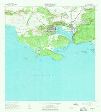
(8)- 1938 Map of Guanica
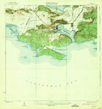 1938 Guanica1938 Print · USGSThe southern coast of Puerto Rico thrived as a sugar-producing powerhouse in the late 1930s, centered on the massive Central Guanica mill. Researchers can trace the industrial footprint of Ensenada, locate the historic Guanica LH, and find local schools like Escuela No 225.6 unique versions available
 - 1949 Map of Guanica NE
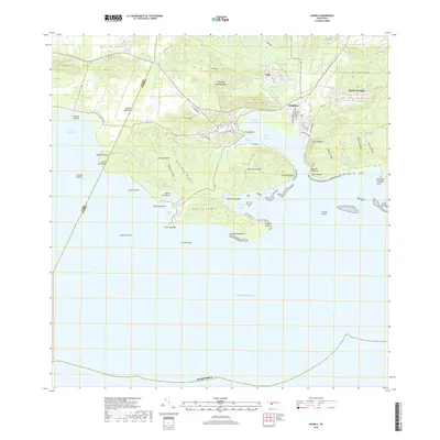
 1949 Guanica NE1949 Print · USGSThe industrial and maritime landscape of southwest Puerto Rico is captured here in the late 1940s. Genealogists and historians can trace the development of Ensenada, the operations at Central Guánica, and coastal landmarks like the Faro de Guánica.
 - 1949 Map of Guanica
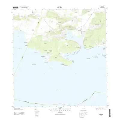
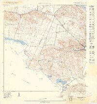 1949 Guanica1949 Print · USGSCoastal salt production and rural barrios define the southwest shore of Puerto Rico in the late 1940s. Researchers can trace ancestral connections and land use at Salinas Fortuna, Escuela Las Colinas, and the village of Ensenada.
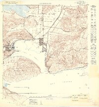
 - 1956 Map of Guanica, 1959 Print
 1956 Guanica1959 Print · USGSThe southwestern coast of Puerto Rico is shown here in the mid-1950s, centered on the bustling sugar industry and salt works of the era. Researchers can trace the layout of Ensenada, the maritime importance of Faro de Guánica, and salt flats like Salinas Providencia.
 - 1966 Map of Guanica, 1969 Print
 1966 Guanica1969 Print · USGSCoastal Guánica in the mid-sixties reveals a landscape balancing the industrial output of Central Guánica with the protected reaches of the Bosque Estatal de Guánica. Researchers can trace the layout of Ensenada, locate the Faro de Guánica, and find family-named landmarks like Punta Montalva.3 unique versions available
 - 2013 Map of Guanica, 2013 Print
 2013 Guanica2013 Print · USGSCovers Ensenada, including Guánica, Villa Dibble, and other nearby areas
 - 2018 Map of Guanica, 2018 Print
 2018 Guanica2018 Print · USGSCovers Ensenada, including Guánica, Villa Dibble, and other nearby areas
 - 2024 Map of Guanica, 2024 Print
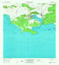
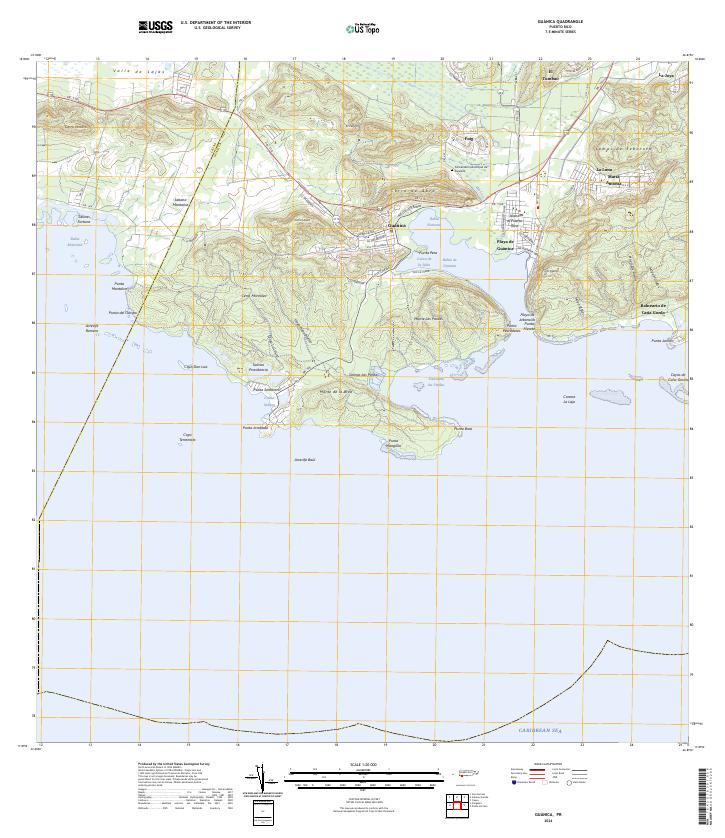 2024 Guanica2024 Print · USGSThe southern coast of Puerto Rico is detailed here in the contemporary era, centered on the deep harbor and salt-producing history of the region. Researchers can trace local heritage through the Cementerio Municipal de Guánica and settlements like Fuig and Sabana Montalva.
End of results
Showing maps 1-8 of 8
Frequently asked questions
- What are the different types of historical maps available for Ensenada?
- What is the oldest map of Ensenada?
- Where can I purchase historical maps of Ensenada for my home or office?
- Where can I download high-res historical maps of Ensenada?
- Are there historical topographic maps available for Ensenada?
- Is there historical aerial imagery available for Ensenada?
- Where are historical maps of Ensenada sourced from?