1900s (20th Century) Maps of Caimito, Juncos
Explore 16 historic maps of Caimito from the 1900s (20th Century). These maps offer a rare glimpse into what life looked like during the 1900s — showing old roads, neighborhoods, homes, and landmarks that have changed or disappeared over time.
Whether you're researching your family's past, planning a metal detecting trip, or studying how Caimito's landscape evolved across the 1900s, these high-resolution maps are a powerful tool for exploring the history of this region.
- Focus on a specific era: All maps on this page are from the 1900s, giving you a focused view of this time period.
- See what’s changed: Compare century-old streets, trails, and buildings to today's modern landscape using overlays and satellite layers.
- Research with precision: Use these maps for genealogy, historical research, land use analysis, or educational projects.
- View, download, or print: Maps are fully viewable online in high resolution, and can be downloaded or printed for your own records.
Start exploring Caimito's history through authentic maps from the 1900s. This is your window into the past.
Caimito, Juncos maps
(16)- 1945 Map of El Yunque
 1945 El Yunque1945 Print · USGSThe peaks of the Luquillo range rise sharply in the mid-1940s, showing the interior of the Caribbean National Forest before modern expansion. Genealogists and historians can trace old community sites like Mameyes (Palmer), the Escuela Casiano Cepeda, and the localized activity at La Mina.
 - 1946 Map of El Yunque
 1946 El Yunque1946 Print · USGSNortheastern Puerto Rico is depicted here in the mid-1940s, showcasing the mountainous interior as it rises from the coast. Researchers can trace the trails and summits of the Luquillo National Forest or locate rural landmarks like Mameyes (Palmer) and the Escuela Casiano Cepeda.3 unique versions available
 - 1946 Map of Humacao
 1946 Humacao1946 Print · USGSCoastal Puerto Rico in the mid-forties was a landscape defined by the sugar industry and its specialized rail networks. Genealogists and historians can trace the worker colonias and railroads like the Ferrocarril de Pasto Viejo and Central Ejemplo.4 unique versions available
 - 1946 Map of Juncos
 1946 Juncos1946 Print · USGSEastern Puerto Rico’s agricultural heartland is documented here in the mid-1940s, centered on the growing municipalities of Juncos and San Lorenzo. Genealogists and researchers can trace local family lands near the Escuela Segunda Unidad de Quebrada Honda and the fields of Eastern Sugar Associates.3 unique versions available
 - 1947 Map of El Yunque SO
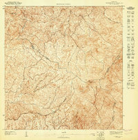 1947 El Yunque SO1947 Print · USGSThe rainforest peaks of eastern Puerto Rico are captured in this mid-century survey as they appeared before modern infrastructure reached deep into the mountains. Researchers can trace the high-altitude municipal boundaries near El Toro Southwest Peak and the source of the Río Grande de Loíza.
 - 1947 Map of Juncos NE
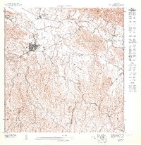 1947 Juncos NE1947 Print · USGSJuncos and its surrounding sugar lands are captured here in the late 1940s, just after the war. Researchers can trace the industrial footprint of the Central Juncos mill and the rail lines of Eastern Sugar Associates along the Río Gurabo.
 - 1947 Map of Humacao NO
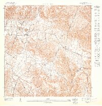 1947 Humacao NO1947 Print · USGSEastern Puerto Rico in the late 1940s reveals a landscape defined by the sugar industry and the mountains of the Caribbean National Forest. Genealogists and historians can trace the early footprints of settlements like Pueblito del Rio and Melillas along the banks of the Rio Gurabo.
 - 1952 Map of Humacao, 1953 Print
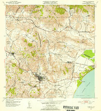 1952 Humacao1953 Print · USGSSoutheast Puerto Rico in the early fifties shows a bustling agricultural landscape defined by the sugar industry and coastal rail. Genealogists and historians can locate numerous workforce settlements and family-named landmarks like Central El Ejemplo, Colonia Santa Teresa, and Pueblito del Rio.2 unique versions available
 - 1952 Map of El Yunque, 1953 Print
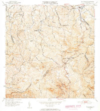 1952 El Yunque1953 Print · USGSThe peaks of the Sierra de Luquillo are mapped here in the early fifties during a period of expanding forest management and rural education. Researchers can locate early forest facilities like the Area Recreo de la Mina and local landmarks like Escuela Malpica.2 unique versions available
 - 1952 Map of Juncos, 1953 Print
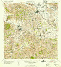 1952 Juncos1953 Print · USGSEastern Puerto Rico in the early fifties reveals a landscape of sugar production and mountain mining. Genealogists and historians can trace family roots through the barrio sectors of Juncos and San Lorenzo or locate the Mina de Hierro and Central Juncos.2 unique versions available
 - 1958 Map of El Yunque, 1960 Print
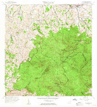 1958 El Yunque1960 Print · USGSThe rainforest peaks and coastal valleys of eastern Puerto Rico are captured here in the late fifties. Genealogists and researchers can trace rural life at Mameyes or locate local landmarks like the Escuela Malpica and the old Mina workings.
 - 1958 Map of Juncos, 1960 Print
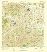 1958 Juncos1960 Print · USGSJuncos and San Lorenzo are captured here during a period of industrial sugar production and rural educational growth. Genealogists can locate family landmarks like Escuela Fraternidad Humana, the Central Juncos mill, and the inactive mine near Gurabo Arriba.
 - 1958 Map of Humacao, 1960 Print
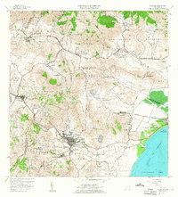 1958 Humacao1960 Print · USGSSoutheastern Puerto Rico is mapped here in the late fifties, showing the coastal sugar economy and mountain utility developments. Trace family roots in Humacao neighborhoods or find rural landmarks like Central El Ejemplo and the Planta Hidroeléctrica de Río Blanco.
 - 1967 Map of Humacao, 1969 Print
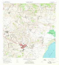 1967 Humacao1969 Print · USGSSoutheast Puerto Rico during the late sixties shows a landscape of growing towns and industrial sites near the coast. Genealogists can locate numerous local schools like Escuela Dra Isidra Vidal and trace historical transport lines like the Via del Ferrocarril.3 unique versions available
 - 1967 Map of Juncos, 1969 Print
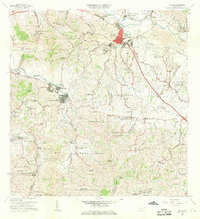 1967 Juncos1969 Print · USGSJuncos and the surrounding valley are captured in the late sixties, showcasing the intersection of industrial sites and dozens of rural schools. Researchers can trace the layout of Central Juncos, locate the Iglesia de la Placita, or find family-named sites like Escuela Manuel Torres.5 unique versions available
 - 1967 Map of El Yunque, 1969 Print
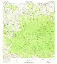 1967 El Yunque1969 Print · USGSThe Luquillo Mountains of Puerto Rico appear here in the late sixties as the island’s mountain interior and coastal barrios continued to develop. Researchers can trace rural school locations like Escuela Morovis and forest landmarks like Pico El Yunque.4 unique versions available
End of results
Showing maps 1-16 of 16
Frequently asked questions
- What are the different types of historical maps available for Caimito?
- What is the oldest map of Caimito?
- Where can I purchase historical maps of Caimito for my home or office?
- Where can I download high-res historical maps of Caimito?
- Are there historical topographic maps available for Caimito?
- Is there historical aerial imagery available for Caimito?
- Where are historical maps of Caimito sourced from?