Old Maps of San Patricio, Ponce for Genealogy
Trace your family roots with 17 historic maps of San Patricio. These high-res maps reveal old neighborhoods, homesites, landmarks, and streets — helping you uncover where your ancestors lived and how the area evolved over time.
- Explore historic neighborhoods: Identify where your relatives may have lived in the 1800s or 1900s.
- Compare maps over time: Trace the changes in streets, buildings, and landmarks for multi-generational research.
- Perfect for genealogy & ancestry research: Used by family historians and researchers to map out lineage and migration.
These maps are an incredible resource for exploring your personal connection to San Patricio's past.
San Patricio, Ponce maps
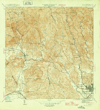
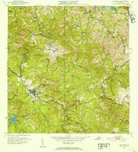
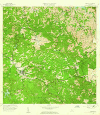
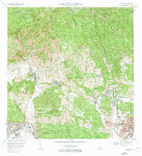
(17)- 1945 Map of Ponce
 1945 Ponce1945 Print · USGSCovers San Patricio, including Ponce, Juana Díaz, and other nearby areas3 unique versions available
 - 1946 Map of Jayuya
 1946 Jayuya1946 Print · USGSCovers San Patricio, including Jayuya, Sector Estancias del Indio, and other nearby areas3 unique versions available
 - 1946 Map of Penuelas
 1946 Penuelas1946 Print · USGSCovers San Patricio, including Peñuelas, Sector La Gelpa, and other nearby areas3 unique versions available
 - 1946 Map of Adjuntas
 1946 Adjuntas1946 Print · USGSCovers San Patricio, including Adjuntas, Sector Vickey Oquendo, and other nearby areas
 - 1947 Map of Adjuntas SE
 1947 Adjuntas SE1947 Print · USGSCovers San Patricio, including Ponce, Utuado, and other nearby areas
 - 1952 Map of Penuelas, 1953 Print
 1952 Penuelas1953 Print · USGSCovers San Patricio, including Peñuelas, Sector La Gelpa, and other nearby areas
 - 1952 Map of Ponce, 1953 Print
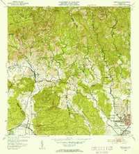
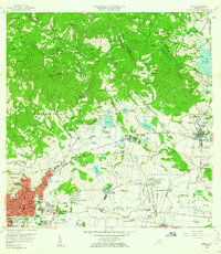
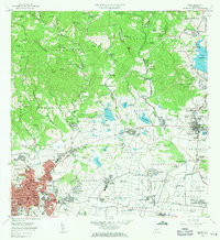
 1952 Ponce1953 Print · USGSCovers San Patricio, including Ponce, Juana Díaz, and other nearby areas2 unique versions available
 - 1952 Map of Jayuya, 1953 Print
 1952 Jayuya1953 Print · USGSCovers San Patricio, including Jayuya, Sector Estancias del Indio, and other nearby areas2 unique versions available
 - 1952 Map of Adjuntas, 1953 Print
 1952 Adjuntas1953 Print · USGSCovers San Patricio, including Adjuntas, Sector Vickey Oquendo, and other nearby areas2 unique versions available
 - 1958 Map of Ponce, 1961 Print
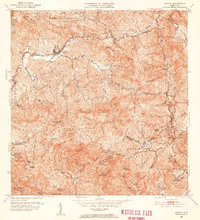
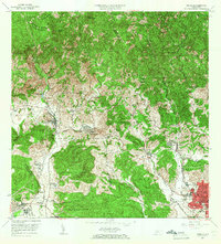
 1958 Ponce1961 Print · USGSCovers San Patricio, including Ponce, Juana Díaz, and other nearby areas
 - 1958 Map of Penuelas, 1961 Print
 1958 Penuelas1961 Print · USGSCovers San Patricio, including Peñuelas, Sector La Gelpa, and other nearby areas
 - 1960 Map of Jayuya, 1961 Print
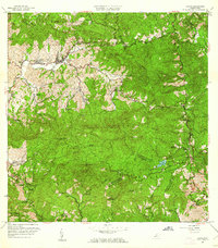 1960 Jayuya1961 Print · USGSCovers San Patricio, including Jayuya, Sector Estancias del Indio, and other nearby areas3 unique versions available
 - 1960 Map of Adjuntas, 1962 Print
 1960 Adjuntas1962 Print · USGSCovers San Patricio, including Adjuntas, Sector Vickey Oquendo, and other nearby areas4 unique versions available
 - 1964 Map of Ponce, 1965 Print
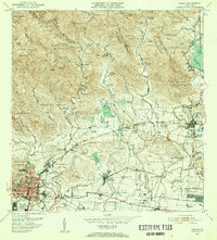
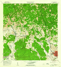
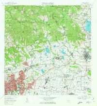
 1964 Ponce1965 Print · USGSCovers San Patricio, including Ponce, Juana Díaz, and other nearby areas
 - 1964 Map of Penuelas, 1966 Print
 1964 Penuelas1966 Print · USGSCovers San Patricio, including Peñuelas, Sector La Gelpa, and other nearby areas2 unique versions available
 - 1970 Map of Ponce, 1972 Print
 1970 Ponce1972 Print · USGSCovers San Patricio, including Ponce, Juana Díaz, and other nearby areas4 unique versions available
 - 1972 Map of Penuelas, 1974 Print
 1972 Penuelas1974 Print · USGSCovers San Patricio, including Peñuelas, Sector La Gelpa, and other nearby areas2 unique versions available
End of results
Showing maps 1-17 of 17
Frequently asked questions
- What are the different types of historical maps available for San Patricio?
- What is the oldest map of San Patricio?
- Where can I purchase historical maps of San Patricio for my home or office?
- Where can I download high-res historical maps of San Patricio?
- Are there historical topographic maps available for San Patricio?
- Is there historical aerial imagery available for San Patricio?
- Where are historical maps of San Patricio sourced from?