Old Maps of San Patricio, Ponce for Metal Detecting
Plan your next treasure hunt with 17 historic maps of San Patricio. Find old homesites, ghost towns, trails, and gathering spots that may be lost to time — perfect for identifying promising metal detecting locations.
- Locate forgotten sites: Uncover places like long-lost settlements, abandoned rail lines, or gathering spots.
- Plan better hunts: Use map overlays combined with LiDAR or satellite views to narrow in on historically rich areas.
- Made for detectorists: Thousands of hobbyists use these maps to discover relics, coins, and hidden history.
Use these historic maps to boost your research and find new opportunities beneath the surface of San Patricio.
San Patricio, Ponce maps
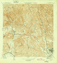
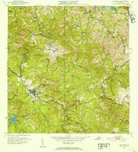
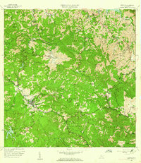
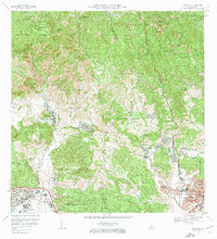
(17)- 1945 Map of Ponce
 1945 Ponce1945 Print · USGSCovers San Patricio, including Ponce, Juana Díaz, and other nearby areas3 unique versions available
 - 1946 Map of Jayuya
 1946 Jayuya1946 Print · USGSCovers San Patricio, including Jayuya, Sector Estancias del Indio, and other nearby areas3 unique versions available
 - 1946 Map of Penuelas
 1946 Penuelas1946 Print · USGSCovers San Patricio, including Peñuelas, Sector La Gelpa, and other nearby areas3 unique versions available
 - 1946 Map of Adjuntas
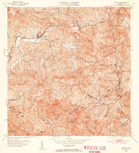
 1946 Adjuntas1946 Print · USGSCovers San Patricio, including Adjuntas, Sector Vickey Oquendo, and other nearby areas
 - 1947 Map of Adjuntas SE
 1947 Adjuntas SE1947 Print · USGSCovers San Patricio, including Ponce, Utuado, and other nearby areas
 - 1952 Map of Penuelas, 1953 Print
 1952 Penuelas1953 Print · USGSCovers San Patricio, including Peñuelas, Sector La Gelpa, and other nearby areas
 - 1952 Map of Ponce, 1953 Print
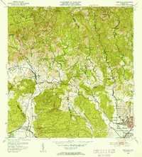
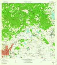
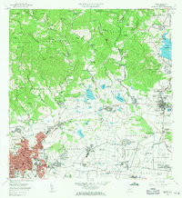
 1952 Ponce1953 Print · USGSCovers San Patricio, including Ponce, Juana Díaz, and other nearby areas2 unique versions available
 - 1952 Map of Jayuya, 1953 Print
 1952 Jayuya1953 Print · USGSCovers San Patricio, including Jayuya, Sector Estancias del Indio, and other nearby areas2 unique versions available
 - 1952 Map of Adjuntas, 1953 Print
 1952 Adjuntas1953 Print · USGSCovers San Patricio, including Adjuntas, Sector Vickey Oquendo, and other nearby areas2 unique versions available
 - 1958 Map of Ponce, 1961 Print
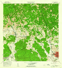
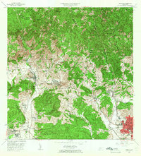
 1958 Ponce1961 Print · USGSCovers San Patricio, including Ponce, Juana Díaz, and other nearby areas
 - 1958 Map of Penuelas, 1961 Print
 1958 Penuelas1961 Print · USGSCovers San Patricio, including Peñuelas, Sector La Gelpa, and other nearby areas
 - 1960 Map of Jayuya, 1961 Print
 1960 Jayuya1961 Print · USGSCovers San Patricio, including Jayuya, Sector Estancias del Indio, and other nearby areas3 unique versions available
 - 1960 Map of Adjuntas, 1962 Print
 1960 Adjuntas1962 Print · USGSCovers San Patricio, including Adjuntas, Sector Vickey Oquendo, and other nearby areas4 unique versions available
 - 1964 Map of Ponce, 1965 Print
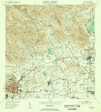
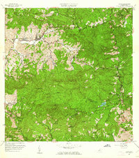
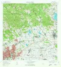
 1964 Ponce1965 Print · USGSCovers San Patricio, including Ponce, Juana Díaz, and other nearby areas
 - 1964 Map of Penuelas, 1966 Print
 1964 Penuelas1966 Print · USGSCovers San Patricio, including Peñuelas, Sector La Gelpa, and other nearby areas2 unique versions available
 - 1970 Map of Ponce, 1972 Print
 1970 Ponce1972 Print · USGSCovers San Patricio, including Ponce, Juana Díaz, and other nearby areas4 unique versions available
 - 1972 Map of Penuelas, 1974 Print
 1972 Penuelas1974 Print · USGSCovers San Patricio, including Peñuelas, Sector La Gelpa, and other nearby areas2 unique versions available
End of results
Showing maps 1-17 of 17
Frequently asked questions
- What are the different types of historical maps available for San Patricio?
- What is the oldest map of San Patricio?
- Where can I purchase historical maps of San Patricio for my home or office?
- Where can I download high-res historical maps of San Patricio?
- Are there historical topographic maps available for San Patricio?
- Is there historical aerial imagery available for San Patricio?
- Where are historical maps of San Patricio sourced from?