1980s Maps of Autauga County, Alabama
Explore 22 historic maps of Autauga County from the 1980s. These maps offer a rare glimpse into what life looked like during the 1980s — showing old roads, neighborhoods, homes, and landmarks that have changed or disappeared over time.
Whether you're researching your family's past, planning a metal detecting trip, or studying how Autauga County's landscape evolved across the 1980s, these high-resolution maps are a powerful tool for exploring the history of this region.
- Focus on a specific era: All maps on this page are from the 1980s, giving you a focused view of this time period.
- See what’s changed: Compare century-old streets, trails, and buildings to today's modern landscape using overlays and satellite layers.
- Research with precision: Use these maps for genealogy, historical research, land use analysis, or educational projects.
- View, download, or print: Maps are fully viewable online in high resolution, and can be downloaded or printed for your own records.
Start exploring Autauga County's history through authentic maps from the 1980s. This is your window into the past.
Autauga County, AL maps
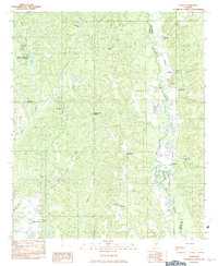
(22)- 1981 Map of Lowndesboro
 1981 Lowndesboro1981 Print · USGSLowndesboro and the surrounding Black Belt river country are captured here in the early eighties. Genealogists can trace numerous local sites like Yankee Town Cem, Oakview Cem, and the rural Mt Canaan Ch.2 unique versions available
 - 1981 Map of Prattville
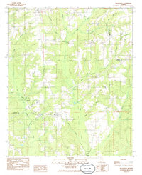
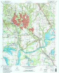 1981 Prattville1981 Print · USGSPrattville at the start of the eighties shows a city balancing its industrial heritage with modern expansion near the Alabama River. Genealogists and historians can locate family burial sites like Doster Cem and trace the old Washington Ferry Road toward the water.2 unique versions available
 - 1981 Map of Forester, 1982 Print
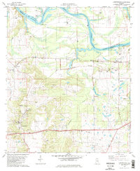
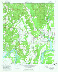
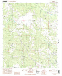
 1981 Forester1982 Print · USGSAutauga County in the early eighties centers on the riverbank communities and sprawling wetlands along the Alabama River. Researchers can trace the layout of Autaugaville and Booth, or locate family sites near DeJarnett Cem and Autauga Hill Ch.2 unique versions available
 - 1981 Map of Cantelous, 1982 Print
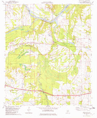
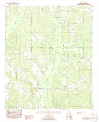
 1981 Cantelous1982 Print · USGSSouthwest of Montgomery in the early eighties, this area showcases a landscape defined by military aviation and rural junctions. Genealogists and historians can trace the foundations of Dannelly Field and local settlements like Antioch and Mt Sinai.2 unique versions available
 - 1982 Map of Milton
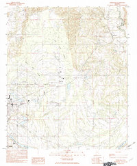
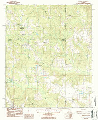
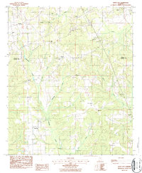
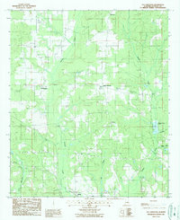
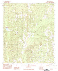 1982 Milton1982 Print · USGSNorthwestern Autauga County in the early eighties was a landscape of winding creeks and quiet rural settlements. Genealogists and local historians can trace the foundations of Milton, Evergreen, and Winslow, alongside landmarks like Dawson Mill and Ivy Hill.
 - 1982 Map of Plantersville
 1982 Plantersville1982 Print · USGSPlantersville and the surrounding forest lands are shown here in the early 1980s as the regional economy balanced timber and rail. Researchers can trace family roots through small settlements like Stanton, Riderville, and Dixie, or locate landmarks like the Air Strip and Southern rail line.
 - 1982 Map of Durant Bend
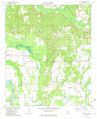
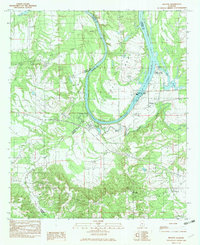
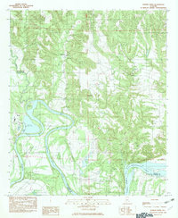 1982 Durant Bend1982 Print · USGSThe Alabama River dominates Autauga County in the early eighties, winding through the namesake Durant Bend and into Woodruff (Bob) Lake. Researchers can locate river-dependent sites like Steels Landing, Henderson Ldg, and the Statesville settlement.
 - 1982 Map of Pletcher
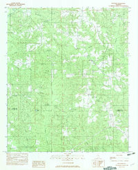 1982 Pletcher1982 Print · USGSChilton and Autauga counties are captured here in the early eighties, showing a landscape of timbered ridges and creek-bottom homesteads. Genealogists can locate several Cemeteries and trace the rural reaches of Mulberry Creek, Adams, and the Clay Pit near Pletcher.
 - 1982 Map of Autaugaville
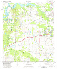
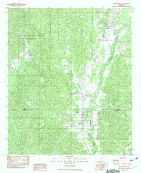
 1982 Autaugaville1982 Print · USGSCentral Alabama's river country comes to life in the early eighties as the town of Autaugaville sits perched above the fertile lowlands of Dutch Bend. Genealogists can trace deep local roots at Stoudenmire Cem, Cedar Grove Ch, and the old Autauga Landing.
 - 1982 Map of White Hall
 1982 White Hall1982 Print · USGSWhite Hall and the Alabama River are captured in the early 1980s, showcasing a landscape of fertile bends and rail-side settlements. Genealogists can trace family roots through several local landmarks like Hall Cem, Trickem, and Wright Chapel.
 - 1982 Map of Burnsville, 1983 Print
 1982 Burnsville1983 Print · USGSIn the early 1980s, the area around the Dallas and Autauga county line remained a landscape of riverfront commerce and rural outposts. Local history researchers can trace the outskirts of Selma and Selmont or locate smaller settlements like Burnsville and Manila near the Blue Gurth Swamp.
 - 1982 Map of Benton, 1983 Print
 1982 Benton1983 Print · USGSThe Alabama River and its complex system of locks and dams define this Lowndes County landscape during the early 1980s. Researchers can trace rural community centers such as Petronia, Benton, and Trickem alongside major landmarks like the Robert F Henry Lock and Dam.
 - 1982 Map of Jones, 1983 Print
 1982 Jones1983 Print · USGSThe borderlands of Dallas and Autauga counties are captured here in the early eighties, centered on the SOUTHERN rail line and Mulberry Creek. Researchers can trace rural lineages through numerous landmarks like Pea Ridge Cem, Cedar Grove Ch, and the settlement at Vine Hill.
 - 1984 Map of Billingsley, 1985 Print
 1984 Billingsley1985 Print · USGSThe rural Alabama borderlands of Chilton and Autauga counties come into focus in the 1980s, centered on the rail-side community of Billingsley. Local historians can trace family ties and transport routes through landmarks like Bethsalem Ch, the ILLINOIS CENTRAL GULF line, and Pools Crossroads.
 - 1984 Map of Deatsville, 1985 Print
 1984 Deatsville1985 Print · USGSDeatsville and the Autauga-Elmore county line are shown in the mid-1980s as rural communities began to intersect with state institutions. Genealogists can trace family names at Holland Cem or McKeithen Cem and locate landmarks like Stoney Point.2 unique versions available
 - 1986 Map of Montgomery
 1986 Montgomery1986 Print · USGSCentral Alabama's river-and-rail corridor is captured in the mid-1980s, centered on the state capital and its surrounding rural counties. Researchers can trace ancestral landmarks like Oakwood Cemetery, military sites like Maxwell Air Force Base, and small towns such as Lowndesboro.2 unique versions available
 - 1986 Map of Clanton
 1986 Clanton1986 Print · USGSCentral Alabama’s river-driven landscape is captured here in the mid-eighties, centered on the growth of Clanton and the hydroelectric lakes of the Coosa River. Genealogists and historians can trace the Old Indian Treaty Boundary or locate landmarks like Sykes Mill and Collins Chapel.
 - 1987 Map of Vida
 1987 Vida1987 Print · USGSAutauga County's rural communities and rail corridors are preserved here as they appeared in the late eighties. Genealogists and local historians can trace family landmarks like Jones Cem, Bethesda Ch, and the small settlement of Independence.
 - 1987 Map of Marbury
 1987 Marbury1987 Print · USGSCentral Alabama at the edge of the eighties is captured here, centered on the intersection of three counties and the CSX rail line. Genealogists can trace family roots at Canaan Cem, Jo Anna Cem, and the historic Confederate Memorial Park.
 - 1987 Map of White City
 1987 White City1987 Print · USGSThe rural border of Chilton and Autauga counties comes into focus in the 1980s, showing a landscape of small settlements and creek-side industry. Genealogists can trace family landmarks like Evergreen Cem, Bethany Ch, and the crossroads at White City.
 - 1987 Map of Old Kingston
 1987 Old Kingston1987 Print · USGSAutauga County in the late eighties remains a landscape of quiet crossroads and winding waterways like Autauga Creek. Researchers can trace old family locales and rural landmarks including Old Kingston, Poseys Crossroads, and Mt Sinai.
 - 1987 Map of Clanton, 1990 Print
 1987 Clanton1990 Print · USGSCentral Alabama in the late eighties reveals a landscape of massive river reservoirs and forest reserves. Trace the rail-and-road corridors through Clanton and Wetumpka to find historic sites like Fort Toulouse and Collins Chapel.
End of results
Showing maps 1-22 of 22
Top cities of Autauga County
- Prattville historical maps
- Pine Level historical maps
- Marbury historical maps
- Autaugaville historical maps
- Billingsley historical maps
Frequently asked questions
- What are the different types of historical maps available for Autauga County?
- What is the oldest map of Autauga County?
- Where can I purchase historical maps of Autauga County for my home or office?
- Where can I download high-res historical maps of Autauga County?
- Are there historical topographic maps available for Autauga County?
- Is there historical aerial imagery available for Autauga County?
- Where are historical maps of Autauga County sourced from?