Old Maps of Cherokee County, Alabama
Explore 150 old maps of Cherokee County, spanning from 1886 to today. These high-resolution historic maps reveal how streets, neighborhoods, landmarks, and natural features evolved over time — perfect for genealogy, metal detecting, research, and local history exploration.
What you can do with these maps:
- See how Cherokee County changed over time: Compare historical maps to modern-day views to trace roads, homesites, rail lines & more.
- View detailed metadata: Each map includes creators, publishers, year, scale, and archive source.
- Overlay maps with satellite & LiDAR: Visualize the past alongside modern tools to explore terrain & human change.
- Trusted historical sources: Maps sourced from the USGS, Library of Congress, and other archives.
- Access maps your way: View online, download high-res files, or order prints for personal or research use.
Start exploring old maps of Cherokee County to uncover forgotten places, hidden landmarks, and the deep history beneath your feet.
Cherokee County, AL maps
(150)- 1886 Map of Rome
 1886 Rome1886 Print · USGSNorthwest Georgia in the mid-1880s is captured as a vital junction of river navigation and emerging rail power. Genealogists and historians can trace family locations near Rome and Cedartown or find rural landmarks like Kirk's Grave and Cunningham or Agate P.O.
 - 1886 Map of Stevenson
 1886 Stevenson1886 Print · USGSNortheast Alabama at the peak of the railroad era shows a landscape tied to the river and the rails. Genealogists can trace family landmarks like Coffey's Store or locate river crossings such as Caperton Ferry and Snodgrass Ferry.
 - 1889 Map of Tallapoosa
 1889 Tallapoosa1889 Print · USGSAcross the Georgia and Alabama border in the late nineteenth century, iron furnaces and river mills powered the local economy. Genealogists can trace family homesteads near landmarks like Tecumseh Furnace, Pine Wood Church, and Allgood's Mill.
 - 1892 Map of Stevenson
 1892 Stevenson1892 Print · USGSNortheast Alabama and the Tennessee border in the 1890s reveal a landscape of mountain coves and vital river crossings. Genealogists and historians can trace rail junctions at Stevenson, river landings like Coffey's Ferry, and landmarks like Nickajack Cave.
 - 1892 Map of Tallapoosa
 1892 Tallapoosa1892 Print · USGSThe Georgia-Alabama borderlands at the end of the nineteenth century reveal a landscape of early industry and river-powered mills. Genealogists and historians can trace family-named landmarks like Allgood Mill, Rainwater Ford, and the Tecumseh Furnace ruins.
 - 1893 Map of Fort Payne
 1893 Fort Payne1893 Print · USGSNortheast Alabama is shown here in the late nineteenth century as the rail network transformed the valley floor. Genealogists and historians can trace family-named crossroads like Hoge's X Roads and vital river crossings including Coker Ferry and Sewell Ferry.
 - 1895 Map of Stevenson
 1895 Stevenson1895 Print · USGSThe Tennessee River valley and surrounding plateaus were a hub of rail and river commerce at the close of the century. Genealogists can trace family crossings at Island Creek Ferry or locate old communities like Bellefonte, Stevenson, and Valley Head.6 unique versions available
 - 1897 Map of Tallapoosa
 1897 Tallapoosa1897 Print · USGSThe Georgia and Alabama borderlands are captured here in the late nineteenth century as the railroad and milling industries reshaped the landscape. Researchers can trace family-named sites like Munroe Mill, early crossings at Rainwater Ford, and old depots at Rockrun Station.4 unique versions available
 - 1898 Map of Rome, 1960 Print
 1898 Rome1960 Print · USGSNorthwest Georgia in the late nineteenth century is a landscape of mountain ridges and busy river confluences. Researchers can trace historic river crossings like Perkins Ferry and the rail-side growth of Summerville, Lindale, and Rome.
 - 1898 Map of Fort Payne, 1964 Print
 1898 Fort Payne1964 Print · USGSDeKalb and Cherokee counties in the late 1890s are defined by the steep ridges of Lookout Mountain and a bustling network of river ferries. Genealogists can trace family roots through numerous river crossings like Hardwick Ferry and early industrial sites such as Sloan Mill or Abernathy Mill.
 - 1899 Map of Rome
 1899 Rome1899 Print · USGSNorthwest Georgia and the Alabama border are captured in the late 1890s, when river travel and mountain gaps dictated the flow of commerce. Genealogists can trace family footprints near Miller Ferry, Raccoon Mills, and the thriving rail hub of Rome.
 - 1900 Map of Fort Payne
 1900 Fort Payne1900 Print · USGSNortheast Alabama is defined by its deep ridges and river valleys in the late nineteenth century. Researchers can trace the era's ferry network across the Coosa River and find old family-run landmarks like Wagners Store and Santy Mills.6 unique versions available
 - 1900 Map of Anniston
 1900 Anniston1900 Print · USGSNortheast Alabama thrived as a railroad and industrial crossroads at the turn of the century. Genealogists and researchers can trace family landmarks and early transport hubs from the Coosa River to Anniston, including Salt Creek Church and Fowler Ferry.6 unique versions available
 - 1904 Map of Rome
 1904 Rome1904 Print · USGSNorthwest Georgia and the Alabama borderlands are captured here during a period of heavy river traffic and expanding rail lines. Genealogists can trace family footprints across dozens of river crossings like Freeman Ferry and early settlements such as Chubbtown or Raccoon Mills.4 unique versions available
 - 1936 Map of Little Falls
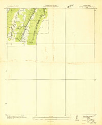 1936 Little Falls1936 Print · USGSDeKalb County, Alabama, is captured in the mid-1930s just as the Tennessee Valley Authority began modernizing the region. Researchers can trace rural life through the upland community of Violet Hill, its Violet Hill Ch, and the high ridges of Lookout Mountain.
 - 1946 Map of Valley Head, 1956 Print
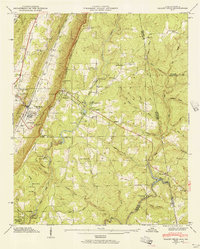 1946 Valley Head1956 Print · USGSThe Alabama-Georgia state line and the slopes of Lookout Mountain are captured here in the mid-1940s. Genealogists and researchers can locate the Southern Railroad corridor, rural schools like Moon Lake Sch, and local landmarks including Mentone and Valley Head.2 unique versions available
 - 1946 Map of Portersville, 1958 Print
 1946 Portersville1958 Print · USGSDeKalb County and the southern reaches of Lookout Mountain appear here just after the war, showing a landscape defined by parallel ridges and valley rail lines. Genealogists can locate family landmarks like Longshore Mill, McNutt Memorial Ch, and the Brown Fell Sch.2 unique versions available
 - 1946 Map of Ft Payne, 1960 Print
 1946 Ft Payne1960 Print · USGSDeKalb County’s rugged valley terrain is captured here just after the war, showing the industrial core of Fort Payne nestled beneath Lookout Mountain. Genealogists can trace family landmarks like Fisher Crossroads, Manitou Cave, and the Log Cabin Chapel.5 unique versions available
 - 1947 Map of Valley Head
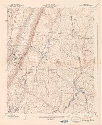 1947 Valley Head1947 Print · USGSDeKalb County and the Alabama-Georgia borderlands are captured here just after the war, showing the mountain communities and valley rail lines of the late 1940s. Genealogists can locate family landmarks like Jones Cem, Johns Chapel, and the Davenport Chapel School.2 unique versions available
 - 1947 Map of Ft Payne
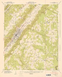 1947 Ft Payne1947 Print · USGSThe valley city of Fort Payne and the surrounding ridges of DeKalb County appear in great detail during the late 1940s. Researchers can trace family history through sites like Fisher Sch, Manitou Cave, and the Glenwood Cem burial grounds.2 unique versions available
 - 1947 Map of Portersville
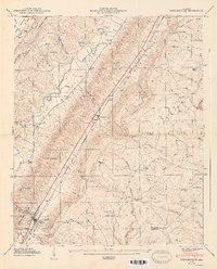 1947 Portersville1947 Print · USGSBig Wills Valley was a vital rail and agricultural corridor after the war, tucked between the ridges of Sand and Lookout Mountains. Genealogists can trace family landmarks like Longshore Mill, the Brown Fell Sch, and country churches such as McNutt Memorial Ch.2 unique versions available
 - 1953 Map of Atlanta, 1965 Print
 1953 Atlanta1965 Print · USGSThe growing Atlanta metro and the industrial corridors of Eastern Alabama are captured here during the mid-century transition. Researchers can trace the rail-to-road shift through hubs like Anniston and La Grange or locate sites within Fort McClellan.2 unique versions available
 - 1955 Map of Rome
 1955 Rome1955 Print · USGSThe tri-state borderlands of Georgia, Alabama, and Tennessee appear in the mid-fifties as a landscape of ridge-and-valley industry and river navigation. Genealogists can trace family footprints near Chattanooga, the iron works of Gadsden, and textile towns like Trion or Summerville.
 - 1957 Map of Atlanta
 1957 Atlanta1957 Print · USGSAtlanta and the Alabama borderlands appear here in the mid-fifties, capturing the region's post-war suburban and industrial transition. Trace the development of early transport hubs and military sites like Fort McPherson, Anniston, and the Kennesaw Mountain National Battlefield Park.
 - 1958 Map of Atlanta
 1958 Atlanta1958 Print · USGSMid-century Georgia and Alabama are shown in this regional study of the corridor between the Chattahoochee River and the Appalachian foothills. Local historians can trace the development of suburban Atlanta alongside vital landmarks like Stone Mountain, Dobbins AFB, and the Seaboard Air Line rail routes.
Showing maps 1-25 of 150
Top cities of Cherokee County
- Centre historical maps
- Cedar Bluff historical maps
- Leesburg historical maps
- Sand Rock historical maps
- Spring Garden historical maps
- Gaylesville historical maps
Frequently asked questions
- What are the different types of historical maps available for Cherokee County?
- What is the oldest map of Cherokee County?
- Where can I purchase historical maps of Cherokee County for my home or office?
- Where can I download high-res historical maps of Cherokee County?
- Are there historical topographic maps available for Cherokee County?
- Is there historical aerial imagery available for Cherokee County?
- Where are historical maps of Cherokee County sourced from?