1980s Maps of Jemison, Alabama
Explore 4 historic maps of Jemison from the 1980s. These maps offer a rare glimpse into what life looked like during the 1980s — showing old roads, neighborhoods, homes, and landmarks that have changed or disappeared over time.
Whether you're researching your family's past, planning a metal detecting trip, or studying how Jemison's landscape evolved across the 1980s, these high-resolution maps are a powerful tool for exploring the history of this region.
- Focus on a specific era: All maps on this page are from the 1980s, giving you a focused view of this time period.
- See what’s changed: Compare century-old streets, trails, and buildings to today's modern landscape using overlays and satellite layers.
- Research with precision: Use these maps for genealogy, historical research, land use analysis, or educational projects.
- View, download, or print: Maps are fully viewable online in high resolution, and can be downloaded or printed for your own records.
Start exploring Jemison's history through authentic maps from the 1980s. This is your window into the past.
Jemison, AL maps
(4)- 1980 Map of Montevallo
 1980 Montevallo1980 Print · USGSMontevallo and Calera are captured here in the 1980s, revealing a landscape shaped by the rail industry and limestone extraction. Genealogists and historians can trace family markers at Old Rock Springs Cem or locate the Covered Bridge on Spring Creek.3 unique versions available
 - 1984 Map of Birmingham South, 1985 Print
 1984 Birmingham South1985 Print · USGSThe Birmingham metropolitan region and the Coosa River valley are shown here in the mid-eighties as suburban growth expanded south into the ridges. Genealogists and local historians can trace the development of communities from Bessemer to Sylacauga alongside the Lay Lake shoreline and the Talladega National Forest.2 unique versions available
 - 1986 Map of Clanton
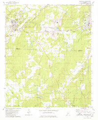
 1986 Clanton1986 Print · USGSCentral Alabama’s river-driven landscape is captured here in the mid-eighties, centered on the growth of Clanton and the hydroelectric lakes of the Coosa River. Genealogists and historians can trace the Old Indian Treaty Boundary or locate landmarks like Sykes Mill and Collins Chapel.
 - 1987 Map of Clanton, 1990 Print
 1987 Clanton1990 Print · USGSCentral Alabama in the late eighties reveals a landscape of massive river reservoirs and forest reserves. Trace the rail-and-road corridors through Clanton and Wetumpka to find historic sites like Fort Toulouse and Collins Chapel.
End of results
Showing maps 1-4 of 4
Top cities near Jemison
- Alabaster historical maps
- Calera historical maps
- Clanton historical maps
- Montevallo historical maps
- Columbiana historical maps
- Thorsby historical maps
See more
Top neighborhoods of Jemison
Frequently asked questions
- What are the different types of historical maps available for Jemison?
- What is the oldest map of Jemison?
- Where can I purchase historical maps of Jemison for my home or office?
- Where can I download high-res historical maps of Jemison?
- Are there historical topographic maps available for Jemison?
- Is there historical aerial imagery available for Jemison?
- Where are historical maps of Jemison sourced from?