1970s Maps of Choctaw County, Alabama
Explore 26 historic maps of Choctaw County from the 1970s. These maps offer a rare glimpse into what life looked like during the 1970s — showing old roads, neighborhoods, homes, and landmarks that have changed or disappeared over time.
Whether you're researching your family's past, planning a metal detecting trip, or studying how Choctaw County's landscape evolved across the 1970s, these high-resolution maps are a powerful tool for exploring the history of this region.
- Focus on a specific era: All maps on this page are from the 1970s, giving you a focused view of this time period.
- See what’s changed: Compare century-old streets, trails, and buildings to today's modern landscape using overlays and satellite layers.
- Research with precision: Use these maps for genealogy, historical research, land use analysis, or educational projects.
- View, download, or print: Maps are fully viewable online in high resolution, and can be downloaded or printed for your own records.
Start exploring Choctaw County's history through authentic maps from the 1970s. This is your window into the past.
Choctaw County, AL maps
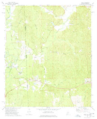
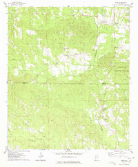
(26)- 1970 Map of Myrtlewood North, 1973 Print
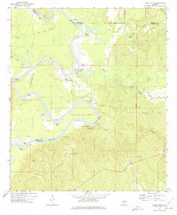
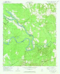 1970 Myrtlewood North1973 Print · USGSMarengo County and its neighbors meet along the winding river bends of the Tombigbee in the late sixties. Genealogists and local historians can trace family locations near Myrtlewood, Hill Top, and country churches like New Macedonia Ch.
 - 1971 Map of Whitfield, 1973 Print
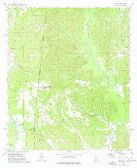
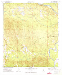 1971 Whitfield1973 Print · USGSChoctaw County’s rural river border comes into focus in the early 1970s as the Tombigbee meanders past local settlements. Genealogists can trace community roots at Bethlehem Cem and Edna, or locate the path of the Kinterbish Railroad Grade.
 - 1971 Map of Coffeeville, 1974 Print
 1971 Coffeeville1974 Print · USGSThe Tombigbee River country of Clarke County is shown here in the early 1970s, before modern infrastructure reshaped many rural Alabamian river towns. Researchers can trace family sites near Coffeeville, explore the crossroads at Center Point, and locate landmarks like Jones Chapel and the High Sch.2 unique versions available
 - 1971 Map of Gaston, 1974 Print
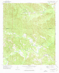
 1971 Gaston1974 Print · USGSThe Sumter and Choctaw county line area comes to life in the early 1970s, showing a landscape of deep creek valleys and quiet rural crossroads. Genealogists and historians can locate family landmarks like Gaston Valley Ch, the community of Derby, and the winding course of Kinterbish Creek.3 unique versions available
 - 1971 Map of Ararat, 1975 Print
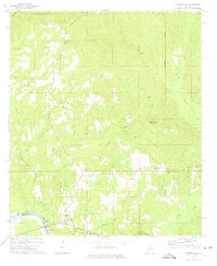
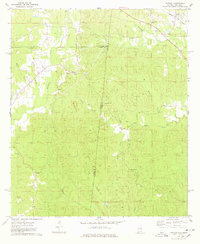
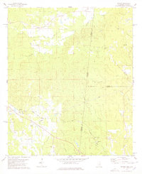
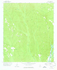 1971 Ararat1975 Print · USGSChoctaw County in the early 1970s is shown here as a landscape of timbered ridges and river bottomlands. Genealogists and local historians can trace the sites of Slaters Chapel, Thornton Springs, and the Old Indian Treaty Boundary near the river.2 unique versions available
 - 1971 Map of Bladon Springs, 1975 Print
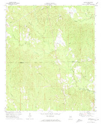
 1971 Bladon Springs1975 Print · USGSThe borderlands of Choctaw and Washington Counties come to life in this early 1970s survey of the Alabama piney woods. Researchers can trace ancestral roots through rural landmarks like Antioch Ch, the community of Frankville, and the grounds of Bladon Springs State Park.
 - 1971 Map of Coffeeville Lock And Dam, 1975 Print
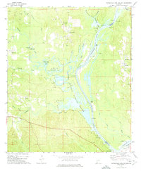 1971 Coffeeville Lock And Dam1975 Print · USGSThe Tombigbee River corridor was undergoing significant change in the 1970s as industrial oil extraction operated alongside new conservation efforts. Researchers can trace river landings like Sellers Landing and find local landmarks such as Pleasant Chapel and Womack Hill.2 unique versions available
 - 1972 Map of Tattlersville, 1975 Print
 1972 Tattlersville1975 Print · USGSThe Tombigbee River corridor in southwestern Alabama was defined by its water-bound commerce and quiet rural crossroads in the early 1970s. Genealogists can trace family names at Blount Landing and rural congregations at New Hope Ch or St Pauls Ch.2 unique versions available
 - 1972 Map of Woods Bluff, 1975 Print
 1972 Woods Bluff1975 Print · USGSThe Tombigbee River country at the start of the 1970s reveals a landscape of historic river landings and ancient boundaries. Researchers can trace family sites near Smyer and Woods Bluff, or locate the Old Indian Treaty Boundary and Witch Creek Ch.2 unique versions available
 - 1974 Map of Melvin, 1977 Print
 1974 Melvin1977 Print · USGSThe Alabama and Mississippi borderlands come to life in the mid-1970s, showing a landscape defined by old treaty lines and early oil exploration. Genealogists can trace family names at Zion Chapel Cem, Stroud Cem, and rural settlements like Melvin and Eiler.
 - 1974 Map of Millry North, 1977 Print
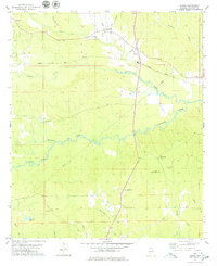
 1974 Millry North1977 Print · USGSThe border of Washington and Choctaw Counties is captured here in the mid-1970s, as the St Louis-San Francisco railroad connects rural hubs. Trace family roots at Winsletts Cem or Mt Zion Chapel, and locate the historic Healing Springs.
 - 1974 Map of Silas, 1977 Print
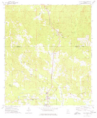
 1974 Silas1977 Print · USGSIn the mid-1970s, this area of Choctaw County was a hub of timber, oil extraction, and deep-rooted rural communities. Genealogists can trace family footprints through numerous local landmarks, including the Harrison Cem, Shady Grove Sch, and the St Louis-San Francisco rail line.2 unique versions available
 - 1974 Map of Isney, 1977 Print
 1974 Isney1977 Print · USGSThe Alabama and Mississippi borderlands come to life in the mid-1970s, showing a landscape defined by timber, small farms, and winding waterways. Researchers can trace family sites at Cem Coyt Ch, follow the Old Railroad Grade, or locate the crossroads at Isney.
 - 1974 Map of Aquilla, 1977 Print
 1974 Aquilla1977 Print · USGSThe Alabama-Mississippi borderlands come into focus in the 1970s, revealing a landscape of rural communities and winding creek bottoms. Researchers can trace family history through sites like Old Aquilla Cemetery, Kings Chapel, and the settlement at Shady Grove.2 unique versions available
 - 1974 Map of Toxey, 1977 Print
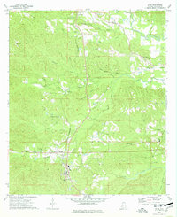
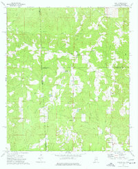
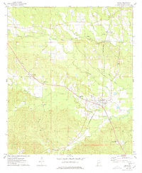
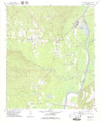
 1974 Toxey1977 Print · USGSChoctaw County in the mid-1970s shows a landscape of active oil production and deep-rooted rural communities. Trace the intersection of the Indian Treaty Boundary and the St Louis - San Francisco rail line alongside sites like South Choctaw Academy and Gilbertown.2 unique versions available
 - 1974 Map of Yantley, 1978 Print
 1974 Yantley1978 Print · USGSChoctaw County at the Alabama-Mississippi border in the mid-1970s reveals a quiet landscape of rural settlements and winding creek bottoms. Researchers can trace family roots at McLendon Cem or explore old community hubs like Cyril and Yantley.
 - 1974 Map of Ward, 1978 Print
 1974 Ward1978 Print · USGSSumter and Choctaw Counties come into focus during the mid-seventies, showing a rural landscape shaped by the St Louis-San Francisco railroad. You can trace family history through local landmarks like Cokes Chapel Cem, Halsell, and Pine Grove Ch.
 - 1974 Map of Lisman, 1978 Print
 1974 Lisman1978 Print · USGSChoctaw County in the mid-seventies reveals a landscape of railroad sidings and rural church communities. Genealogists can trace family footprints at Mt Nebo Ch, the settlement of Pushmataha, and the rail junction at Lisman.
 - 1974 Map of Hinton, 1978 Print
 1974 Hinton1978 Print · USGSThe Alabama and Mississippi borderlands are captured here in the mid-seventies, showing the rural communities of Choctaw and Clarke counties. Researchers can trace family roots at Antioch Cemetery or locate landmarks like Shiloh and Camp Pine Crest.
 - 1974 Map of Land, 1978 Print
 1974 Land1978 Print · USGSChoctaw County is captured here in the mid-seventies, showing the intersection of rural life and the St Louis - San Francisco railroad. Genealogists can trace family landmarks like Rock Springs Ch, Red Springs, and the Providence Cem among the creek-cut hills.
 - 1978 Map of Whynot
 1978 Whynot1978 Print · USGSThis Mississippi-Alabama borderland in the late seventies is a detailed record of rural Lauderdale and Sumter counties. Genealogists can trace family connections through numerous local landmarks like Reids Chapel, McMury Cem, and the settlement of Whynot.
 - 1978 Map of Pennington, 1979 Print
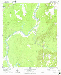
 1978 Pennington1979 Print · USGSThe Tombigbee River corridor in the late 1970s reveals a landscape of industrial river landings and rural churches. Genealogists and local historians can trace family-named sites like Watters Lake, Millwood Cem, and several historic congregations including Little Zion Ch.
 - 1978 Map of Putnam, 1979 Print
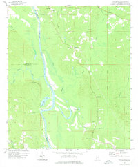
 1978 Putnam1979 Print · USGSThe riverfronts of Marengo and Choctaw Counties come into focus during the late 1970s, centered on the Tombigbee River. Researchers can locate rural landmarks like Tuscahoma Landing, East Choctaw Sch, and the Putnam Cem.
 - 1978 Map of Butler, 1979 Print
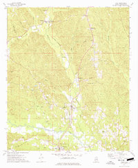
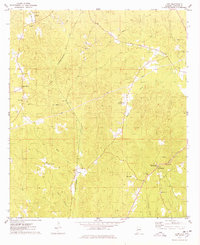
 1978 Butler1979 Print · USGSButler and Mount Sterling are shown in detail during the late 1970s as the regional landscape was shaped by aviation and local industry. Researchers can trace rural lineages through sites like Morgan Chapel, Patrician Academy, and the Butler-Choctaw Co Airport.2 unique versions available
 - 1978 Map of Jachin, 1979 Print
 1978 Jachin1979 Print · USGSChoctaw County, Alabama, is documented here in the late seventies, showing a landscape defined by timberlands and small rural communities. Genealogists can trace family landmarks at Morning Star Ch and Chapel Hill, or locate homesites near Jachin and Robjohn.2 unique versions available
Showing maps 1-25 of 26
Top cities of Choctaw County
- Butler historical maps
- Gilbertown historical maps
- Lisman historical maps
- Pennington historical maps
- Silas historical maps
- Toxey historical maps
See more
Frequently asked questions
- What are the different types of historical maps available for Choctaw County?
- What is the oldest map of Choctaw County?
- Where can I purchase historical maps of Choctaw County for my home or office?
- Where can I download high-res historical maps of Choctaw County?
- Are there historical topographic maps available for Choctaw County?
- Is there historical aerial imagery available for Choctaw County?
- Where are historical maps of Choctaw County sourced from?