Old Maps of Choctaw Bluff, Alabama for Academic Research
Study the evolution of Choctaw Bluff with 11 high-resolution historic maps. Whether you're teaching, researching, or modeling changes in land use, these maps provide essential visual documentation of urban, environmental, and geographic change.
- Analyze long-term change: Track patterns in development, transportation, and natural features.
- Ideal for environmental or urban studies: Support academic projects with primary historical map data.
- Use in the classroom or lab: Educators and researchers rely on these maps to bring historical context to life.
These maps are a powerful tool for teaching, research, and visualizing how Choctaw Bluff has changed over the decades.
Choctaw Bluff, AL maps
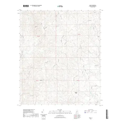
(11)- 1943 Map of Choctaw Bluff, 1958 Print
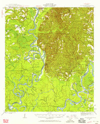 1943 Choctaw Bluff1958 Print · USGSSouthwestern Alabama during the 1940s is shaped by the meeting of the Tombigbee River and Alabama River. Researchers can trace old river landings like Dixie Ldg and find the historic Grave of Red Eagle (Weatherford).2 unique versions available
 - 1946 Map of Choctaw Bluff
 1946 Choctaw Bluff1946 Print · USGSThe river-bottom country of southwest Alabama is shown here just after the war, where the mighty Tombigbee and Alabama rivers meet. Researchers can trace historic river landings like Oven Bluff or find the Grave of Red Eagle (Weatherford) near the confluence.2 unique versions available
 - 1953 Map of Andalusia, 1965 Print
 1953 Andalusia1965 Print · USGSSouth Alabama in the mid-twentieth century remains a land of pine forests and river-fed settlements. You can trace the vital rail corridors of the Louisville & Nashville and locate regional centers such as Andalusia, Brewton, and Monroeville.3 unique versions available
 - 1957 Map of Andalusia
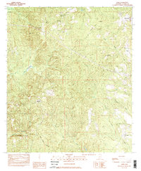
 1957 Andalusia1957 Print · USGSSouthern Alabama in the mid-1950s was a landscape defined by timbered stretches and the rhythmic flow of the Alabama River. Researchers can trace the legacy of the rail era through the Central of Georgia tracks and the storied river bluffs at Choctaw Bluff.
 - 1983 Map of Alma
 1983 Alma1983 Print · USGSClarke County in the early eighties retains its rural character, marked by conservation lands and historic property lines. Researchers can trace the Old Indian Treaty Boundary and locate family landmarks like McGowan Cem or the Old Mt Sinai Ch.2 unique versions available
 - 1986 Map of Atmore
 1986 Atmore1986 Print · USGSSouth Alabama’s river country and timberlands are captured here in the mid-eighties, showing the deep-water bends of the Alabama River and the expanding road networks. Genealogists and historians can trace family locations through small-town post offices and rural churches like Chrysler Ch and the settlement of Barlow Bend.2 unique versions available
 - 2011 Map of Alma, 2011 Print
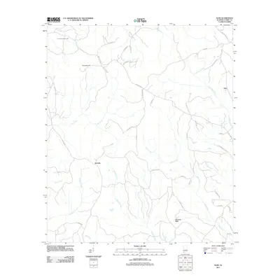 2011 Alma2011 Print · USGSCovers Choctaw Bluff, including Jackson, Alma, and other nearby areas
 - 2014 Map of Alma, 2014 Print
 2014 Alma2014 Print · USGSCovers Choctaw Bluff, including Jackson, Alma, and other nearby areas
 - 2018 Map of Alma, 2018 Print
 2018 Alma2018 Print · USGSCovers Choctaw Bluff, including Jackson, Alma, and other nearby areas
 - 2020 Map of Alma, 2020 Print
 2020 Alma2020 Print · USGSCovers Choctaw Bluff, including Jackson, Alma, and other nearby areas
 - 2024 Map of Alma, 2024 Print
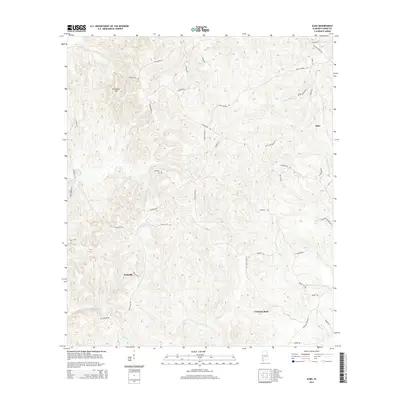
 2024 Alma2024 Print · USGSClarke County in the current era remains a landscape of deep creek valleys and rural outposts. Genealogists and historians can trace family-named routes and the relationship between settlements like Rockville, Alma, and the river-side geography of Choctaw Bluff.
End of results
Showing maps 1-11 of 11
Top cities near Choctaw Bluff
Frequently asked questions
- What are the different types of historical maps available for Choctaw Bluff?
- What is the oldest map of Choctaw Bluff?
- Where can I purchase historical maps of Choctaw Bluff for my home or office?
- Where can I download high-res historical maps of Choctaw Bluff?
- Are there historical topographic maps available for Choctaw Bluff?
- Is there historical aerial imagery available for Choctaw Bluff?
- Where are historical maps of Choctaw Bluff sourced from?