Old Maps of Gage, Alabama for Academic Research
Study the evolution of Gage with 16 high-resolution historic maps. Whether you're teaching, researching, or modeling changes in land use, these maps provide essential visual documentation of urban, environmental, and geographic change.
- Analyze long-term change: Track patterns in development, transportation, and natural features.
- Ideal for environmental or urban studies: Support academic projects with primary historical map data.
- Use in the classroom or lab: Educators and researchers rely on these maps to bring historical context to life.
These maps are a powerful tool for teaching, research, and visualizing how Gage has changed over the decades.
Gage, AL maps
(16)- 1890 Map of Talladega
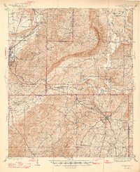
 1890 Talladega1890 Print · USGSTalladega and the surrounding river valleys are captured here in the late nineteenth century as the railroad and river economy flourished. Trace the locations of historic river crossings like Old Kymulga Ferry and local landmarks such as Odens Mill.
 - 1892 Map of Talladega
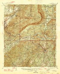
 1892 Talladega1892 Print · USGSTalladega County and the Coosa River valley are captured here in the late nineteenth century as the regional rail network expanded through the mountains. Researchers can locate old river crossings like Chancelors Ferry, rural landmarks such as Edwards Store, and early hubs like Childersburgh.6 unique versions available
 - 1944 Map of Goodwater, 1947 Print
 1944 Goodwater1947 Print · USGSThe hill country of Coosa and Talladega counties is captured here just after the war, showing the railroad-industrial corridor from Sylacauga to Goodwater. Genealogists and historians can trace numerous rural sites like Trammells Sch, Haynes Chapel, and the remote Hollins Fire Tower.3 unique versions available
 - 1947 Map of Goodwater
 1947 Goodwater1947 Print · USGSCoosa and Talladega counties in the mid-1940s are shown as a network of rail-side towns and ridge-top lookouts. Genealogists and historians can locate rural landmarks like Hatchet Springs Sch, the Hollins Fire Tower, and the historic Wiregrass Road.2 unique versions available
 - 1953 Map of Birmingham, 1964 Print
 1953 Birmingham1964 Print · USGSCentral Alabama at mid-century shows a landscape defined by industrial expansion and the iron-rich ridges surrounding Birmingham. Researchers can trace the extensive rail networks of the L & N RR or locate historic federal sites like the Anniston Ordnance Depot.4 unique versions available
 - 1956 Map of Birmingham
 1956 Birmingham1956 Print · USGSCentral Alabama in the mid-fifties exhibits a landscape of growing cities and deep-rooted industrial corridors. Genealogists and historians can trace the development of suburban Mountain Brook or locate regional hubs like Sylacauga and Jasper.
 - 1957 Map of Birmingham
 1957 Birmingham1957 Print · USGSNorth-Central Alabama in the mid-fifties is an industrial powerhouse centered on the steel valleys and sprawling iron ridges. Genealogists and historians can trace the rail-linked growth of Birmingham and Tuscaloosa, or locate rural landmarks like Talladega College and the Anniston Ordnance Depot.
 - 1975 Map of Goodwater NE, 1977 Print
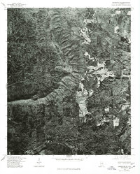 1975 Goodwater NE1977 Print · USGSClay County timberlands and small rural outposts appear in this mid-seventies aerial survey. Genealogists and local researchers can trace the roads and clearings around Shady Grove, Midway, and Brownsville.
 - 1984 Map of Birmingham South, 1985 Print
 1984 Birmingham South1985 Print · USGSThe Birmingham metropolitan region and the Coosa River valley are shown here in the mid-eighties as suburban growth expanded south into the ridges. Genealogists and local historians can trace the development of communities from Bessemer to Sylacauga alongside the Lay Lake shoreline and the Talladega National Forest.2 unique versions available
 - 1987 Map of Bulls Gap
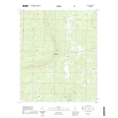
 1987 Bulls Gap1987 Print · USGSThe wooded ridges of Clay and Talladega counties are shown here in the late 1980s as the wilderness of the Talladega National Forest persisted. Researchers can locate remote community hubs like Bull Gap, Hatchet Creek Ch, and Midway tucked between the peaks.
 - 2001 Map of Bulls Gap, 2004 Print
 2001 Bulls Gap2004 Print · USGSClay County as it appeared at the start of the century is defined by its deep forest roads and mountain ridges. Trace family history at Bethlehem Ch or explore the early 2000s landscape of Brownsville and Rocky Mount.
 - 2011 Map of Bulls Gap, 2011 Print
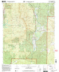
 2011 Bulls Gap2011 Print · USGSCovers Gage, including Roselle, Midway, and other nearby areas
 - 2014 Map of Bulls Gap, 2014 Print
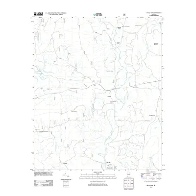
 2014 Bulls Gap2014 Print · USGSCovers Gage, including Roselle, Midway, and other nearby areas
 - 2018 Map of Bulls Gap, 2018 Print
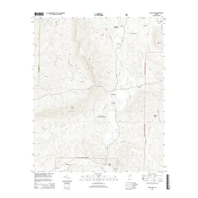
 2018 Bulls Gap2018 Print · USGSCovers Gage, including Roselle, Midway, and other nearby areas
 - 2021 Map of Bulls Gap, 2021 Print
 2021 Bulls Gap2021 Print · USGSCovers Gage, including Roselle, Midway, and other nearby areas
 - 2024 Map of Bulls Gap, 2024 Print
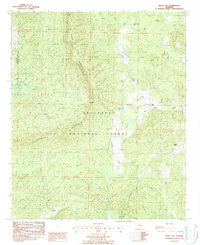
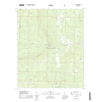
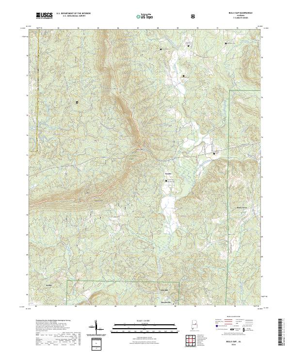 2024 Bulls Gap2024 Print · USGSThe Talladega National Forest ridgelines and the winding Hatchet Creek valley define this Alabama landscape in the mid-2020s. Genealogists can locate family landmarks like the Rozelle and Chandler Cem, Marvin Chapel, and the settlement of Brownsville.
End of results
Showing maps 1-16 of 16
Top cities near Gage
- Talladega historical maps
- Sylacauga historical maps
- Lineville historical maps
- Ashland historical maps
- Goodwater historical maps
- New Site historical maps
See more
Frequently asked questions
- What are the different types of historical maps available for Gage?
- What is the oldest map of Gage?
- Where can I purchase historical maps of Gage for my home or office?
- Where can I download high-res historical maps of Gage?
- Are there historical topographic maps available for Gage?
- Is there historical aerial imagery available for Gage?
- Where are historical maps of Gage sourced from?