Old Maps of Conecuh County, Alabama for Genealogy
Trace your family roots with 151 historic maps of Conecuh County. These high-res maps reveal old neighborhoods, homesites, landmarks, and streets — helping you uncover where your ancestors lived and how the area evolved over time.
- Explore historic neighborhoods: Identify where your relatives may have lived in the 1800s or 1900s.
- Compare maps over time: Trace the changes in streets, buildings, and landmarks for multi-generational research.
- Perfect for genealogy & ancestry research: Used by family historians and researchers to map out lineage and migration.
These maps are an incredible resource for exploring your personal connection to Conecuh County's past.
Conecuh County, AL maps
(151)- 1953 Map of Andalusia, 1965 Print
 1953 Andalusia1965 Print · USGSSouth Alabama in the mid-twentieth century remains a land of pine forests and river-fed settlements. You can trace the vital rail corridors of the Louisville & Nashville and locate regional centers such as Andalusia, Brewton, and Monroeville.3 unique versions available
 - 1957 Map of Andalusia
 1957 Andalusia1957 Print · USGSSouthern Alabama in the mid-1950s was a landscape defined by timbered stretches and the rhythmic flow of the Alabama River. Researchers can trace the legacy of the rail era through the Central of Georgia tracks and the storied river bluffs at Choctaw Bluff.
 - 1967 Map of Beatrice, 1984 Print
 1967 Beatrice1984 Print · USGSLamar County's rural heartland is captured here in the late sixties, where the river and rail lines shaped community life. Genealogists can trace family landmarks like Olive Hill Cem, Stanford Cem, and the railroad siding at Crews.
 - 1971 Map of Lyeffion
 1971 Lyeffion1971 Print · USGSConecuh County's rural heartland is preserved here in the early 1970s, showcasing a landscape of river forks and timberland outposts. Researchers can trace the heritage of local communities like Lyeffion and Bowles or locate family landmarks such as Mt Zion Ch and the Sepulga Lookout Tower.2 unique versions available
 - 1971 Map of Dixie, 1972 Print
 1971 Dixie1972 Print · USGSIn the early seventies, the borderlands of Escambia and Covington counties remained a world of deep timber and quiet settlements. Genealogists can locate family landmarks like Mason Cem and Welfare Ch, or trace the path of the Old RR Grade through the Conecuh National Forest.3 unique versions available
 - 1971 Map of Brooks, 1972 Print
 1971 Brooks1972 Print · USGSConecuh and Covington counties come together in the early 1970s along the winding Sepulga River and the rural communities of South Alabama. Researchers can locate family landmarks like New Home Ch, the community of Cohassett, and the Louisville and Nashville rail line.2 unique versions available
 - 1971 Map of Mc Kenzie, 1973 Print
 1971 Mc Kenzie1973 Print · USGSButler County and the surrounding tri-county borderlands appear here in the early seventies, centered on the railroad town of Mc Kenzie. Genealogists can trace family locations through sites like South Butler Academy, Riley Cem, and Sweet Home Ch.2 unique versions available
 - 1971 Map of Loango, 1973 Print
 1971 Loango1973 Print · USGSCovington and Conecuh counties in the early seventies reveal a landscape of river-bottom lands and small rural outposts. Researchers can trace family history at Loango, Mt Pilgrim Ch, and Darwin Cem along the winding Pigeon Creek.2 unique versions available
 - 1971 Map of Range, 1974 Print
 1971 Range1974 Print · USGSConecuh County’s rural rail and river landscape is captured here in the early seventies, centered on the railroad stop at Range (Deer Range Sta). Genealogists and local historians can trace family roots through numerous landmarks like Baggetts Chapel, Janes Mill, and Ramah Ch.
 - 1971 Map of Castleberry, 1974 Print
 1971 Castleberry1974 Print · USGSSouthern Alabama's rural corridor comes to life in the early seventies, centered on the railroad town of Castleberry. Genealogists and historians can trace family locations near Hamden Ridge Ch, Buffington Cem, and the old rail line.
 - 1971 Map of Belleville, 1974 Print
 1971 Belleville1974 Print · USGSConecuh County in the early seventies remains a landscape of quiet rural settlements and small country churches. Genealogists and local historians can trace family locations near Arkadelphia Ch, Loree, and the aviation grounds at Middleton Field.
 - 1971 Map of Garland, 1974 Print
 1971 Garland1974 Print · USGSButler and Conecuh Counties appear here in the early 1970s, as rural life centered on the Sepulga River and the Louisville and Nashville railroad. Genealogists can trace family names at Sellers Cem, McClure Cem, and small congregations like St John Ch.2 unique versions available
 - 1971 Map of Skinnerton, 1974 Print
 1971 Skinnerton1974 Print · USGSMonroe and Conecuh counties in the early 1970s remained a landscape of timber stands and quiet country crossroads. Genealogists and researchers can locate family-named landmarks and rural congregations like Dene Step Ch, Asbury Ch, and the high-point McWilliams Lookout Tower.2 unique versions available
 - 1971 Map of China, 1974 Print
 1971 China1974 Print · USGSConecuh County in the early seventies remained a landscape of quiet rural settlements and small family-named landmarks. Researchers can locate historic community centers like China and Fairnelson, or trace local lineages through Witherington Cem and New Haven Ch.2 unique versions available
 - 1971 Map of Burnt Corn, 1974 Print
 1971 Burnt Corn1974 Print · USGSThe Monroe and Conecuh county line in the early 1970s reveals a quiet landscape of rural settlements and agricultural crossroads. You can trace the Louisville and Nashville railroad and locate sites like Harpers Store, Burnt Corn, and Pilgrim Rest Ch.
 - 1971 Map of Repton, 1974 Print
 1971 Repton1974 Print · USGSRepton and its surrounding rural communities are captured here in the early seventies, centered on the Louisville and Nashville railroad corridor. Genealogists can locate several small cemeteries and country houses of worship like Beulah Ch and Oak Grove Ch.2 unique versions available
 - 1971 Map of Bethel, 1974 Print
 1971 Bethel1974 Print · USGSConecuh County and its neighbors show a landscape of timber and traditional crossroads in the early seventies. Genealogists can trace family roots through numerous country churches and cemeteries, including Middleton Cem, New Hope Ch, and Mt Zion Ch.
 - 1971 Map of Beatrice, 1974 Print
 1971 Beatrice1974 Print · USGSMonroe County, Alabama, in the early seventies was a landscape of rail-connected settlements and winding creek valleys. Genealogists can trace family footprints near Beatrice and Tunnel Springs or locate the Antioch Ch and Greer Jr High Sch.2 unique versions available
 - 1972 Map of Frisco City SE, 1974 Print
 1972 Frisco City SE1974 Print · USGSConecuh County in the early seventies is a landscape of winding watercourses and deep timber history. Researchers can trace the path of an Old Railroad Grade or locate the rural communities of Range and Dean near Big Escambia Creek.2 unique versions available
 - 1972 Map of Uriah East, 1974 Print
 1972 Uriah East1974 Print · USGSMonroe County in the early seventies shows a landscape defined by timber, rail, and early oil exploration. Genealogists can trace local roots through rural landmarks like Oak Grove Ch, Vocation, and the Middle Sch.2 unique versions available
 - 1972 Map of Excel, 1974 Print
 1972 Excel1974 Print · USGSMonroe County's evolving landscape in the early seventies shows the expansion of Excel and the infrastructure of the neighboring county seat. Genealogists and historians can locate rural landmarks like Mt Olive Ch, Halls Crossroads, and the Monroeville Academy.2 unique versions available
 - 1981 Map of Pine Apple South
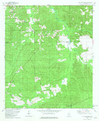 1981 Pine Apple South1981 Print · USGSMonroe and Wilcox Counties appear here in the early eighties as the L & N railroad still shaped the rural landscape. Genealogists can locate family landmarks like Solomon Cem, Old Texas, and country churches such as Mount Zion Ch or Hopkins Chapel Cem.
 - 1982 Map of Evergreen
 1982 Evergreen1982 Print · USGSConecuh County centers on the growing hub of Evergreen during the early 1980s. Researchers can trace rural settlement patterns through communities like Owassa, Fairview, and Brownville situated along the winding banks of Murder Creek.
 - 1982 Map of Damascus
 1982 Damascus1982 Print · USGSSouthern Alabama in the early eighties reveals a landscape shaped by the Conecuh River and its many tributaries. Trace the rural settlements of Damascus, Boykin, and Teddy, or locate landmarks like McGowin Bridge and Fishpond.
 - 1982 Map of Nymph
 1982 Nymph1982 Print · USGSConecuh and Escambia counties are captured here in the late 1970s, showcasing a rural Alabama landscape shaped by many creeks and ponds. Genealogists and local historians can trace family-named sites like Jay Villa, McMillan Pond, and the old settlement of Old Sparta.
Showing maps 1-25 of 151
Top cities of Conecuh County
Frequently asked questions
- What are the different types of historical maps available for Conecuh County?
- What is the oldest map of Conecuh County?
- Where can I purchase historical maps of Conecuh County for my home or office?
- Where can I download high-res historical maps of Conecuh County?
- Are there historical topographic maps available for Conecuh County?
- Is there historical aerial imagery available for Conecuh County?
- Where are historical maps of Conecuh County sourced from?