1980s Maps of Conecuh County, Alabama
Explore 10 historic maps of Conecuh County from the 1980s. These maps offer a rare glimpse into what life looked like during the 1980s — showing old roads, neighborhoods, homes, and landmarks that have changed or disappeared over time.
Whether you're researching your family's past, planning a metal detecting trip, or studying how Conecuh County's landscape evolved across the 1980s, these high-resolution maps are a powerful tool for exploring the history of this region.
- Focus on a specific era: All maps on this page are from the 1980s, giving you a focused view of this time period.
- See what’s changed: Compare century-old streets, trails, and buildings to today's modern landscape using overlays and satellite layers.
- Research with precision: Use these maps for genealogy, historical research, land use analysis, or educational projects.
- View, download, or print: Maps are fully viewable online in high resolution, and can be downloaded or printed for your own records.
Start exploring Conecuh County's history through authentic maps from the 1980s. This is your window into the past.
Conecuh County, AL maps
(10)- 1981 Map of Pine Apple South
 1981 Pine Apple South1981 Print · USGSMonroe and Wilcox Counties appear here in the early eighties as the L & N railroad still shaped the rural landscape. Genealogists can locate family landmarks like Solomon Cem, Old Texas, and country churches such as Mount Zion Ch or Hopkins Chapel Cem.
 - 1982 Map of Evergreen
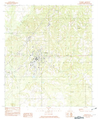 1982 Evergreen1982 Print · USGSConecuh County centers on the growing hub of Evergreen during the early 1980s. Researchers can trace rural settlement patterns through communities like Owassa, Fairview, and Brownville situated along the winding banks of Murder Creek.
 - 1982 Map of Damascus
 1982 Damascus1982 Print · USGSSouthern Alabama in the early eighties reveals a landscape shaped by the Conecuh River and its many tributaries. Trace the rural settlements of Damascus, Boykin, and Teddy, or locate landmarks like McGowin Bridge and Fishpond.
 - 1982 Map of Nymph
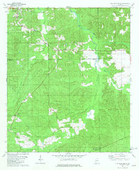
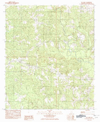
 1982 Nymph1982 Print · USGSConecuh and Escambia counties are captured here in the late 1970s, showcasing a rural Alabama landscape shaped by many creeks and ponds. Genealogists and local historians can trace family-named sites like Jay Villa, McMillan Pond, and the old settlement of Old Sparta.
 - 1982 Map of Old Town
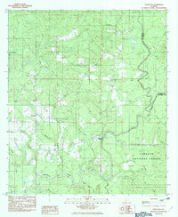
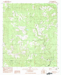
 1982 Old Town1982 Print · USGSConecuh County in the early eighties is captured here, centered on the historic settlement of Old Town. Genealogists and local historians can trace the course of the Sepulga River and locate small communities like Herbert and Mancil Mill Creek.
 - 1982 Map of Brooklyn
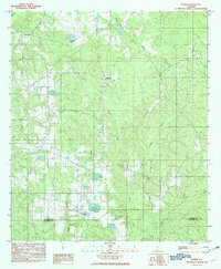
 1982 Brooklyn1982 Print · USGSThe borderlands of Conecuh and Escambia counties are captured here in the early eighties as a rural landscape of creek-side settlements and timbered terrain. Researchers can trace family roots through the namesake homes and sites of Brooklyn, Spring Hill, and Johnsonville.
 - 1986 Map of Andalusia
 1986 Andalusia1986 Print · USGSCovington County and the Wiregrass region are shown here in the mid-1980s, centered on the growing hubs of Andalusia and Opp. Genealogists and local historians can trace legacy sites like the Old Pioneer Cem, Straughn Sch, and the rail lines of the Louisville and Nashville RR.2 unique versions available
 - 1986 Map of Monroeville
 1986 Monroeville1986 Print · USGSMonroe and Clarke counties are captured here in the mid-eighties, centered on the river valleys of the Alabama River and Tombigbee River. Genealogists and local historians can trace legacy settlements like Burnt Corn, Whatley, and the river site of Claiborne.2 unique versions available
 - 1986 Map of Atmore
 1986 Atmore1986 Print · USGSSouth Alabama’s river country and timberlands are captured here in the mid-eighties, showing the deep-water bends of the Alabama River and the expanding road networks. Genealogists and historians can trace family locations through small-town post offices and rural churches like Chrysler Ch and the settlement of Barlow Bend.2 unique versions available
 - 1986 Map of Greenville
 1986 Greenville1986 Print · USGSMid-century South Central Alabama comes alive in this survey of the creek-laced timberlands and rail-dependent towns between the Gulf Coastal Plain and the Piedmont. Researchers can trace family roots through numerous country landmarks like Magnolia Cem, Spring Hill Ch, and the Butler County State Wildlife Management Area.2 unique versions available
End of results
Showing maps 1-10 of 10
Top cities of Conecuh County
Frequently asked questions
- What are the different types of historical maps available for Conecuh County?
- What is the oldest map of Conecuh County?
- Where can I purchase historical maps of Conecuh County for my home or office?
- Where can I download high-res historical maps of Conecuh County?
- Are there historical topographic maps available for Conecuh County?
- Is there historical aerial imagery available for Conecuh County?
- Where are historical maps of Conecuh County sourced from?