Old Maps of Parkdale, Alabama for Hiking & Exploration
Hike through history with 16 historic maps of Parkdale. Explore old trails, ghost towns, and forgotten backroads — perfect for outdoor adventurers and local explorers.
- Rediscover forgotten places: Map out old mining camps, roads, and footpaths that no longer exist on modern maps.
- Layer with modern tools: Combine with LiDAR or satellite views to plan hikes through historical terrain.
- Made for exploration: Popular among hikers, overlanders, and local history lovers.
Use these maps to find adventure and explore the hidden past of Parkdale.
Parkdale, AL maps
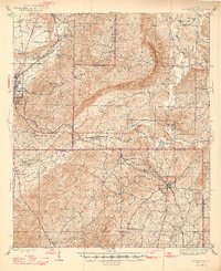
(16)- 1890 Map of Talladega
 1890 Talladega1890 Print · USGSTalladega and the surrounding river valleys are captured here in the late nineteenth century as the railroad and river economy flourished. Trace the locations of historic river crossings like Old Kymulga Ferry and local landmarks such as Odens Mill.
 - 1892 Map of Talladega
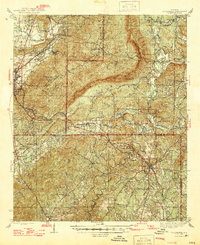
 1892 Talladega1892 Print · USGSTalladega County and the Coosa River valley are captured here in the late nineteenth century as the regional rail network expanded through the mountains. Researchers can locate old river crossings like Chancelors Ferry, rural landmarks such as Edwards Store, and early hubs like Childersburgh.6 unique versions available
 - 1944 Map of Goodwater, 1947 Print
 1944 Goodwater1947 Print · USGSThe hill country of Coosa and Talladega counties is captured here just after the war, showing the railroad-industrial corridor from Sylacauga to Goodwater. Genealogists and historians can trace numerous rural sites like Trammells Sch, Haynes Chapel, and the remote Hollins Fire Tower.3 unique versions available
 - 1947 Map of Goodwater
 1947 Goodwater1947 Print · USGSCoosa and Talladega counties in the mid-1940s are shown as a network of rail-side towns and ridge-top lookouts. Genealogists and historians can locate rural landmarks like Hatchet Springs Sch, the Hollins Fire Tower, and the historic Wiregrass Road.2 unique versions available
 - 1953 Map of Birmingham, 1964 Print
 1953 Birmingham1964 Print · USGSCentral Alabama at mid-century shows a landscape defined by industrial expansion and the iron-rich ridges surrounding Birmingham. Researchers can trace the extensive rail networks of the L & N RR or locate historic federal sites like the Anniston Ordnance Depot.4 unique versions available
 - 1956 Map of Birmingham
 1956 Birmingham1956 Print · USGSCentral Alabama in the mid-fifties exhibits a landscape of growing cities and deep-rooted industrial corridors. Genealogists and historians can trace the development of suburban Mountain Brook or locate regional hubs like Sylacauga and Jasper.
 - 1957 Map of Birmingham
 1957 Birmingham1957 Print · USGSNorth-Central Alabama in the mid-fifties is an industrial powerhouse centered on the steel valleys and sprawling iron ridges. Genealogists and historians can trace the rail-linked growth of Birmingham and Tuscaloosa, or locate rural landmarks like Talladega College and the Anniston Ordnance Depot.
 - 1975 Map of Goodwater SE, 1977 Print
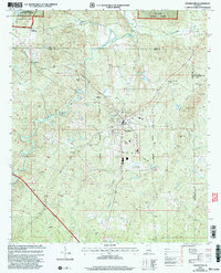
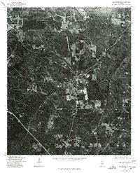 1975 Goodwater SE1977 Print · USGSCoosa County territory during the mid-seventies is revealed through high-resolution aerial imagery centered on the town of Goodwater. Researchers can trace the layout of the settlement and the clearings of nearby homesteads exactly as they appeared just after the war.
 - 1984 Map of Birmingham South, 1985 Print
 1984 Birmingham South1985 Print · USGSThe Birmingham metropolitan region and the Coosa River valley are shown here in the mid-eighties as suburban growth expanded south into the ridges. Genealogists and local historians can trace the development of communities from Bessemer to Sylacauga alongside the Lay Lake shoreline and the Talladega National Forest.2 unique versions available
 - 1987 Map of Goodwater
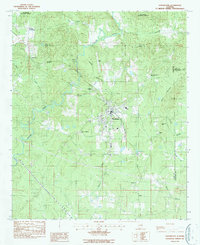 1987 Goodwater1987 Print · USGSThe town of Goodwater is documented in the late 1980s as a junction of rail and river in the heart of Coosa County. Researchers can trace family sites at Crestview Memorial Cem or locate community landmarks like Goodwater Academy and Marietta Ch.
 - 2001 Map of Goodwater, 2004 Print
 2001 Goodwater2004 Print · USGSThe crossroads and creeks of Coosa County come into focus in the early 2000s as the Central of Georgia railroad passes through Goodwater. Genealogists and local historians can trace family roots through rural landmarks like Smyrna Ch, Skeggs Crossroads, and Crestview Memorial Cem.
 - 2011 Map of Goodwater, 2011 Print
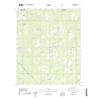
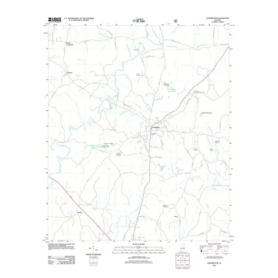 2011 Goodwater2011 Print · USGSCovers Parkdale, including Goodwater, Hatchet, and other nearby areas
 - 2014 Map of Goodwater, 2014 Print
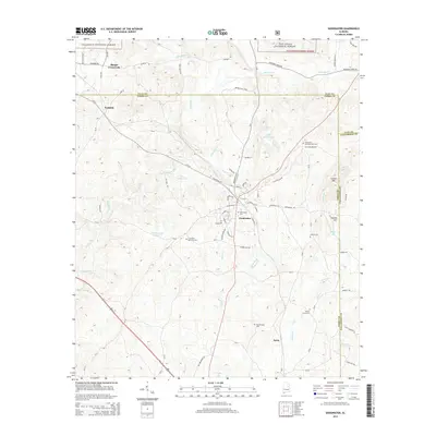 2014 Goodwater2014 Print · USGSCovers Parkdale, including Goodwater, Hatchet, and other nearby areas
 - 2018 Map of Goodwater, 2018 Print
 2018 Goodwater2018 Print · USGSCovers Parkdale, including Goodwater, Hatchet, and other nearby areas
 - 2021 Map of Goodwater, 2021 Print
 2021 Goodwater2021 Print · USGSCovers Parkdale, including Goodwater, Hatchet, and other nearby areas
 - 2024 Map of Goodwater, 2024 Print
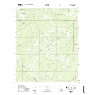
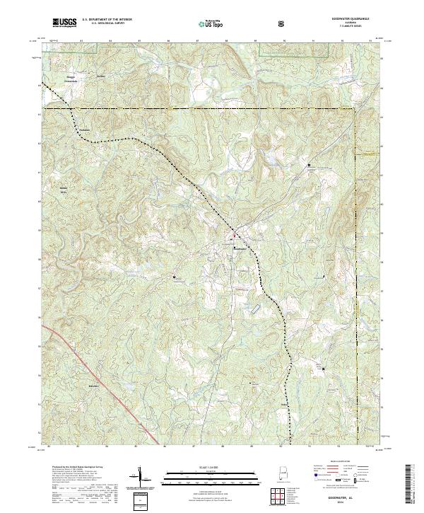 2024 Goodwater2024 Print · USGSCoosa County at the start of the 2020s shows a landscape of forest reserves and established rural townships. Genealogists can trace several local burial grounds including Smyrna Cem and Old Marietta Cem near the town of Goodwater.
End of results
Showing maps 1-16 of 16
Top cities near Parkdale
- Alexander City historical maps
- Sylacauga historical maps
- Childersburg historical maps
- Stewartville historical maps
- Goodwater historical maps
- Mignon historical maps
See more
Frequently asked questions
- What are the different types of historical maps available for Parkdale?
- What is the oldest map of Parkdale?
- Where can I purchase historical maps of Parkdale for my home or office?
- Where can I download high-res historical maps of Parkdale?
- Are there historical topographic maps available for Parkdale?
- Is there historical aerial imagery available for Parkdale?
- Where are historical maps of Parkdale sourced from?