Old Maps of Attalla, Alabama for Academic Research
Study the evolution of Attalla with 46 high-resolution historic maps. Whether you're teaching, researching, or modeling changes in land use, these maps provide essential visual documentation of urban, environmental, and geographic change.
- Analyze long-term change: Track patterns in development, transportation, and natural features.
- Ideal for environmental or urban studies: Support academic projects with primary historical map data.
- Use in the classroom or lab: Educators and researchers rely on these maps to bring historical context to life.
These maps are a powerful tool for teaching, research, and visualizing how Attalla has changed over the decades.
Attalla, AL maps
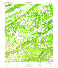
(46)- 1885 Map of Gadsden
 1885 Gadsden1885 Print · USGSNortheast Alabama in the mid-1880s was a landscape of river-side landings and emerging rail towns. Genealogists and historians can trace the early foundations of Guntersville and Gadsden while locating rural landmarks like Hillian Store, Cottonville, and Law Landing.
 - 1888 Map of Gadsden
 1888 Gadsden1888 Print · USGSNorth Alabama's river valleys and plateau lands are captured here in the late nineteenth century as the region transitioned from river landings to rail transport. Researchers can locate early post offices and commerce centers like Hillian's Store, Guntersville, and the ferry at Ft Deposit.
 - 1889 Map of Springville
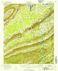
 1889 Springville1889 Print · USGSSt. Clair County and its neighbors are mapped here during the late Victorian era as railroads began to transform the old plantation and river economy. Genealogists can locate family landmarks like Henry's Mill, trace the path of Jackson's Trace, or find the location of old river crossings at Colman's Ferry.
 - 1892 Map of Springville
 1892 Springville1892 Print · USGSNortheast Alabama at the end of the nineteenth century is a landscape of river crossings and expanding rail lines. Genealogists can trace family footprints at St. Clair Springs, Greensport, and numerous river crossings like Colman's Ferry or Goodwin's Mill.7 unique versions available
 - 1892 Map of Gadsden
 1892 Gadsden1892 Print · USGSNorth Alabama's river-and-rail economy is captured here in the late nineteenth century as Guntersville and Gadsden emerge as regional hubs. Genealogists and historians can trace the routes of the Birmingham Mineral R. R. or locate old community centers like Cottonville and Mt Zion.
 - 1895 Map of Gadsden
 1895 Gadsden1895 Print · USGSNortheast Alabama at the close of the century was a landscape of river landings and mountain gaps where the Tennessee River met growing rail hubs. Genealogists can trace family holdings near Hillian Store, Cottonville, and the remote heights of Lookout Mountain.
 - 1903 Map of Gadsden
 1903 Gadsden1903 Print · USGSNorthern Alabama in the late nineteenth century centers on the busy Tennessee River corridor and its surrounding ridges. Trace old family sites and transport hubs like Hillian Store, Lovelace Landing, and the Mt Zion church.4 unique versions available
 - 1947 Map of Dunaway Mountain, 1953 Print
 1947 Dunaway Mountain1953 Print · USGSThe Etowah County countryside near Gadsden is captured here just after World War II, showing a landscape transitioning from military use to civil expansion. Researchers can trace the grounds of Camp Sibert (Abandoned) or locate local landmarks like Listers Ferry (Abandoned) and Old Harmony Ch.3 unique versions available
 - 1947 Map of Steele, 1953 Print
 1947 Steele1953 Print · USGSNorthern St. Clair County appears here in the immediate post-war years as military installations give way to rural life. Researchers can trace the boundaries of Camp Sibert, find old family church sites like Deerman Chapel, and follow the Southern rail line through Steele.3 unique versions available
 - 1947 Map of Steele, 1953 Print
 1947 Steele1953 Print · USGSMid-century Alabama life centered on the river and rail corridors between Gadsden and Ashville. Genealogists can locate family landmarks like Morgans Crossroad, Old Harmony Ch Cem, and the decommissioned Camp Sibert.2 unique versions available
 - 1953 Map of Birmingham, 1964 Print
 1953 Birmingham1964 Print · USGSCentral Alabama at mid-century shows a landscape defined by industrial expansion and the iron-rich ridges surrounding Birmingham. Researchers can trace the extensive rail networks of the L & N RR or locate historic federal sites like the Anniston Ordnance Depot.4 unique versions available
 - 1956 Map of Birmingham
 1956 Birmingham1956 Print · USGSCentral Alabama in the mid-fifties exhibits a landscape of growing cities and deep-rooted industrial corridors. Genealogists and historians can trace the development of suburban Mountain Brook or locate regional hubs like Sylacauga and Jasper.
 - 1956 Map of Gadsden, 1966 Print
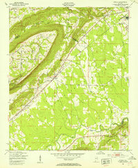
 1956 Gadsden1966 Print · USGSNorth Alabama in the mid-1950s shows a region transformed by river engineering and federal industry. Genealogists and local historians can trace the development of the Tennessee Valley through the growth of Huntsville, the sprawling Redstone Arsenal, and the expansive Guntersville Lake.3 unique versions available
 - 1957 Map of Birmingham
 1957 Birmingham1957 Print · USGSNorth-Central Alabama in the mid-fifties is an industrial powerhouse centered on the steel valleys and sprawling iron ridges. Genealogists and historians can trace the rail-linked growth of Birmingham and Tuscaloosa, or locate rural landmarks like Talladega College and the Anniston Ordnance Depot.
 - 1958 Map of Gadsden
 1958 Gadsden1958 Print · USGSNorth Alabama comes alive in the late 1950s as the Tennessee Valley Authority’s massive river projects and the rise of the space industry reshaped the landscape. Researchers can trace the mid-century footprints of Huntsville, Redstone Arsenal, and the riverside rail networks of the Southern railroad.
 - 1959 Map of Gadsden, 1961 Print
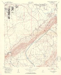
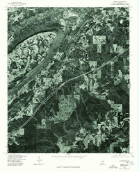
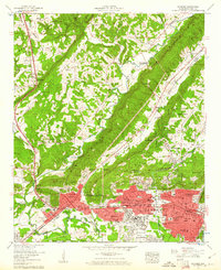 1959 Gadsden1961 Print · USGSGadsden and Attalla are shown during a period of industrial growth in the late fifties, framed by the ridges of Lookout Mountain. Researchers can trace the city’s footprint from Union Station to residential developments like Tuckahoe Heights and local landmarks like Noccalula Falls.5 unique versions available
 - 1959 Map of Howelton, 1961 Print
 1959 Howelton1961 Print · USGSEtowah and Blount counties are shown in the late 1950s, revealing a landscape of ridge-and-valley settlements. Researchers can trace the Louisville and Nashville rail corridor and find local landmarks like Howelton Cem and Egypt.2 unique versions available
 - 1960 Map of Gadsden
 1960 Gadsden1960 Print · USGSNorthern Alabama in the mid-1950s is defined by the mighty Tennessee River and its massive reservoirs. Trace the development of Huntsville and Redstone Arsenal or explore the vast William B Bankhead National Forest.2 unique versions available
 - 1963 Map of Gadsden
 1963 Gadsden1963 Print · USGSNorthern Alabama underwent a dramatic mid-century transformation as the Tennessee Valley became a hub for defense and industry. Researchers can trace the development of the Redstone Arsenal, the route of the Natchez Trace Parkway, and long-standing rail lines like the Southern Railway.
 - 1975 Map of Steele, 1977 Print
 1975 Steele1977 Print · USGSSt. Clair County settlements appear amidst the ridge-and-valley terrain during the mid-seventies. Researchers can examine the exact land use and road patterns surrounding Steele and Gallant as the interstate era reshaped the region.
 - 1975 Map of Dunaway Mountain, 1977 Print
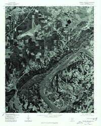 1975 Dunaway Mountain1977 Print · USGSThe Coosa River valley comes into sharp focus during the mid-seventies, showing the transition from agricultural land to growing suburban centers. Local historians can trace the exact 1975 footprint of Rainbow City, the infrastructure of Gadsden, and the shoreline of H Neely Henry Lake.
 - 1984 Map of Guntersville, 1985 Print
 1984 Guntersville1985 Print · USGSNorthern Alabama at the start of the eighties shows a landscape shaped by massive TVA impoundments and a robust rail network. Genealogists and historians can trace family land across Brindley Mountain or near old rail stops on the Louisville and Nashville RR and Southern Ry.2 unique versions available
 - 1984 Map of Birmingham North, 1985 Print
 1984 Birmingham North1985 Print · USGSNorth Alabama in the mid-eighties shows the bustling intersection of the Appalachian foothills and the Deep South's industrial heart. Genealogists and historians can trace the paths of the Southern Railway and Seaboard System Railroad through towns like Oneonta, Leeds, and Springville.2 unique versions available
 - 2011 Map of Gadsden West, 2011 Print
 2011 Gadsden West2011 Print · USGSCovers Attalla, including Gadsden, Reece City, and other nearby areas
 - 2011 Map of Dunaway Mountain, 2011 Print
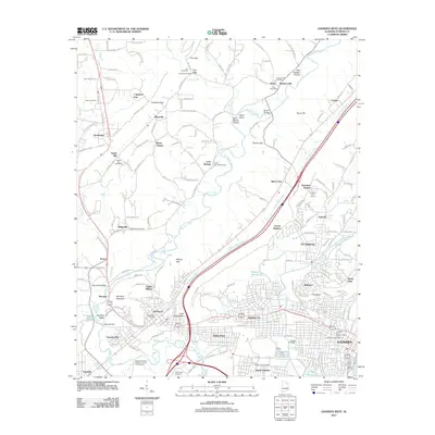
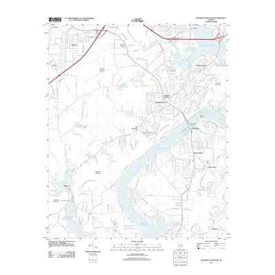 2011 Dunaway Mountain2011 Print · USGSCovers Attalla, including Gadsden, Rainbow City, and other nearby areas
Showing maps 1-25 of 46
Top cities near Attalla
- Gadsden historical maps
- Albertville historical maps
- Rainbow City historical maps
- Boaz historical maps
- Southside historical maps
- Glencoe historical maps
See more
Top neighborhoods of Attalla
- Curtiston historical maps
- Pleasant Valley historical maps
- Happy Hollow historical maps
- Stowers Hill historical maps
- Lester historical maps
- Siberton historical maps
Frequently asked questions
- What are the different types of historical maps available for Attalla?
- What is the oldest map of Attalla?
- Where can I purchase historical maps of Attalla for my home or office?
- Where can I download high-res historical maps of Attalla?
- Are there historical topographic maps available for Attalla?
- Is there historical aerial imagery available for Attalla?
- Where are historical maps of Attalla sourced from?