Old Maps of Gadsden, Alabama for Hiking & Exploration
Hike through history with 58 historic maps of Gadsden. Explore old trails, ghost towns, and forgotten backroads — perfect for outdoor adventurers and local explorers.
- Rediscover forgotten places: Map out old mining camps, roads, and footpaths that no longer exist on modern maps.
- Layer with modern tools: Combine with LiDAR or satellite views to plan hikes through historical terrain.
- Made for exploration: Popular among hikers, overlanders, and local history lovers.
Use these maps to find adventure and explore the hidden past of Gadsden.
Gadsden, AL maps
(58)- 1885 Map of Gadsden
 1885 Gadsden1885 Print · USGSNortheast Alabama in the mid-1880s was a landscape of river-side landings and emerging rail towns. Genealogists and historians can trace the early foundations of Guntersville and Gadsden while locating rural landmarks like Hillian Store, Cottonville, and Law Landing.
 - 1888 Map of Gadsden
 1888 Gadsden1888 Print · USGSNorth Alabama's river valleys and plateau lands are captured here in the late nineteenth century as the region transitioned from river landings to rail transport. Researchers can locate early post offices and commerce centers like Hillian's Store, Guntersville, and the ferry at Ft Deposit.
 - 1889 Map of Springville
 1889 Springville1889 Print · USGSSt. Clair County and its neighbors are mapped here during the late Victorian era as railroads began to transform the old plantation and river economy. Genealogists can locate family landmarks like Henry's Mill, trace the path of Jackson's Trace, or find the location of old river crossings at Colman's Ferry.
 - 1892 Map of Springville
 1892 Springville1892 Print · USGSNortheast Alabama at the end of the nineteenth century is a landscape of river crossings and expanding rail lines. Genealogists can trace family footprints at St. Clair Springs, Greensport, and numerous river crossings like Colman's Ferry or Goodwin's Mill.7 unique versions available
 - 1892 Map of Gadsden
 1892 Gadsden1892 Print · USGSNorth Alabama's river-and-rail economy is captured here in the late nineteenth century as Guntersville and Gadsden emerge as regional hubs. Genealogists and historians can trace the routes of the Birmingham Mineral R. R. or locate old community centers like Cottonville and Mt Zion.
 - 1893 Map of Fort Payne
 1893 Fort Payne1893 Print · USGSNortheast Alabama is shown here in the late nineteenth century as the rail network transformed the valley floor. Genealogists and historians can trace family-named crossroads like Hoge's X Roads and vital river crossings including Coker Ferry and Sewell Ferry.
 - 1895 Map of Gadsden
 1895 Gadsden1895 Print · USGSNortheast Alabama at the close of the century was a landscape of river landings and mountain gaps where the Tennessee River met growing rail hubs. Genealogists can trace family holdings near Hillian Store, Cottonville, and the remote heights of Lookout Mountain.
 - 1898 Map of Fort Payne, 1964 Print
 1898 Fort Payne1964 Print · USGSDeKalb and Cherokee counties in the late 1890s are defined by the steep ridges of Lookout Mountain and a bustling network of river ferries. Genealogists can trace family roots through numerous river crossings like Hardwick Ferry and early industrial sites such as Sloan Mill or Abernathy Mill.
 - 1900 Map of Fort Payne
 1900 Fort Payne1900 Print · USGSNortheast Alabama is defined by its deep ridges and river valleys in the late nineteenth century. Researchers can trace the era's ferry network across the Coosa River and find old family-run landmarks like Wagners Store and Santy Mills.6 unique versions available
 - 1900 Map of Anniston
 1900 Anniston1900 Print · USGSNortheast Alabama thrived as a railroad and industrial crossroads at the turn of the century. Genealogists and researchers can trace family landmarks and early transport hubs from the Coosa River to Anniston, including Salt Creek Church and Fowler Ferry.6 unique versions available
 - 1903 Map of Gadsden
 1903 Gadsden1903 Print · USGSNorthern Alabama in the late nineteenth century centers on the busy Tennessee River corridor and its surrounding ridges. Trace old family sites and transport hubs like Hillian Store, Lovelace Landing, and the Mt Zion church.4 unique versions available
 - 1947 Map of Dunaway Mountain, 1953 Print
 1947 Dunaway Mountain1953 Print · USGSThe Etowah County countryside near Gadsden is captured here just after World War II, showing a landscape transitioning from military use to civil expansion. Researchers can trace the grounds of Camp Sibert (Abandoned) or locate local landmarks like Listers Ferry (Abandoned) and Old Harmony Ch.3 unique versions available
 - 1947 Map of Glencoe, 1953 Print
 1947 Glencoe1953 Print · USGSGadsden and the Coosa River valley are seen here in the post-war era, showing a mix of industrial mobilization and rural life. Researchers can find military installations like the Specialized Depot 889th AF and historic churches including Antioch Ch and Oak Grove Ch.2 unique versions available
 - 1947 Map of Jacksonville, 1953 Print
 1947 Jacksonville1953 Print · USGSPostwar Etowah and Calhoun counties show a unique mix of expanding industrial centers and deeply rooted rural communities. Local historians can trace early school sites like Webster Sch and long-standing spiritual hubs such as Tredegar Chapel or Friendship Ch.
 - 1947 Map of Steele, 1953 Print
 1947 Steele1953 Print · USGSMid-century Alabama life centered on the river and rail corridors between Gadsden and Ashville. Genealogists can locate family landmarks like Morgans Crossroad, Old Harmony Ch Cem, and the decommissioned Camp Sibert.2 unique versions available
 - 1953 Map of Birmingham, 1964 Print
 1953 Birmingham1964 Print · USGSCentral Alabama at mid-century shows a landscape defined by industrial expansion and the iron-rich ridges surrounding Birmingham. Researchers can trace the extensive rail networks of the L & N RR or locate historic federal sites like the Anniston Ordnance Depot.4 unique versions available
 - 1953 Map of Atlanta, 1965 Print
 1953 Atlanta1965 Print · USGSThe growing Atlanta metro and the industrial corridors of Eastern Alabama are captured here during the mid-century transition. Researchers can trace the rail-to-road shift through hubs like Anniston and La Grange or locate sites within Fort McClellan.2 unique versions available
 - 1955 Map of Rome
 1955 Rome1955 Print · USGSThe tri-state borderlands of Georgia, Alabama, and Tennessee appear in the mid-fifties as a landscape of ridge-and-valley industry and river navigation. Genealogists can trace family footprints near Chattanooga, the iron works of Gadsden, and textile towns like Trion or Summerville.
 - 1956 Map of Birmingham
 1956 Birmingham1956 Print · USGSCentral Alabama in the mid-fifties exhibits a landscape of growing cities and deep-rooted industrial corridors. Genealogists and historians can trace the development of suburban Mountain Brook or locate regional hubs like Sylacauga and Jasper.
 - 1956 Map of Glencoe, 1961 Print
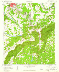 1956 Glencoe1961 Print · USGSThe industrial corridor south of Gadsden comes alive in this mid-century portrait of Etowah County. Researchers can trace the sprawling Gadsden Air Force Depot and local landmarks like Paden Ch and the State Prison Camp.3 unique versions available
 - 1956 Map of Gadsden, 1966 Print
 1956 Gadsden1966 Print · USGSNorth Alabama in the mid-1950s shows a region transformed by river engineering and federal industry. Genealogists and local historians can trace the development of the Tennessee Valley through the growth of Huntsville, the sprawling Redstone Arsenal, and the expansive Guntersville Lake.3 unique versions available
 - 1957 Map of Birmingham
 1957 Birmingham1957 Print · USGSNorth-Central Alabama in the mid-fifties is an industrial powerhouse centered on the steel valleys and sprawling iron ridges. Genealogists and historians can trace the rail-linked growth of Birmingham and Tuscaloosa, or locate rural landmarks like Talladega College and the Anniston Ordnance Depot.
 - 1957 Map of Atlanta
 1957 Atlanta1957 Print · USGSAtlanta and the Alabama borderlands appear here in the mid-fifties, capturing the region's post-war suburban and industrial transition. Trace the development of early transport hubs and military sites like Fort McPherson, Anniston, and the Kennesaw Mountain National Battlefield Park.
 - 1958 Map of Gadsden
 1958 Gadsden1958 Print · USGSNorth Alabama comes alive in the late 1950s as the Tennessee Valley Authority’s massive river projects and the rise of the space industry reshaped the landscape. Researchers can trace the mid-century footprints of Huntsville, Redstone Arsenal, and the riverside rail networks of the Southern railroad.
 - 1958 Map of Atlanta
 1958 Atlanta1958 Print · USGSMid-century Georgia and Alabama are shown in this regional study of the corridor between the Chattahoochee River and the Appalachian foothills. Local historians can trace the development of suburban Atlanta alongside vital landmarks like Stone Mountain, Dobbins AFB, and the Seaboard Air Line rail routes.
Showing maps 1-25 of 58
Top cities near Gadsden
- Albertville historical maps
- Rainbow City historical maps
- Boaz historical maps
- Southside historical maps
- Attalla historical maps
- Glencoe historical maps
See more
Top neighborhoods of Gadsden
- Agricola historical maps
- Northside historical maps
- Burns Park historical maps
- East Gadsden historical maps
- Walnut Park historical maps
- Alabama City historical maps
See more
Frequently asked questions
- What are the different types of historical maps available for Gadsden?
- What is the oldest map of Gadsden?
- Where can I purchase historical maps of Gadsden for my home or office?
- Where can I download high-res historical maps of Gadsden?
- Are there historical topographic maps available for Gadsden?
- Is there historical aerial imagery available for Gadsden?
- Where are historical maps of Gadsden sourced from?