Old Maps of Hale County, Alabama for Academic Research
Study the evolution of Hale County with 145 high-resolution historic maps. Whether you're teaching, researching, or modeling changes in land use, these maps provide essential visual documentation of urban, environmental, and geographic change.
- Analyze long-term change: Track patterns in development, transportation, and natural features.
- Ideal for environmental or urban studies: Support academic projects with primary historical map data.
- Use in the classroom or lab: Educators and researchers rely on these maps to bring historical context to life.
These maps are a powerful tool for teaching, research, and visualizing how Hale County has changed over the decades.
Hale County, AL maps
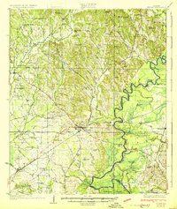
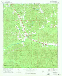
(145)- 1899 Map of Brookwood
 1899 Brookwood1899 Print · USGSCentral Alabama at the close of the nineteenth century is a landscape of growing mining towns and vital river crossings. Trace the early industrial rail lines like the Birmingham Mineral R. R. and locate family landmarks such as Weaver Mill, Pratt Ferry, and Providence Ch.4 unique versions available
 - 1924 Map of Tuscaloosa, 1957 Print
 1924 Tuscaloosa1957 Print · USGSTuscaloosa and the Black Warrior River valley are seen here in the mid-1920s, showing a landscape defined by river bends and rail lines. Researchers can trace the early footprint of the University of Alabama or locate rural sites like Cribbs Mill and Little Satan Church.
 - 1926 Map of Tuscaloosa
 1926 Tuscaloosa1926 Print · USGSCentral Alabama's river-and-rail landscape is captured here during the mid-twenties, showcasing the growth of the University of Alabama and Tuscaloosa. Genealogists and historians can trace family-named sites like Carson Bluff Bend and rural landmarks such as Coker, Kings Ferry, and the Hull Consolidated School.3 unique versions available
 - 1927 Map of Eutaw
 1927 Eutaw1927 Print · USGSIn the Alabama Black Belt during the late 1920s, the river and rail networks defined local life and commerce. Genealogists and researchers can trace dozens of rural landmarks, from the County Poor Farm and Rosenwald School to river crossings at Forches Ferry.
 - 1931 Map of Cottondale
 1931 Cottondale1931 Print · USGSTuscaloosa County at the start of the 1930s shows a landscape of timber rails and rural churches. Genealogists and historians can trace the Kaul Lumber Co (Abandoned) line or locate old community centers like Andrews Chapel and Duncanville.
 - 1931 Map of Eutaw
 1931 Eutaw1931 Print · USGSThe Black Warrior River valley in the late twenties was a landscape of river locks and rail junctions centered on Eutaw. Local historians can trace early rural infrastructure like the Rosenwald School, the County Poor Farm, and Pinckes Ferry.4 unique versions available
 - 1934 Map of Cottondale
 1934 Cottondale1934 Print · USGSDuring the mid-1930s, the rail corridors of the Southern Railway and Mobile and Ohio Railroad shaped the growth of eastern Tuscaloosa County. Genealogists can trace family footprints near Cottondale and Duncanville or locate long-standing landmarks like Emerson Chapel and Howell Sch.3 unique versions available
 - 1946 Map of Demopolis, 1947 Print
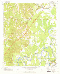
 1946 Demopolis1947 Print · USGSDemopolis and its surrounding river bends are captured here in the mid-1940s, showing a landscape defined by the Tombigbee and Black Warrior rivers. Genealogists and historians can trace community roots through numerous local landmarks like Jerusalem Ch, Birdine Junior High Sch, and Merriwether Ferry.3 unique versions available
 - 1947 Map of Demopolis
 1947 Demopolis1947 Print · USGSDemopolis and its surroundings were defined by the convergence of major rivers and railroads in the late 1940s. Genealogists and historians can trace community life through sites like the Rosenwald Sch, the Arington Cem, and landmarks such as Merriwether Ferry.
 - 1947 Map of Mason Bend, 1948 Print
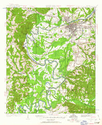
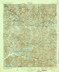
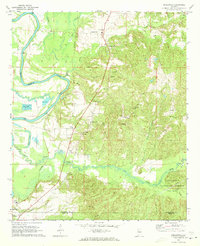
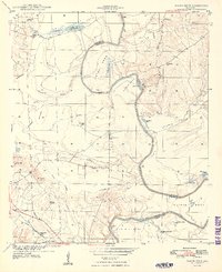 1947 Mason Bend1948 Print · USGSThe Black Warrior River winds through Greene and Hale counties in the late 1940s, defining a landscape of deep oxbows and rural quarters. Researchers can trace local genealogy through several school sites like Loyss Sch and family landmarks such as Walden Quarters and Creehill Cem.2 unique versions available
 - 1948 Map of Mason Bend
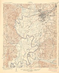
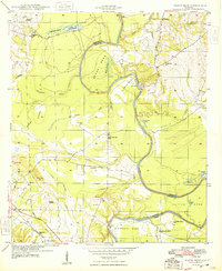 1948 Mason Bend1948 Print · USGSThe Black Warrior River winds through Greene and Hale counties in the late 1940s, revealing a landscape of river-bend settlements and labor quarters. Genealogists and historians can trace the locations of Ebenezer Sch, Walden Quarters, and Lock No 6.
 - 1953 Map of Montgomery, 1964 Print
 1953 Montgomery1964 Print · USGSCentral Alabama's river-and-rail corridor is mapped here in the mid-fifties, showing the vital connections between the capital and the Black Belt. Genealogists and historians can trace rail depots and crossroads from Marion Junction to Wetumpka, alongside landmarks like Craig AFB.4 unique versions available
 - 1953 Map of Birmingham, 1964 Print
 1953 Birmingham1964 Print · USGSCentral Alabama at mid-century shows a landscape defined by industrial expansion and the iron-rich ridges surrounding Birmingham. Researchers can trace the extensive rail networks of the L & N RR or locate historic federal sites like the Anniston Ordnance Depot.4 unique versions available
 - 1956 Map of Birmingham
 1956 Birmingham1956 Print · USGSCentral Alabama in the mid-fifties exhibits a landscape of growing cities and deep-rooted industrial corridors. Genealogists and historians can trace the development of suburban Mountain Brook or locate regional hubs like Sylacauga and Jasper.
 - 1956 Map of Montgomery
 1956 Montgomery1956 Print · USGSCentral Alabama in the mid-1950s shows a landscape defined by its great river systems and a booming military aviation presence. Genealogists and historians can trace the rail corridors of the Southern Railway and locate tactical bases like Maxwell AFB and Craig AFB.
 - 1957 Map of Birmingham
 1957 Birmingham1957 Print · USGSNorth-Central Alabama in the mid-fifties is an industrial powerhouse centered on the steel valleys and sprawling iron ridges. Genealogists and historians can trace the rail-linked growth of Birmingham and Tuscaloosa, or locate rural landmarks like Talladega College and the Anniston Ordnance Depot.
 - 1957 Map of Montgomery
 1957 Montgomery1957 Print · USGSCentral Alabama in the mid-fifties is defined by the winding Alabama River and a strategic network of military bases and rail lines. Trace family roots in Montgomery and Selma, or locate landmarks like Craig AFB and the State Capitol before the interstate era.
 - 1968 Map of Uniontown West, 1971 Print
 1968 Uniontown West1971 Print · USGSUniontown and Faunsdale sit at the center of this late-sixties survey of Alabama's Black Belt, following the route of the SOUTHERN railroad. Researchers can trace family history through local landmarks like St Michaels Cem, Siddonsville, and Hatch High Sch.3 unique versions available
 - 1968 Map of Gallion, 1971 Print
 1968 Gallion1971 Print · USGSGallion and the surrounding Marengo County countryside appear here in the late sixties, showing a landscape defined by small rural congregations and the Southern railway. Researchers can trace family history through several landmarks like St Pauls Ch, St James Ch, and the Allenville Cem.3 unique versions available
 - 1969 Map of Duncanville, 1972 Print
 1969 Duncanville1972 Print · USGSDuncanville and the surrounding Tuscaloosa County hinterlands are shown here in the late sixties as the timber and rail industries shaped the local landscape. Genealogists can locate family landmarks like Mt Sinai Ch Cem, South Sandy Cem, and the Shiloh Lookout Tower.3 unique versions available
 - 1969 Map of Fosters, 1973 Print
 1969 Fosters1973 Print · USGSThe Black Warrior River valley near Tuscaloosa was undergoing major change in the late sixties as new highways were built through the bottomlands. Researchers can locate the Indian Mounds at Moundville or trace family sites like Myrtlewood Sch and Dry Creek Ch.2 unique versions available
 - 1970 Map of Englewood, 1973 Print
 1970 Englewood1973 Print · USGSThe Black Warrior River valley and the Talladega National Forest meet in this 1970s survey of the Alabama borderlands. Researchers can trace rural lineages through numerous country churches like Zion Hope Ch or locate the ancient mounds at Mound State Mon.4 unique versions available
 - 1979 Map of Morgan Springs, 1980 Print
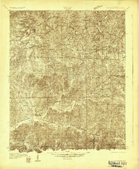
 1979 Morgan Springs1980 Print · USGSThe Alabama countryside along the Hale and Perry county line is captured here in the late seventies. Family historians can locate several burial grounds and rural congregations, including Harper Cem, Morning Star Ch, and Pineview Ch.2 unique versions available
 - 1979 Map of Greensboro, 1980 Print
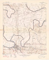
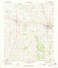
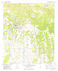 1979 Greensboro1980 Print · USGSThe Hale County seat of Greensboro is shown in the late 1970s as a hub of rail and local commerce. Genealogists can trace family landmarks like Jenkins Place Cem, McCoy Cem, and numerous country chapels including Rising Star Ch.
 - 1980 Map of Casemore
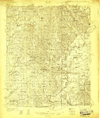
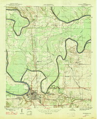
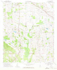
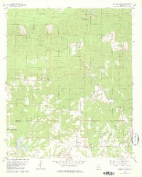
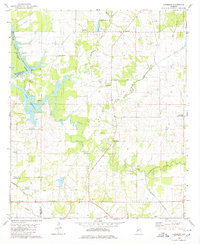 1980 Casemore1980 Print · USGSHale County's fertile Black Belt region is captured here in the 1980s, defined by the winding Black Warrior River and a dense network of rural communities. Researchers can trace local heritage through numerous landmarks like St Andrews Ch, Lock 5, and the old settlement of Prairieville.4 unique versions available
Showing maps 1-25 of 145
Top cities of Hale County
Frequently asked questions
- What are the different types of historical maps available for Hale County?
- What is the oldest map of Hale County?
- Where can I purchase historical maps of Hale County for my home or office?
- Where can I download high-res historical maps of Hale County?
- Are there historical topographic maps available for Hale County?
- Is there historical aerial imagery available for Hale County?
- Where are historical maps of Hale County sourced from?