Old Maps of Riverland Estates, Alabama for Metal Detecting
Plan your next treasure hunt with 16 historic maps of Riverland Estates. Find old homesites, ghost towns, trails, and gathering spots that may be lost to time — perfect for identifying promising metal detecting locations.
- Locate forgotten sites: Uncover places like long-lost settlements, abandoned rail lines, or gathering spots.
- Plan better hunts: Use map overlays combined with LiDAR or satellite views to narrow in on historically rich areas.
- Made for detectorists: Thousands of hobbyists use these maps to discover relics, coins, and hidden history.
Use these historic maps to boost your research and find new opportunities beneath the surface of Riverland Estates.
Riverland Estates, AL maps
(16)- 1886 Map of Stevenson
 1886 Stevenson1886 Print · USGSNortheast Alabama at the peak of the railroad era shows a landscape tied to the river and the rails. Genealogists can trace family landmarks like Coffey's Store or locate river crossings such as Caperton Ferry and Snodgrass Ferry.
 - 1892 Map of Stevenson
 1892 Stevenson1892 Print · USGSNortheast Alabama and the Tennessee border in the 1890s reveal a landscape of mountain coves and vital river crossings. Genealogists and historians can trace rail junctions at Stevenson, river landings like Coffey's Ferry, and landmarks like Nickajack Cave.
 - 1895 Map of Stevenson
 1895 Stevenson1895 Print · USGSThe Tennessee River valley and surrounding plateaus were a hub of rail and river commerce at the close of the century. Genealogists can trace family crossings at Island Creek Ferry or locate old communities like Bellefonte, Stevenson, and Valley Head.6 unique versions available
 - 1936 Map of Hollywood
 1936 Hollywood1936 Print · USGSJackson County is captured during the mid-thirties as the Tennessee Valley Authority prepared for the flooding of the Guntersville Reservoir. You can trace the old paths of the Lee Highway, locate the Wheeler Mine, or find family names at Phillip Cem and Bellefonte Cem.
 - 1947 Map of Hollywood, 1972 Print
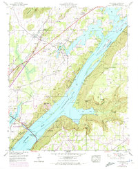 1947 Hollywood1972 Print · USGSJackson County is shown during a period of transition as the Tennessee River valley matured around Guntersville Lake. Researchers can trace family history through sites like Hollywood School and over a dozen family cemeteries including Finnell Cem and Hudgins Cem.4 unique versions available
 - 1950 Map of Hollywood
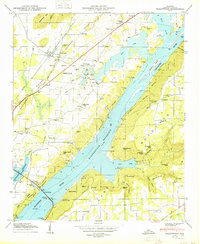 1950 Hollywood1950 Print · USGSMid-century Jackson County is defined here by the rising waters of the Guntersville Reservoir as it reshapes the Tennessee River valley. Genealogists and local historians can trace old community ties through sites like Bellefonte, the Hollywood School, and the Chisenhall Cem.2 unique versions available
 - 1955 Map of Rome
 1955 Rome1955 Print · USGSThe tri-state borderlands of Georgia, Alabama, and Tennessee appear in the mid-fifties as a landscape of ridge-and-valley industry and river navigation. Genealogists can trace family footprints near Chattanooga, the iron works of Gadsden, and textile towns like Trion or Summerville.
 - 1958 Map of Rome, 1966 Print
 1958 Rome1966 Print · USGSNorthwest Georgia and neighboring Tennessee and Alabama are captured here in the late fifties, showcasing a landscape of high ridges and river valleys. Researchers can trace historic rail lines like the Seaboard Air Line RR and explore the bounds of Cloudland Canyon State Park or Fort Oglethorpe.3 unique versions available
 - 1961 Map of Rome
 1961 Rome1961 Print · USGSNorthwest Georgia and neighboring Tennessee and Alabama are shown here at a moment of significant mid-century growth. Researchers can trace the rail networks of the Central of Georgia or locate landmarks within Chickamauga and Chattanooga Nat Military Park.
 - 1963 Map of Rome
 1963 Rome1963 Print · USGSThe tri-state corner of Georgia, Alabama, and Tennessee is captured here during a period of massive reservoir expansion and post-war growth. Genealogists and historians can trace the rail corridors of the Southern Ry or locate landmarks like Fort Oglethorpe and Cloudland Canyon State Park.
 - 1981 Map of Chickamauga, 1982 Print
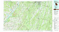 1981 Chickamauga1982 Print · USGSThe tri-state border region of Georgia, Alabama, and Tennessee comes into focus during the early eighties, defined by the towering ridges of the Appalachians. Historians can trace the preserved grounds of Chickamauga and Chattanooga National Military Park and old rail stops like Rising Fawn or Sulphur Springs.2 unique versions available
 - 2011 Map of Hollywood, 2011 Print
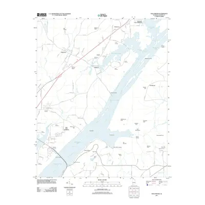 2011 Hollywood2011 Print · USGSJackson County's riverfront emerges in this modern survey, showing the vast reach of Guntersville Lake over the old Tennessee River channel. Genealogists can locate several family burial grounds including Sarratt Cemetery, Henry Cemetery, and Norwood Cemetery.
 - 2014 Map of Hollywood, 2014 Print
 2014 Hollywood2014 Print · USGSJackson County's river valley and surrounding ridges are captured here in the mid-2010s as the Tennessee River bypasses several small settlements. Genealogists and local historians can locate many family burial sites such as Shipp Cem and Finnell Cem or trace the old routes near Hales Ferry Gap.
 - 2018 Map of Hollywood, 2018 Print
 2018 Hollywood2018 Print · USGSThe Tennessee River valley near Scottsboro comes into focus in this late twenty-tens survey, showing a landscape defined by the waters of Guntersville Lake. Genealogists and local historians can trace scattered family sites like Bellefonte Cem and Hansbrough Cem alongside landmarks like Comer Bridge.
 - 2020 Map of Hollywood, 2020 Print
 2020 Hollywood2020 Print · USGSThe Tennessee River valley near Scottsboro comes into focus here, showing the modern lakefront and the legacy of early settlements. Genealogists can trace family burial sites like Wilhelm Mordah Cem and Duncan Hill Harris Cem while exploring landmarks like Comer Bridge.
 - 2024 Map of Hollywood, 2024 Print
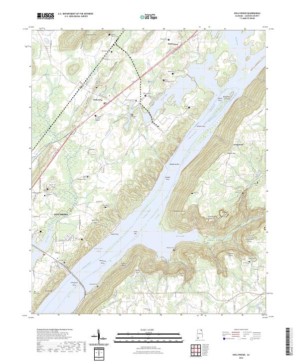 2024 Hollywood2024 Print · USGSNortheast Alabama’s river culture is on full display in this study of the Jackson County landscape. Family researchers can locate numerous burial grounds like Old Baptist Cem and Samuel Rorex Cem or trace river crossings at Whites Ferry.
End of results
Showing maps 1-16 of 16
Top cities near Riverland Estates
- Scottsboro historical maps
- Fort Payne historical maps
- Rainsville historical maps
- Henagar historical maps
- Bridgeport historical maps
- Stevenson historical maps
See more
Frequently asked questions
- What are the different types of historical maps available for Riverland Estates?
- What is the oldest map of Riverland Estates?
- Where can I purchase historical maps of Riverland Estates for my home or office?
- Where can I download high-res historical maps of Riverland Estates?
- Are there historical topographic maps available for Riverland Estates?
- Is there historical aerial imagery available for Riverland Estates?
- Where are historical maps of Riverland Estates sourced from?