Old Maps of Sullivan Crossroads, Alabama for Genealogy
Trace your family roots with 14 historic maps of Sullivan Crossroads. These high-res maps reveal old neighborhoods, homesites, landmarks, and streets — helping you uncover where your ancestors lived and how the area evolved over time.
- Explore historic neighborhoods: Identify where your relatives may have lived in the 1800s or 1900s.
- Compare maps over time: Trace the changes in streets, buildings, and landmarks for multi-generational research.
- Perfect for genealogy & ancestry research: Used by family historians and researchers to map out lineage and migration.
These maps are an incredible resource for exploring your personal connection to Sullivan Crossroads's past.
Sullivan Crossroads, AL maps
(14)- 1924 Map of Gravelly Springs
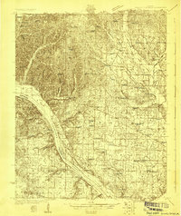 1924 Gravelly Springs1924 Print · USGSLauderdale County at the edge of the Tennessee River reveals a vibrant rural society in the mid-twenties, centered on the river and the rail line. Researchers can trace the heritage of vanished landmarks like Lyle Academy, the Colbert Shoals Canal, and the Oakland School (Colored).2 unique versions available
 - 1926 Map of Gravelly Springs
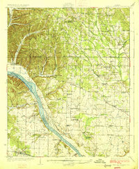 1926 Gravelly Springs1926 Print · USGSNorthwest Alabama is seen here in the mid-twenties, when the river and rail lines dictated the rhythm of Lauderdale and Colbert counties. Genealogists can locate family landmarks like Lyle Academy, Youngs Store, and the Colbert Shoals Canal.2 unique versions available
 - 1936 Map of Threet
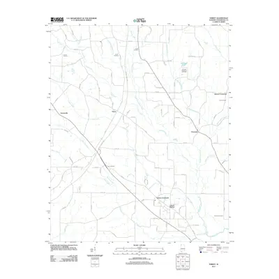
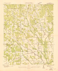 1936 Threet1936 Print · USGSLauderdale County in the mid-1930s is revealed as a network of creek-side farmsteads and rural crossroads. Genealogists can locate family landmarks like Pine Hill Cem, Wesley Chapel, and the Burcham Valley Sch.
 - 1954 Map of Threet, 1958 Print
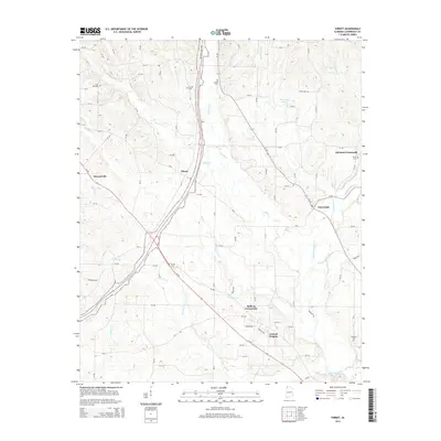
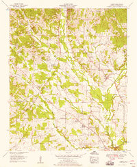 1954 Threet1958 Print · USGSLauderdale County in the mid-fifties is seen here through its rural network of community churches and the historic Natchez Trace Parkway. Local historians can trace old property boundaries near Sullivan Crossroads, Threet, and the Little Zion Church.4 unique versions available
 - 1956 Map of Gadsden, 1966 Print
 1956 Gadsden1966 Print · USGSNorth Alabama in the mid-1950s shows a region transformed by river engineering and federal industry. Genealogists and local historians can trace the development of the Tennessee Valley through the growth of Huntsville, the sprawling Redstone Arsenal, and the expansive Guntersville Lake.3 unique versions available
 - 1958 Map of Gadsden
 1958 Gadsden1958 Print · USGSNorth Alabama comes alive in the late 1950s as the Tennessee Valley Authority’s massive river projects and the rise of the space industry reshaped the landscape. Researchers can trace the mid-century footprints of Huntsville, Redstone Arsenal, and the riverside rail networks of the Southern railroad.
 - 1960 Map of Gadsden
 1960 Gadsden1960 Print · USGSNorthern Alabama in the mid-1950s is defined by the mighty Tennessee River and its massive reservoirs. Trace the development of Huntsville and Redstone Arsenal or explore the vast William B Bankhead National Forest.2 unique versions available
 - 1963 Map of Gadsden
 1963 Gadsden1963 Print · USGSNorthern Alabama underwent a dramatic mid-century transformation as the Tennessee Valley became a hub for defense and industry. Researchers can trace the development of the Redstone Arsenal, the route of the Natchez Trace Parkway, and long-standing rail lines like the Southern Railway.
 - 1986 Map of Tuscumbia
 1986 Tuscumbia1986 Print · USGSThe Tennessee River valley in the mid-1980s shows a landscape transformed by massive reservoirs and industrial hubs. Genealogists and local historians can trace the development of the Shoals area and locate rural communities like Tharp Town, Leighton, and Rogersville.3 unique versions available
 - 2011 Map of Threet, 2011 Print
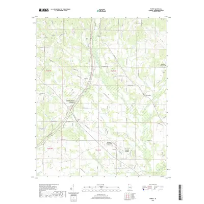
 2011 Threet2011 Print · USGSCovers Sullivan Crossroads, including Stewartville, Central Heights, and other nearby areas
 - 2014 Map of Threet, 2014 Print
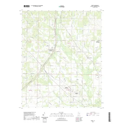
 2014 Threet2014 Print · USGSCovers Sullivan Crossroads, including Stewartville, Central Heights, and other nearby areas
 - 2018 Map of Threet, 2018 Print
 2018 Threet2018 Print · USGSCovers Sullivan Crossroads, including Stewartville, Central Heights, and other nearby areas
 - 2020 Map of Threet, 2020 Print
 2020 Threet2020 Print · USGSCovers Sullivan Crossroads, including Stewartville, Central Heights, and other nearby areas
 - 2024 Map of Threet, 2024 Print
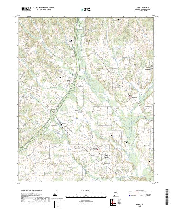 2024 Threet2024 Print · USGSLauderdale County at the start of the 2020s shows a landscape of crossroads communities and ancestral cemeteries. Trace family roots at Wesley Chapel Cem or explore the corridor of the Natchez Trace Parkway near Threet and Cloverdale.
End of results
Showing maps 1-14 of 14
Top cities near Sullivan Crossroads
- Florence historical maps
- Muscle Shoals historical maps
- Sheffield historical maps
- Tuscumbia historical maps
- Underwood-Petersville historical maps
- Cherokee historical maps
See more
Frequently asked questions
- What are the different types of historical maps available for Sullivan Crossroads?
- What is the oldest map of Sullivan Crossroads?
- Where can I purchase historical maps of Sullivan Crossroads for my home or office?
- Where can I download high-res historical maps of Sullivan Crossroads?
- Are there historical topographic maps available for Sullivan Crossroads?
- Is there historical aerial imagery available for Sullivan Crossroads?
- Where are historical maps of Sullivan Crossroads sourced from?