Old Maps of Lee County, Alabama
Explore 30 old maps of Lee County, spanning from 1906 to today. These high-resolution historic maps reveal how streets, neighborhoods, landmarks, and natural features evolved over time — perfect for genealogy, metal detecting, research, and local history exploration.
What you can do with these maps:
- See how Lee County changed over time: Compare historical maps to modern-day views to trace roads, homesites, rail lines & more.
- View detailed metadata: Each map includes creators, publishers, year, scale, and archive source.
- Overlay maps with satellite & LiDAR: Visualize the past alongside modern tools to explore terrain & human change.
- Trusted historical sources: Maps sourced from the USGS, Library of Congress, and other archives.
- Access maps your way: View online, download high-res files, or order prints for personal or research use.
Start exploring old maps of Lee County to uncover forgotten places, hidden landmarks, and the deep history beneath your feet.
Lee County, AL maps
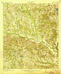
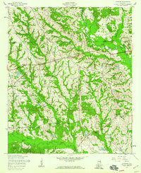
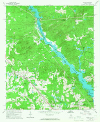
(30)- 1906 Map of Dadeville
 1906 Dadeville1906 Print · USGSCovers Lee County, including Auburn, Alexander City, and other nearby areas3 unique versions available
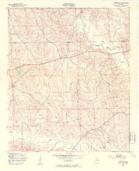
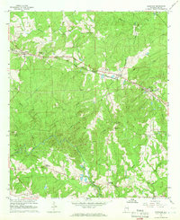
 - 1907 Map of Opelika, 1963 Print
 1907 Opelika1963 Print · USGSCovers Lee County, including Columbus, Auburn, and other nearby areas
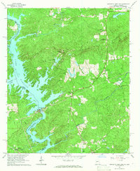
 - 1909 Map of Opelika
 1909 Opelika1909 Print · USGSCovers Lee County, including Columbus, Auburn, and other nearby areas4 unique versions available
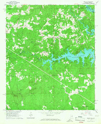
 - 1914 Map of Seale
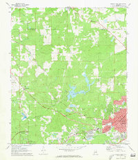
 1914 Seale1914 Print · USGSCovers Lee County, including Phenix City, Smiths Station, and other nearby areas6 unique versions available
 - 1950 Map of Crawford, 1953 Print
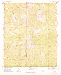
 1950 Crawford1953 Print · USGSCovers Lee County, including Hugley, Crawford, and other nearby areas2 unique versions available
 - 1950 Map of Phenix City, 1954 Print
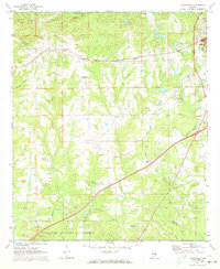
 1950 Phenix City1954 Print · USGSCovers Lee County, including Phenix City, Smiths Station, and other nearby areas2 unique versions available
 - 1950 Map of Seale, 1955 Print
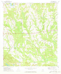
 1950 Seale1955 Print · USGSCovers Lee County, including Phenix City, Smiths Station, and other nearby areas
 - 1955 Map of Phenix City, 1959 Print
 1955 Phenix City1959 Print · USGSCovers Lee County, including Phenix City, Smiths Station, and other nearby areas5 unique versions available
 - 1955 Map of Crawford, 1959 Print
 1955 Crawford1959 Print · USGSCovers Lee County, including Hugley, Crawford, and other nearby areas3 unique versions available
 - 1955 Map of Seale, 1961 Print
 1955 Seale1961 Print · USGSCovers Lee County, including Phenix City, Smiths Station, and other nearby areas
 - 1955 Map of Phenix City, 1964 Print
 1955 Phenix City1964 Print · USGSCovers Lee County, including Columbus, Auburn, and other nearby areas3 unique versions available
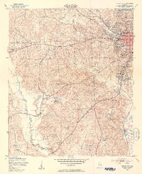
 - 1957 Map of Phenix City
 1957 Phenix City1957 Print · USGSCovers Lee County, including Columbus, Auburn, and other nearby areas
 - 1958 Map of Phenix City
 1958 Phenix City1958 Print · USGSCovers Lee County, including Columbus, Auburn, and other nearby areas
 - 1965 Map of Bleecker, 1966 Print
 1965 Bleecker1966 Print · USGSCovers Lee County, including Smiths Station, Salem, and other nearby areas3 unique versions available
 - 1965 Map of Bartletts Ferry Dam, 1966 Print
 1965 Bartletts Ferry Dam1966 Print · USGSCovers Lee County, including Clines Crossroads, Piney Grove, and other nearby areas2 unique versions available
 - 1965 Map of Beulah, 1967 Print
 1965 Beulah1967 Print · USGSCovers Lee County, including Valley, Halawaka, and other nearby areas2 unique versions available
 - 1965 Map of Smiths, 1967 Print
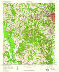
 1965 Smiths1967 Print · USGSCovers Lee County, including Columbus, Phenix City, and other nearby areas3 unique versions available
 - 1970 Map of Opelika East, 1973 Print
 1970 Opelika East1973 Print · USGSCovers Lee County, including Opelika, West Ridge, and other nearby areas4 unique versions available
 - 1971 Map of Waverly
 1971 Waverly1971 Print · USGSCovers Lee County, including Auburn, Waverly, and other nearby areas2 unique versions available
 - 1971 Map of Parkers Crossroads, 1973 Print
 1971 Parkers Crossroads1973 Print · USGSCovers Lee County, including Opelika, Hopewell, and other nearby areas2 unique versions available
 - 1971 Map of Opelika West, 1973 Print
 1971 Opelika West1973 Print · USGSCovers Lee County, including Auburn, Opelika, and other nearby areas3 unique versions available
 - 1971 Map of Loachapoka, 1973 Print
 1971 Loachapoka1973 Print · USGSCovers Lee County, including Auburn, Loachapoka, and other nearby areas3 unique versions available
 - 1971 Map of Marvyn, 1973 Print
 1971 Marvyn1973 Print · USGSCovers Lee County, including Watoola, Uhland, and other nearby areas2 unique versions available
 - 1971 Map of Thornton, 1973 Print
 1971 Thornton1973 Print · USGSCovers Lee County, including Thornton, Simmons Crossroads, and other nearby areas
 - 1971 Map of Society Hill, 1973 Print
 1971 Society Hill1973 Print · USGSCovers Lee County, including Society Hill, Russell County, and other nearby areas2 unique versions available
Showing maps 1-25 of 30
Top cities of Lee County
- Auburn historical maps
- Opelika historical maps
- Smiths Station historical maps
- Loachapoka historical maps
Frequently asked questions
- What are the different types of historical maps available for Lee County?
- What is the oldest map of Lee County?
- Where can I purchase historical maps of Lee County for my home or office?
- Where can I download high-res historical maps of Lee County?
- Are there historical topographic maps available for Lee County?
- Is there historical aerial imagery available for Lee County?
- Where are historical maps of Lee County sourced from?