Old Maps of Ridgway Mill, Alabama for Academic Research
Study the evolution of Ridgway Mill with 14 high-resolution historic maps. Whether you're teaching, researching, or modeling changes in land use, these maps provide essential visual documentation of urban, environmental, and geographic change.
- Analyze long-term change: Track patterns in development, transportation, and natural features.
- Ideal for environmental or urban studies: Support academic projects with primary historical map data.
- Use in the classroom or lab: Educators and researchers rely on these maps to bring historical context to life.
These maps are a powerful tool for teaching, research, and visualizing how Ridgway Mill has changed over the decades.
Ridgway Mill, AL maps
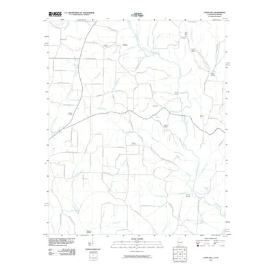
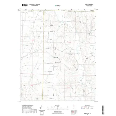
(14)- 1936 Map of Union Hill
 1936 Union Hill1936 Print · USGSThe Alabama and Tennessee borderlands are captured here in the mid-1930s as modern infrastructure arrived in a landscape of small family farms. Researchers can locate long-standing landmarks like Ridgeways Mill, Hester Cem, and the rural community of Good Springs.
 - 1948 Map of Union Hill, 1973 Print
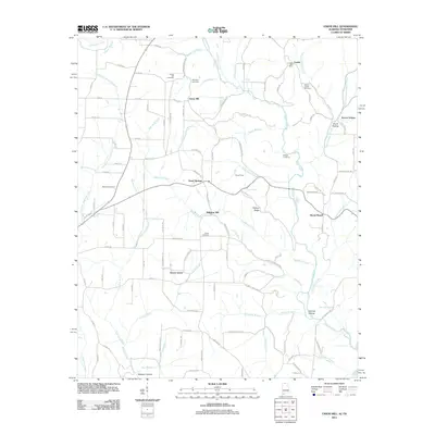
 1948 Union Hill1973 Print · USGSThe Alabama-Tennessee borderlands appear here in the mid-twentieth century as a landscape of small farming hamlets and creek-side industry. Researchers can locate family landmarks like Ridgway Mill, Hester Chapel, and the McCraw Cem along the banks of Sugar Creek.
 - 1951 Map of Union Hill
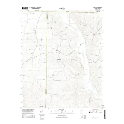
 1951 Union Hill1951 Print · USGSThe Alabama-Tennessee state line runs through this mid-century rural landscape, marked by family farms and the rising influence of the Tennessee Valley Authority. Researchers can trace the legacy of early settlements like Lester and Union Hill or locate old community hubs like Ridgway Mill and Rockaway Sch.2 unique versions available
 - 1956 Map of Gadsden, 1966 Print
 1956 Gadsden1966 Print · USGSNorth Alabama in the mid-1950s shows a region transformed by river engineering and federal industry. Genealogists and local historians can trace the development of the Tennessee Valley through the growth of Huntsville, the sprawling Redstone Arsenal, and the expansive Guntersville Lake.3 unique versions available
 - 1958 Map of Gadsden
 1958 Gadsden1958 Print · USGSNorth Alabama comes alive in the late 1950s as the Tennessee Valley Authority’s massive river projects and the rise of the space industry reshaped the landscape. Researchers can trace the mid-century footprints of Huntsville, Redstone Arsenal, and the riverside rail networks of the Southern railroad.
 - 1960 Map of Gadsden
 1960 Gadsden1960 Print · USGSNorthern Alabama in the mid-1950s is defined by the mighty Tennessee River and its massive reservoirs. Trace the development of Huntsville and Redstone Arsenal or explore the vast William B Bankhead National Forest.2 unique versions available
 - 1963 Map of Gadsden
 1963 Gadsden1963 Print · USGSNorthern Alabama underwent a dramatic mid-century transformation as the Tennessee Valley became a hub for defense and industry. Researchers can trace the development of the Redstone Arsenal, the route of the Natchez Trace Parkway, and long-standing rail lines like the Southern Railway.
 - 1986 Map of Tuscumbia
 1986 Tuscumbia1986 Print · USGSThe Tennessee River valley in the mid-1980s shows a landscape transformed by massive reservoirs and industrial hubs. Genealogists and local historians can trace the development of the Shoals area and locate rural communities like Tharp Town, Leighton, and Rogersville.3 unique versions available
 - 2010 Map of Union Hill, 2010 Print
 2010 Union Hill2010 Print · USGSCovers Ridgway Mill, including Minor Hill, Lester, and other nearby areas
 - 2011 Map of Union Hill, 2011 Print
 2011 Union Hill2011 Print · USGSCovers Ridgway Mill, including Minor Hill, Lester, and other nearby areas
 - 2014 Map of Union Hill, 2014 Print
 2014 Union Hill2014 Print · USGSCovers Ridgway Mill, including Minor Hill, Lester, and other nearby areas
 - 2018 Map of Union Hill, 2018 Print
 2018 Union Hill2018 Print · USGSCovers Ridgway Mill, including Minor Hill, Lester, and other nearby areas
 - 2020 Map of Union Hill, 2020 Print
 2020 Union Hill2020 Print · USGSCovers Ridgway Mill, including Minor Hill, Lester, and other nearby areas
 - 2024 Map of Union Hill, 2024 Print
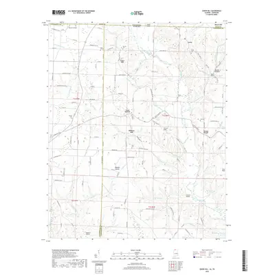
 2024 Union Hill2024 Print · USGSLimestone County, Alabama, and the Tennessee borderlands are captured in this modern survey of rural settlements and family burial grounds. Local historians can trace the early road network and locate sites like Ridgway Mill, Union Hill Cem, and the settlement of Scarce Grease.
End of results
Showing maps 1-14 of 14
Top cities near Ridgway Mill
- Athens historical maps
- Pulaski historical maps
- Loretto historical maps
- Rogersville historical maps
- Lexington historical maps
- Minor Hill historical maps
See more
Frequently asked questions
- What are the different types of historical maps available for Ridgway Mill?
- What is the oldest map of Ridgway Mill?
- Where can I purchase historical maps of Ridgway Mill for my home or office?
- Where can I download high-res historical maps of Ridgway Mill?
- Are there historical topographic maps available for Ridgway Mill?
- Is there historical aerial imagery available for Ridgway Mill?
- Where are historical maps of Ridgway Mill sourced from?