Old Maps of Madison, Alabama
Explore 41 old maps of Madison, spanning from 1888 to today. These high-resolution historic maps reveal how streets, neighborhoods, landmarks, and natural features evolved over time — perfect for genealogy, metal detecting, research, and local history exploration.
What you can do with these maps:
- See how Madison changed over time: Compare historical maps to modern-day views to trace roads, homesites, rail lines & more.
- View detailed metadata: Each map includes creators, publishers, year, scale, and archive source.
- Overlay maps with satellite & LiDAR: Visualize the past alongside modern tools to explore terrain & human change.
- Trusted historical sources: Maps sourced from the USGS, Library of Congress, and other archives.
- Access maps your way: View online, download high-res files, or order prints for personal or research use.
Start exploring old maps of Madison to uncover forgotten places, hidden landmarks, and the deep history beneath your feet.
Madison, AL maps
(41)- 1888 Map of Huntsville
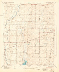
 1888 Huntsville1888 Print · USGSMadison and Limestone counties in the late 1880s showcase a landscape defined by the Tennessee River and major early rail lines. Researchers can trace the layout of Huntsville or locate long-standing communities like Mooresville and Thompsons Mill.
 - 1892 Map of Huntsville
 1892 Huntsville1892 Print · USGSNorth Alabama was a landscape of river ferries and rising rail hubs in the 1890s, caught here just as the region's industry began to modernize. Researchers can locate vanished landmarks like the Monte Sano Hotel and trace old family-named sites from Thompsons Mill to Lemans Ferry.6 unique versions available
 - 1936 Map of Jeff
 1936 Jeff1936 Print · USGSMadison County rural life is captured in the mid-1930s, showing a landscape defined by ancestral lines and small-town centers. Trace family roots through Indian Creek Cem, St John Cem, and old schools like Little Indian Creek Sch.
 - 1936 Map of Capshaw
 1936 Capshaw1936 Print · USGSLimestone and Madison counties are captured here in the mid-1930s as the Tennessee Valley Authority and Alabama Power began modernizing the rural landscape. Researchers can locate numerous vanished country schools like Grimett Sch, family landmarks such as McCully Mill, and the community at Wesley Chapel.
 - 1936 Map of Madison
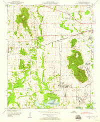
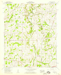
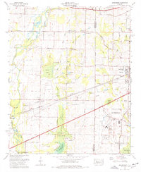
 1936 Madison1936 Print · USGSMadison and its surrounding farmstead landscape are captured in the mid-1930s just as the Tennessee Valley Authority began transforming the river valley. Researchers can locate numerous vanished landmarks like Lankford Mill, trace the CHICKASAW BOUNDARY, and find family sites near Brandontown or Fuller Chapel.
 - 1936 Map of Greenbrier
 1936 Greenbrier1936 Print · USGSAlabama's Tennessee Valley was undergoing a massive transformation in the mid-1930s as the river was harnessed for power. Genealogists can locate family-named settlements like Peete Corners, small rural schools like Betz Sch, and old spiritual centers like Fletcher Chapel.
 - 1938 Map of Greenbrier
 1938 Greenbrier1938 Print · USGSLimestone and Madison Counties are shown in the late 1930s as a landscape of rural schoolhouses and family cemeteries. Genealogists can trace local heritage through sites like Ragland Cem, Mt Pleasant Sch, and the crossroads at Burgreen Corner.3 unique versions available
 - 1948 Map of Madison, 1960 Print
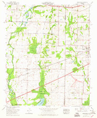
 1948 Madison1960 Print · USGSPost-war Madison County shows a landscape transitioning from rural rail towns to a major federal military hub. Trace family history and land changes through the Royal Cem, the Huntsville Arsenal Airfield, and the Southern Railway corridor.2 unique versions available
 - 1950 Map of Madison
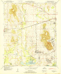 1950 Madison1950 Print · USGSMadison and the surrounding Alabama countryside are captured here just as the post-war military presence was reshaping the region. Local researchers can trace family lands near Rainbow Mountain or locate ancestral sites like Lincoln Sch and Jamar Cem.2 unique versions available
 - 1956 Map of Gadsden, 1966 Print
 1956 Gadsden1966 Print · USGSNorth Alabama in the mid-1950s shows a region transformed by river engineering and federal industry. Genealogists and local historians can trace the development of the Tennessee Valley through the growth of Huntsville, the sprawling Redstone Arsenal, and the expansive Guntersville Lake.3 unique versions available
 - 1958 Map of Gadsden
 1958 Gadsden1958 Print · USGSNorth Alabama comes alive in the late 1950s as the Tennessee Valley Authority’s massive river projects and the rise of the space industry reshaped the landscape. Researchers can trace the mid-century footprints of Huntsville, Redstone Arsenal, and the riverside rail networks of the Southern railroad.
 - 1958 Map of Jeff, 1959 Print
 1958 Jeff1959 Print · USGSMadison County at the end of the 1950s shows a transition from rural farming tracts to early institutional growth north of Huntsville. Genealogists can locate family names at Hammond Cem or Fowlkes Cem and trace the paths of Pulaski Pike and Nick Davis Road.2 unique versions available
 - 1958 Map of Capshaw, 1959 Print
 1958 Capshaw1959 Print · USGSThe rural border of Limestone and Madison counties is captured here in the late fifties as family farms and small crossroad communities thrived. Researchers can trace the Old Railroad Bed and locate historic sites like Pilgrim Home Church and Nick Davis Cem.3 unique versions available
 - 1960 Map of Gadsden
 1960 Gadsden1960 Print · USGSNorthern Alabama in the mid-1950s is defined by the mighty Tennessee River and its massive reservoirs. Trace the development of Huntsville and Redstone Arsenal or explore the vast William B Bankhead National Forest.2 unique versions available
 - 1963 Map of Gadsden
 1963 Gadsden1963 Print · USGSNorthern Alabama underwent a dramatic mid-century transformation as the Tennessee Valley became a hub for defense and industry. Researchers can trace the development of the Redstone Arsenal, the route of the Natchez Trace Parkway, and long-standing rail lines like the Southern Railway.
 - 1963 Map of Greenbrier, 1965 Print
 1963 Greenbrier1965 Print · USGSThe Alabama cotton country of Limestone and Madison Counties is captured here in the early sixties, as the region began its transition toward modern industry. Researchers can find family-named sites like Anderson Cemetery, local industry at the Burgreen Gin, and the early footprint of the Huntsville Madison County Airport.
 - 1964 Map of Madison, 1966 Print
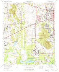
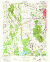 1964 Madison1966 Print · USGSMadison and West Huntsville are caught in a period of significant growth during the mid-sixties space race. Genealogists and historians can trace the intersection of new suburbs like Skyline Acres with older landmarks such as Fletcher Chapel and the Southern Railway.
 - 1967 Map of Jeff, 1972 Print
 1967 Jeff1972 Print · USGSThe Madison and Huntsville area comes into focus during the late sixties as residential neighborhoods began to edge into the surrounding farmland. Genealogists can trace family landmarks like Pattus Cem, Conley Chapel, and Sparkman High Sch.3 unique versions available
 - 1975 Map of Greenbrier, 1977 Print
 1975 Greenbrier1977 Print · USGSLimestone and Madison Counties are captured here in the mid-seventies as the area transitioned from a rail-and-gin economy toward modern aviation and urban growth. Genealogists can locate family landmarks like Ragland Cem, Burgreen Gin, and the historic West Madison Sch.3 unique versions available
 - 1975 Map of Madison, 1977 Print
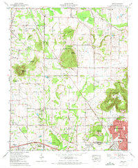
 1975 Madison1977 Print · USGSMadison and Huntsville were undergoing significant expansion during the mid-seventies as aerospace technology reshaped the local economy. Genealogists and historians can trace the foundations of the University of Alabama in Huntsville or locate local burial grounds like Farley Cem and Moore Cem near the Redstone Arsenal.4 unique versions available
 - 1984 Map of Huntsville, 1986 Print
 1984 Huntsville1986 Print · USGSNorthern Alabama and the Tennessee borderlands are captured in the mid-eighties as Huntsville and the Redstone Arsenal expand. Researchers can trace rural landmarks from Woodlin Mill to the Cumberland Plateau and old rail lines like the Southern.3 unique versions available
 - 2011 Map of Capshaw, 2011 Print
 2011 Capshaw2011 Print · USGSCovers Madison, including Huntsville, Athens, and other nearby areas
 - 2011 Map of Greenbrier, 2011 Print
 2011 Greenbrier2011 Print · USGSCovers Madison, including Huntsville, Oakland, and other nearby areas
 - 2011 Map of Madison, 2011 Print
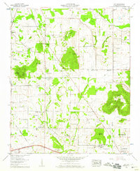
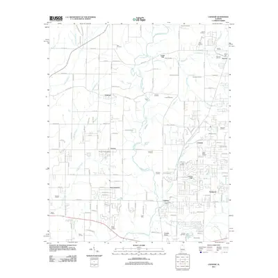
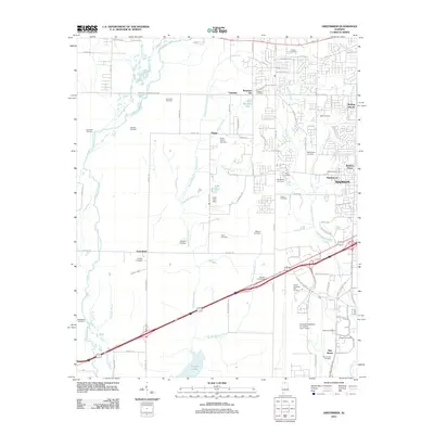
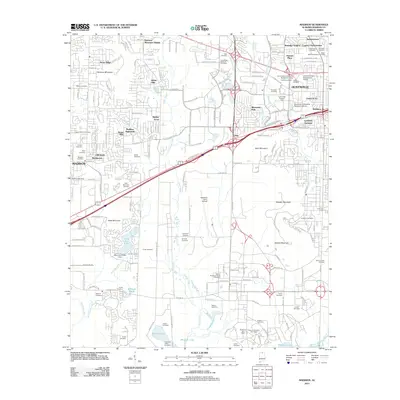 2011 Madison2011 Print · USGSCovers Madison, including Huntsville, Nolan Hills, and other nearby areas
 - 2011 Map of Jeff, 2011 Print
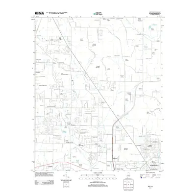 2011 Jeff2011 Print · USGSCovers Madison, including Huntsville, Rainbow, and other nearby areas
Showing maps 1-25 of 41
Top cities near Madison
- Huntsville historical maps
- Decatur historical maps
- Athens historical maps
- Hartselle historical maps
- Meridianville historical maps
- Harvest historical maps
See more
Top neighborhoods of Madison
- Rainbow historical maps
- Oakland historical maps
- Rainbow Gap Estates historical maps
- Maplewood historical maps
- Brentwood historical maps
- Clift Acres historical maps
See more
Frequently asked questions
- What are the different types of historical maps available for Madison?
- What is the oldest map of Madison?
- Where can I purchase historical maps of Madison for my home or office?
- Where can I download high-res historical maps of Madison?
- Are there historical topographic maps available for Madison?
- Is there historical aerial imagery available for Madison?
- Where are historical maps of Madison sourced from?