Old Maps of Marshall County, Alabama for Hiking & Exploration
Hike through history with 196 historic maps of Marshall County. Explore old trails, ghost towns, and forgotten backroads — perfect for outdoor adventurers and local explorers.
- Rediscover forgotten places: Map out old mining camps, roads, and footpaths that no longer exist on modern maps.
- Layer with modern tools: Combine with LiDAR or satellite views to plan hikes through historical terrain.
- Made for exploration: Popular among hikers, overlanders, and local history lovers.
Use these maps to find adventure and explore the hidden past of Marshall County.
Marshall County, AL maps
(196)- 1885 Map of Gadsden
 1885 Gadsden1885 Print · USGSNortheast Alabama in the mid-1880s was a landscape of river-side landings and emerging rail towns. Genealogists and historians can trace the early foundations of Guntersville and Gadsden while locating rural landmarks like Hillian Store, Cottonville, and Law Landing.
 - 1888 Map of Cullman
 1888 Cullman1888 Print · USGSCullman and Morgan counties are shown in the late 1880s as the railroad fueled growth across the Sand Mountain region. Genealogists can trace early homesteads and commerce at Sobotka's Mill, Fort Bluff, and the riverside town of Blountsville.
 - 1888 Map of Gadsden
 1888 Gadsden1888 Print · USGSNorth Alabama's river valleys and plateau lands are captured here in the late nineteenth century as the region transitioned from river landings to rail transport. Researchers can locate early post offices and commerce centers like Hillian's Store, Guntersville, and the ferry at Ft Deposit.
 - 1888 Map of Scottsboro
 1888 Scottsboro1888 Print · USGSNortheast Alabama is shown in the late nineteenth century as a land of steep plateaus and vital river crossings. Genealogists and researchers can trace the early rail-and-river economy through family landmarks like Caldwell's Ferry and the Bell Factory textile site.
 - 1888 Map of Huntsville
 1888 Huntsville1888 Print · USGSMadison and Limestone counties in the late 1880s showcase a landscape defined by the Tennessee River and major early rail lines. Researchers can trace the layout of Huntsville or locate long-standing communities like Mooresville and Thompsons Mill.
 - 1892 Map of Cullman
 1892 Cullman1892 Print · USGSNorth-central Alabama's development is centered on the railroad corridor and rugged plateau country in the late nineteenth century. Genealogists can trace family footprints at Sobotka's Mill, along the historic Stout's Road, or near the remote Newsome Sinks.4 unique versions available
 - 1892 Map of Huntsville
 1892 Huntsville1892 Print · USGSNorth Alabama was a landscape of river ferries and rising rail hubs in the 1890s, caught here just as the region's industry began to modernize. Researchers can locate vanished landmarks like the Monte Sano Hotel and trace old family-named sites from Thompsons Mill to Lemans Ferry.6 unique versions available
 - 1892 Map of Scottsboro
 1892 Scottsboro1892 Print · USGSJackson County and the Tennessee River valley are captured here in the late nineteenth century, just as railroads began to reshape local commerce. Genealogists can trace family-named sites like Owen's Cross Roads, Carrick Mill, and Larkin Landing.5 unique versions available
 - 1892 Map of Gadsden
 1892 Gadsden1892 Print · USGSNorth Alabama's river-and-rail economy is captured here in the late nineteenth century as Guntersville and Gadsden emerge as regional hubs. Genealogists and historians can trace the routes of the Birmingham Mineral R. R. or locate old community centers like Cottonville and Mt Zion.
 - 1895 Map of Gadsden
 1895 Gadsden1895 Print · USGSNortheast Alabama at the close of the century was a landscape of river landings and mountain gaps where the Tennessee River met growing rail hubs. Genealogists can trace family holdings near Hillian Store, Cottonville, and the remote heights of Lookout Mountain.
 - 1903 Map of Gadsden
 1903 Gadsden1903 Print · USGSNorthern Alabama in the late nineteenth century centers on the busy Tennessee River corridor and its surrounding ridges. Trace old family sites and transport hubs like Hillian Store, Lovelace Landing, and the Mt Zion church.4 unique versions available
 - 1936 Map of Painter
 1936 Painter1936 Print · USGSDeKalb and Marshall counties are shown here during the mid-1930s, documenting a landscape of plateau farms and essential creek crossings. Genealogists can trace family roots through landmarks like Blessing Sch, Dalrymple Cem, and rural centers like Whiton and Lathamville.
 - 1936 Map of Guntersville
 1936 Guntersville1936 Print · USGSGuntersville and the Tennessee River valley are shown here in the mid-thirties during the early stages of reservoir flooding. Researchers can trace the river's transformation near Smith Landing Field or locate rural landmarks like Lattiswood Sch and Warrenton Ch.
 - 1936 Map of Mountainboro
 1936 Mountainboro1936 Print · USGSThe Marshall and Etowah County borderlands are captured here in the mid-1930s, defined by the crossing of the Old Cherokee Boundary. You can trace the rural infrastructure of the day, from the Bethsaida Sch to the Nashville Chattanooga and St Louis railroad.
 - 1936 Map of Columbus City
 1936 Columbus City1936 Print · USGSThe Tennessee River valley stands on the brink of transformation in the mid-1930s as the TVA prepares for the Guntersville Reservoir. You can trace the pre-inundation landscape of Columbus City, the Town Creek Ferry, and local landmarks like Haney Chapel.
 - 1936 Map of New Hope
 1936 New Hope1936 Print · USGSThe Flint River valley in the mid-1930s shows a landscape on the brink of change as the Wheeler Reservoir reaches its high-water mark. Researchers can locate family landmarks like Baker Cem, Owens Cross Roads, and local hubs like Buggs Chapel or Cherokee School.
 - 1936 Map of Guntersville Dam
 1936 Guntersville Dam1936 Print · USGSMarshall County is captured during the transformative construction of the TVA system in the mid-1930s. Researchers can locate landmarks like Neighbors Mill, the Construction Camp, and old schools including Mobbs Sch and Lamont Sch.
 - 1936 Map of Hulaco
 1936 Hulaco1936 Print · USGSDuring the mid-1930s, this portion of northern Alabama was a landscape of mountain crossroads and rural congregations. Genealogists and researchers can trace family landmarks like Crawford Cem, Harvells Store, and local schools including Hulaco Sch.
 - 1936 Map of Langston
 1936 Langston1936 Print · USGSJackson and Marshall counties are captured during the 1930s as the Tennessee Valley Authority prepared to flood the valley. Local historians can trace the original landscape around Langston before the reservoir arrived, including Larkins Ferry, Kelley Cem, and St Joseph Sch.
 - 1936 Map of Rodentown
 1936 Rodentown1936 Print · USGSNortheast Alabama hill country is captured here during the mid-thirties, showing the rural communities of Sand Mountain. Researchers can trace family roots through numerous local landmarks like Whitesboro, Smith Chapel, and Duck Springs Sch.
 - 1936 Map of Arab
 1936 Arab1936 Print · USGSThe town of Arab and the surrounding ridges of Marshall and Cullman counties appear here in the mid-1930s. Researchers can trace the early footprint of the Guntersville Reservoir alongside Ellenberg's Mill and Rocky Mtn Ch.
 - 1936 Map of Grant
 1936 Grant1936 Print · USGSAs the mid-1930s brought the Tennessee Valley Authority to Marshall County, this area balanced its mountain heritage with new river developments. Genealogists and researchers can trace family landmarks like Butlers Mill, Fishtrap Ford, and the DAR Sch.
 - 1936 Map of Mt Carmel
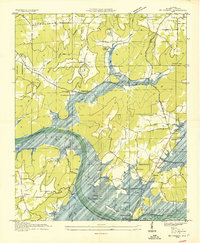 1936 Mt Carmel1936 Print · USGSMarshall County is caught in a moment of transformation in the mid-1930s as the Tennessee River begins its change into a massive reservoir. Genealogists can trace family footprints at Cem Manchester, Simpson Point Ch, and the Claysville School.
 - 1936 Map of Grove Oak
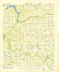 1936 Grove Oak1936 Print · USGSDeKalb and Marshall counties are captured in the mid-1930s as the Tennessee Valley Authority began transforming the river landscape. Genealogists can locate numerous rural landmarks like Prospect Ch, Old Beulah Ch, and High Falls Bridge.
 - 1936 Map of Brooksville
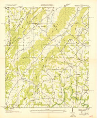 1936 Brooksville1936 Print · USGSBlount and Marshall Counties meet in the mid-1930s among the ridgelines of the Cherokee Basin. Researchers can trace the early road network of Old Tennessee State Highway No 38 to find old community hubs like Nixon Chapel and Oak Hill Sch.
Showing maps 1-25 of 196
Top cities of Marshall County
- Albertville historical maps
- Guntersville historical maps
- Arab historical maps
- Grant historical maps
- Douglas historical maps
- Union Grove historical maps
Frequently asked questions
- What are the different types of historical maps available for Marshall County?
- What is the oldest map of Marshall County?
- Where can I purchase historical maps of Marshall County for my home or office?
- Where can I download high-res historical maps of Marshall County?
- Are there historical topographic maps available for Marshall County?
- Is there historical aerial imagery available for Marshall County?
- Where are historical maps of Marshall County sourced from?