2020s Maps of Mobile, Alabama
Explore 20 historic maps of Mobile from the 2020s. These maps offer a rare glimpse into what life looked like during the 2020s — showing old roads, neighborhoods, homes, and landmarks that have changed or disappeared over time.
Whether you're researching your family's past, planning a metal detecting trip, or studying how Mobile's landscape evolved across the 2020s, these high-resolution maps are a powerful tool for exploring the history of this region.
- Focus on a specific era: All maps on this page are from the 2020s, giving you a focused view of this time period.
- See what’s changed: Compare century-old streets, trails, and buildings to today's modern landscape using overlays and satellite layers.
- Research with precision: Use these maps for genealogy, historical research, land use analysis, or educational projects.
- View, download, or print: Maps are fully viewable online in high resolution, and can be downloaded or printed for your own records.
Start exploring Mobile's history through authentic maps from the 2020s. This is your window into the past.
Mobile, AL maps
(20)- 2020 Map of Daphne, 2020 Print
 2020 Daphne2020 Print · USGSCovers Mobile, including Daphne, Fairhope, and other nearby areas
 - 2020 Map of Bridgehead, 2020 Print
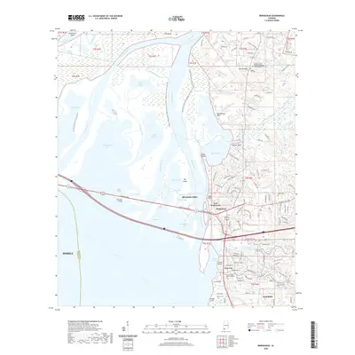 2020 Bridgehead2020 Print · USGSCovers Mobile, including Daphne, Spanish Fort, and other nearby areas
 - 2020 Map of Hurricane, 2020 Print
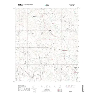
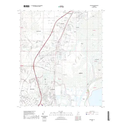
 2020 Hurricane2020 Print · USGSCovers Mobile, including Creola, Hurricane, and other nearby areas
 - 2020 Map of Kushla, 2020 Print
 2020 Kushla2020 Print · USGSCovers Mobile, including Prichard, Saraland, and other nearby areas
 - 2020 Map of Hollingers Island, 2020 Print
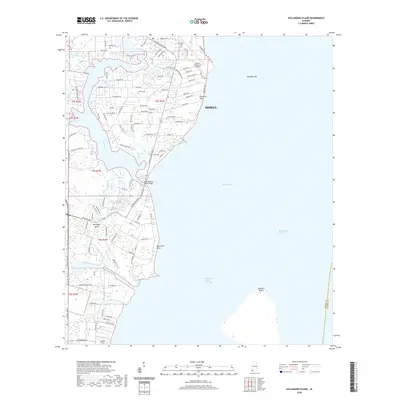 2020 Hollingers Island2020 Print · USGSCovers Mobile, including Clarke Gardens, Michele Estates, and other nearby areas
 - 2020 Map of Theodore, 2020 Print
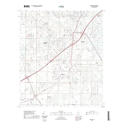 2020 Theodore2020 Print · USGSCovers Mobile, including Tillmans Corner, Theodore, and other nearby areas
 - 2020 Map of Mobile, 2020 Print
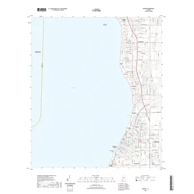
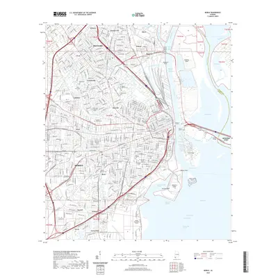 2020 Mobile2020 Print · USGSCovers Mobile, including Prichard, Spanish Fort, and other nearby areas
 - 2020 Map of Spring Hill, 2020 Print
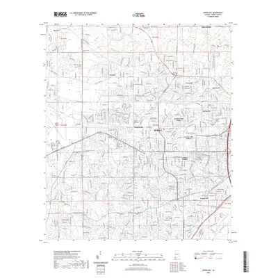 2020 Spring Hill2020 Print · USGSCovers Mobile, including Prichard, Semmes, and other nearby areas
 - 2020 Map of Chickasaw, 2020 Print
 2020 Chickasaw2020 Print · USGSCovers Mobile, including Prichard, Saraland, and other nearby areas
 - 2020 Map of Tanner Williams, 2020 Print
 2020 Tanner Williams2020 Print · USGSCovers Mobile, including Semmes, Ponderosa, and other nearby areas
 - 2024 Map of Mobile, 2024 Print
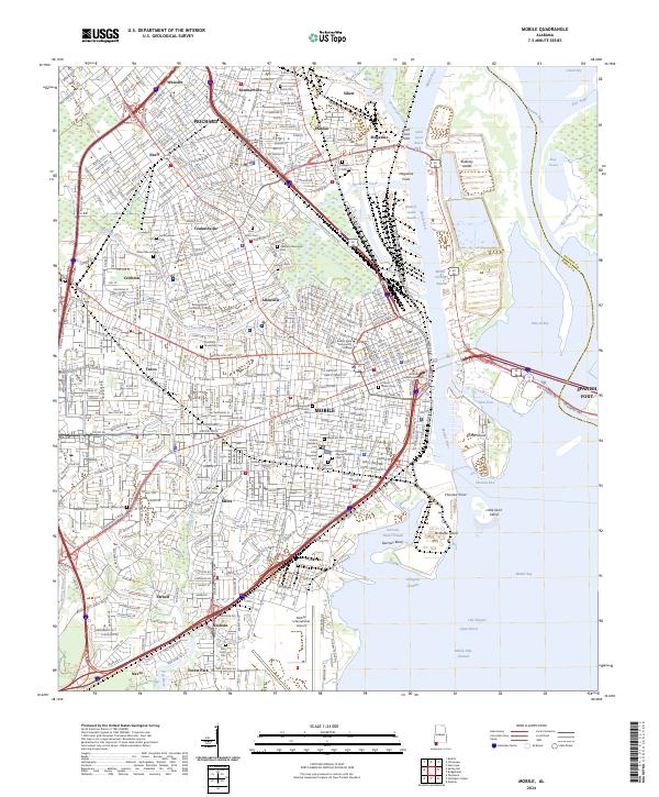 2024 Mobile2024 Print · USGSThe Port of Mobile and its surrounding neighborhoods are captured here in the early twenty-first century, showing the intersection of heavy industry and deep-rooted local history. Genealogists can trace family plots across Magnolia Cem, the Catholic Cem, and Ahavas Chesed Cem.
 - 2024 Map of Tanner Williams, 2024 Print
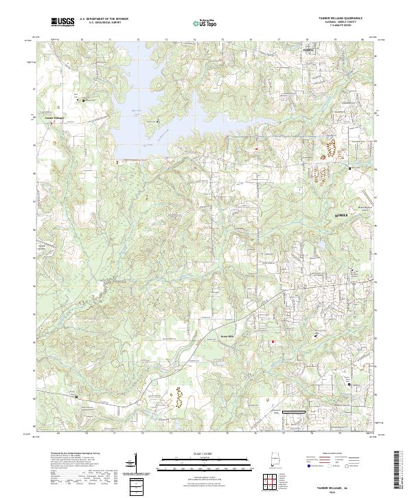 2024 Tanner Williams2024 Print · USGSWestern Mobile County's rural landscape comes alive in this contemporary survey of the communities surrounding Big Creek Lake. Genealogists and local historians can trace family lines through numerous sites like Dees Cem, Tanner Williams, and Seven Hills.
 - 2024 Map of Spring Hill, 2024 Print
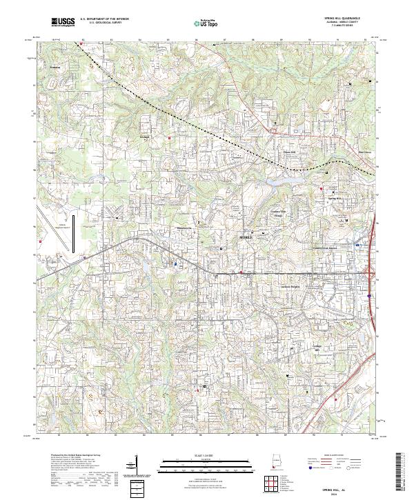 2024 Spring Hill2024 Print · USGSWestern Mobile and the surrounding suburbs are shown in high detail during this recent era of coastal growth. Researchers can trace local history through numerous burial sites like Old Lewis Cem and Rising Sons Cem, or explore the historic campus of Spring Hill College.
 - 2024 Map of Hurricane, 2024 Print
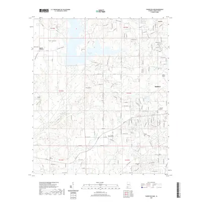
 2024 Hurricane2024 Print · USGSThe Mobile and Tensaw River delta in the 2020s is a complex maze of bayous, islands, and river channels along the Mobile-Baldwin county line. Genealogists and researchers can locate family landmarks like Miller Cem, Byrne Cem, and the Cook Memorial Presbyterian Chapel Cem on the higher ground.
 - 2024 Map of Daphne, 2024 Print
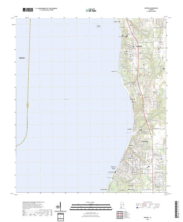 2024 Daphne2024 Print · USGSThe Eastern Shore of Mobile Bay is captured in this recent survey, showing the interconnected communities of Daphne and Fairhope. Genealogists can locate family landmarks like the Friendship Cem, Montrose Cem, and the storied Jackson Oak.
 - 2024 Map of Theodore, 2024 Print
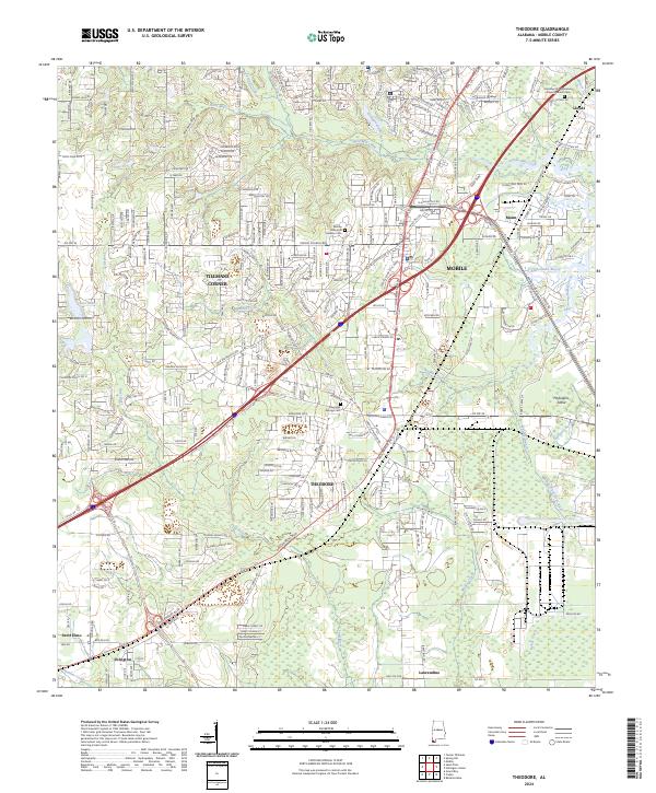 2024 Theodore2024 Print · USGSMobile County’s coastal interior is captured here as suburban growth reaches into the bayou country southwest of the city. Genealogists and local historians can trace family sites at Magnolia Springs Cem and explore the historic settlements of Theodore and Saint Elmo.
 - 2024 Map of Chickasaw, 2024 Print
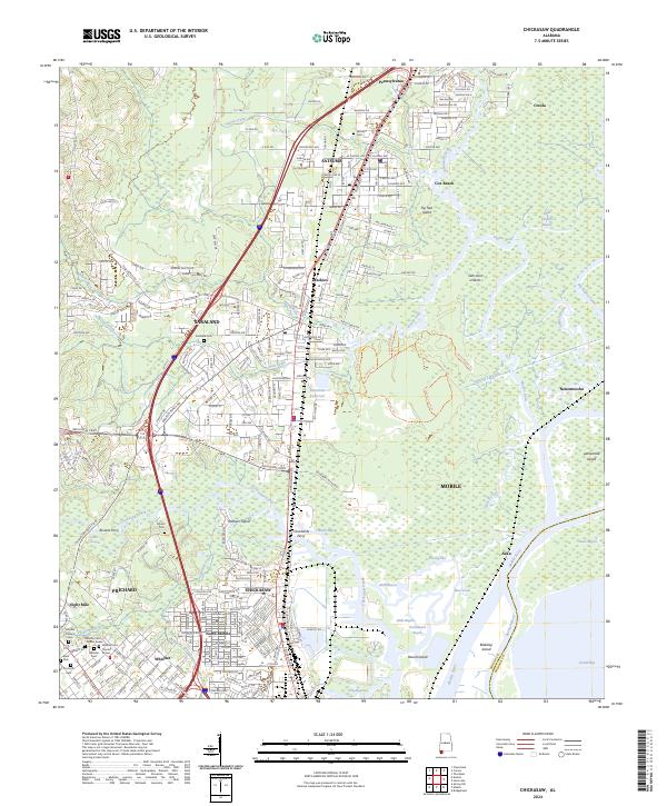 2024 Chickasaw2024 Print · USGSMobile’s northern suburbs and the Mobile River delta are captured in this contemporary survey. Historians and genealogists can trace the layout of early ferries like Alvares Ferry and locate several community burial sites, including Whistler Cem and Myers Cem.
 - 2024 Map of Kushla, 2024 Print
 2024 Kushla2024 Print · USGSMobile County's rural-to-suburban transition is captured here in the mid-2020s, showing the evolving landscapes of Semmes and Eight Mile. Genealogists can trace family sites at Crawford Methodist Cem or Gethsemane North Cem and locate landmarks like the University of Mobile.
 - 2024 Map of Hollingers Island, 2024 Print
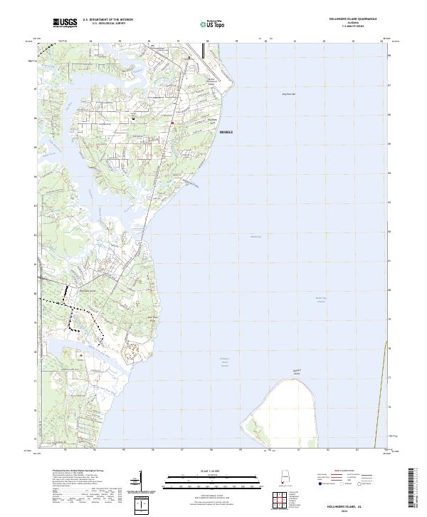 2024 Hollingers Island2024 Print · USGSThe western shores of Mobile Bay are shown in detail as they appeared recently, featuring the developed corridors south of the city. Researchers can trace family sites at Lartigue Cem, navigate the complex inlets of Alligator Bayou, or study the industrial footprint of the Mobile International Airport.
 - 2024 Map of Bridgehead, 2024 Print
 2024 Bridgehead2024 Print · USGSThe Mobile River delta and eastern shore communities are captured here in the contemporary era. Researchers can trace land use from the State Veterans Memorial Cem to landmarks like Fort McDermott and Saluda Hill Cem.
End of results
Showing maps 1-20 of 20
Top cities near Mobile
- Daphne historical maps
- Fairhope historical maps
- Prichard historical maps
- Tillmans Corner historical maps
- Saraland historical maps
- Spanish Fort historical maps
See more
Top neighborhoods of Mobile
- Pine Grove historical maps
- Eau Claire Estates historical maps
- Meadow Lane Estates historical maps
- Regency historical maps
- Pine Run historical maps
- Neshota historical maps
See more
Frequently asked questions
- What are the different types of historical maps available for Mobile?
- What is the oldest map of Mobile?
- Where can I purchase historical maps of Mobile for my home or office?
- Where can I download high-res historical maps of Mobile?
- Are there historical topographic maps available for Mobile?
- Is there historical aerial imagery available for Mobile?
- Where are historical maps of Mobile sourced from?