Old Maps of Nelson, Alabama for Genealogy
Trace your family roots with 16 historic maps of Nelson. These high-res maps reveal old neighborhoods, homesites, landmarks, and streets — helping you uncover where your ancestors lived and how the area evolved over time.
- Explore historic neighborhoods: Identify where your relatives may have lived in the 1800s or 1900s.
- Compare maps over time: Trace the changes in streets, buildings, and landmarks for multi-generational research.
- Perfect for genealogy & ancestry research: Used by family historians and researchers to map out lineage and migration.
These maps are an incredible resource for exploring your personal connection to Nelson's past.
Nelson, AL maps
(16)- 1921 Map of Delchamps
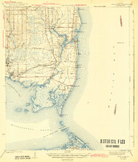
 1921 Delchamps1921 Print · USGSCoastal Mobile County comes alive in this early twentieth-century survey of the bays and sounds before modern development. Genealogists and historians can trace family-named settlements like Delchamps and Prosser, or locate maritime landmarks such as the Oyster Factory and the Mobile & Ohio RR.
 - 1941 Map of Cedar Point
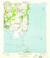 1941 Cedar Point1941 Print · USGSCoastal Mobile County is shown here just before the mid-century, from the fishing docks of Bayou La Batre to the shores of Dauphin Island. Researchers can trace the path of the G M and O railroad or locate old landings at Mon Louis and Alabama Port.2 unique versions available
 - 1943 Map of Cedar Point
 1943 Cedar Point1943 Print · USGSThe Alabama Gulf Coast was a hub of maritime trade and seafood harvesting in the early 1940s. Trace the path of the G M and O (Abandoned) railroad near Bayou La Batre or locate coastal settlements like Alabama Port and Mon Louis.4 unique versions available
 - 1953 Map of Mobile, 1968 Print
 1953 Mobile1968 Print · USGSThe Gulf Coast comes alive in this mid-century survey, from the streets of Mobile to the marshes of New Orleans. Trace family roots in coastal towns like Pass Christian and Bayou La Batre or locate military landmarks including Keesler AFB.3 unique versions available
 - 1956 Map of Coden, 1957 Print
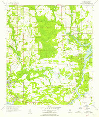 1956 Coden1957 Print · USGSThe Alabama coast in the mid-1950s is captured here, from the bustling waterfront of Bayou La Batre to the famous Bellingrath Gardens. Researchers can trace old family sites and transport routes through Coden, St Pauls Ch, and an Old Railroad Grade.3 unique versions available
 - 1957 Map of Mobile
 1957 Mobile1957 Print · USGSThe Gulf Coast in the mid-1950s reveals a bustling corridor of rail-and-river commerce connecting Alabama to Louisiana. Genealogists and historians can trace old settlements and military hubs from Keesler Afb to the coastal reaches of Ship Island and Bogalusa.3 unique versions available
 - 1960 Map of Mobile
 1960 Mobile1960 Print · USGSThe Gulf Coast at the dawn of the sixties shows a landscape of busy ports, military airbases, and barrier islands. Trace the rail lines of the Louisville & Nashville through BILOXI and Pascagoula or find family history in towns like Bayou La Batre and Poplarville.
 - 1963 Map of Mobile
 1963 Mobile1963 Print · USGSThe Gulf Coast at the dawn of the sixties shows a thriving maritime and military corridor from Louisiana to Alabama. Genealogists and historians can trace rail lines like the Louisville & Nashville RR and find landmarks from Brookley AFB to Fort Morgan.
 - 1965 Map of Mobile
 1965 Mobile1965 Print · USGSThe Gulf Coast at mid-century reveals a landscape of expanding ports and vital military installations from Louisiana to Alabama. Genealogists and historians can trace the growth of Biloxi, Pascagoula, and Mobile, alongside the sprawling De Soto National Forest.
 - 1982 Map of Biloxi
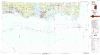 1982 Biloxi1982 Print · USGSThe Mississippi and Alabama coastlines are captured in the early eighties as industrial hubs and wildlife refuges shaped the shoreline. Trace maritime and military history through Fort Morgan, Keesler Air Force Base, and the barrier islands of Gulf Islands National Seashore.2 unique versions available
 - 1984 Map of Mobile
 1984 Mobile1984 Print · USGSThe Gulf Coast at the height of the mid-eighties shows a landscape of rapid industrial growth and military significance. Researchers can trace the sprawling rail lines of the Illinois Central Gulf RR, locate the NASA Test Facility, or study the barrier island chain from Cat Island to Petit Bois Island.3 unique versions available
 - 2011 Map of Coden, 2011 Print
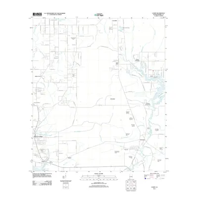 2011 Coden2011 Print · USGSCovers Nelson, including Bayou La Batre, South Orchard, and other nearby areas
 - 2014 Map of Coden, 2014 Print
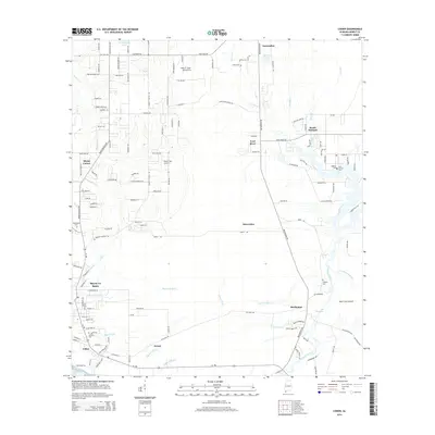 2014 Coden2014 Print · USGSCovers Nelson, including Bayou La Batre, South Orchard, and other nearby areas
 - 2018 Map of Coden, 2018 Print
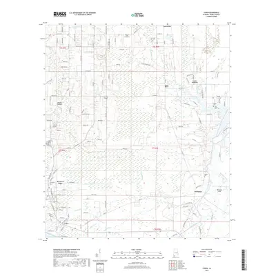 2018 Coden2018 Print · USGSCovers Nelson, including Bayou La Batre, South Orchard, and other nearby areas
 - 2020 Map of Coden, 2020 Print
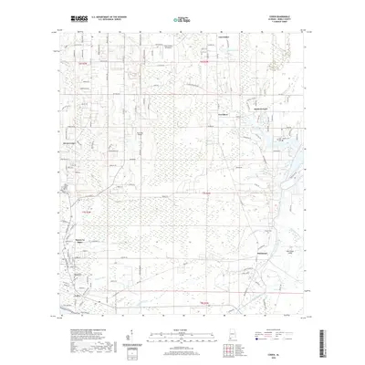 2020 Coden2020 Print · USGSCovers Nelson, including Bayou La Batre, South Orchard, and other nearby areas
 - 2024 Map of Coden, 2024 Print
 2024 Coden2024 Print · USGSMobile County’s coastline comes into focus in this contemporary survey of the Bayou La Batre area. Genealogists and historians can trace family plots at Odd Fellows Cem and English Cem, or follow the winding reach of the Fowl River to The Narrows.
End of results
Showing maps 1-16 of 16
Top cities near Nelson
- Mobile historical maps
- Tillmans Corner historical maps
- Theodore historical maps
- Grand Bay historical maps
- Bayou La Batre historical maps
- Dauphin Island historical maps
See more
Frequently asked questions
- What are the different types of historical maps available for Nelson?
- What is the oldest map of Nelson?
- Where can I purchase historical maps of Nelson for my home or office?
- Where can I download high-res historical maps of Nelson?
- Are there historical topographic maps available for Nelson?
- Is there historical aerial imagery available for Nelson?
- Where are historical maps of Nelson sourced from?