Old Maps of Megargel, Alabama for Genealogy
Trace your family roots with 9 historic maps of Megargel. These high-res maps reveal old neighborhoods, homesites, landmarks, and streets — helping you uncover where your ancestors lived and how the area evolved over time.
- Explore historic neighborhoods: Identify where your relatives may have lived in the 1800s or 1900s.
- Compare maps over time: Trace the changes in streets, buildings, and landmarks for multi-generational research.
- Perfect for genealogy & ancestry research: Used by family historians and researchers to map out lineage and migration.
These maps are an incredible resource for exploring your personal connection to Megargel's past.
Megargel, AL maps
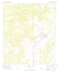
(9)- 1953 Map of Andalusia, 1965 Print
 1953 Andalusia1965 Print · USGSSouth Alabama in the mid-twentieth century remains a land of pine forests and river-fed settlements. You can trace the vital rail corridors of the Louisville & Nashville and locate regional centers such as Andalusia, Brewton, and Monroeville.3 unique versions available
 - 1957 Map of Andalusia
 1957 Andalusia1957 Print · USGSSouthern Alabama in the mid-1950s was a landscape defined by timbered stretches and the rhythmic flow of the Alabama River. Researchers can trace the legacy of the rail era through the Central of Georgia tracks and the storied river bluffs at Choctaw Bluff.
 - 1972 Map of Frisco City, 1973 Print
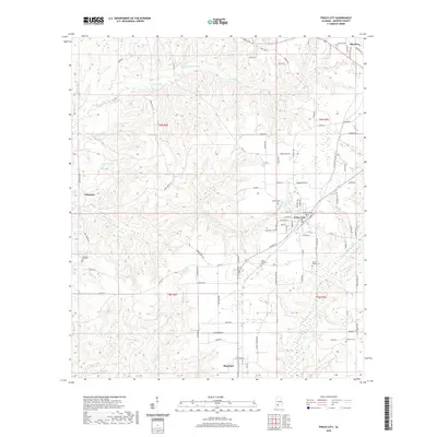
 1972 Frisco City1973 Print · USGSMonroe County in the early seventies centers on the rail-to-road transition of its rural communities. Genealogists and historians can trace family locations through numerous landmarks like Lilly Ch, Baas Cem, and the tracks of the St Louis - San Francisco railroad.3 unique versions available
 - 1986 Map of Atmore
 1986 Atmore1986 Print · USGSSouth Alabama’s river country and timberlands are captured here in the mid-eighties, showing the deep-water bends of the Alabama River and the expanding road networks. Genealogists and historians can trace family locations through small-town post offices and rural churches like Chrysler Ch and the settlement of Barlow Bend.2 unique versions available
 - 2011 Map of Frisco City, 2011 Print
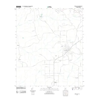 2011 Frisco City2011 Print · USGSCovers Megargel, including Frisco City, Manistee, and other nearby areas
 - 2014 Map of Frisco City, 2014 Print
 2014 Frisco City2014 Print · USGSCovers Megargel, including Frisco City, Manistee, and other nearby areas
 - 2018 Map of Frisco City, 2018 Print
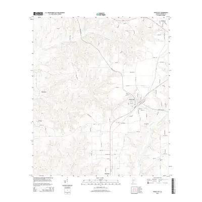
 2018 Frisco City2018 Print · USGSCovers Megargel, including Frisco City, Manistee, and other nearby areas
 - 2020 Map of Frisco City, 2020 Print
 2020 Frisco City2020 Print · USGSCovers Megargel, including Frisco City, Manistee, and other nearby areas
 - 2024 Map of Frisco City, 2024 Print
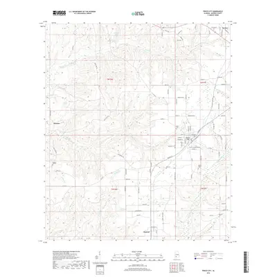
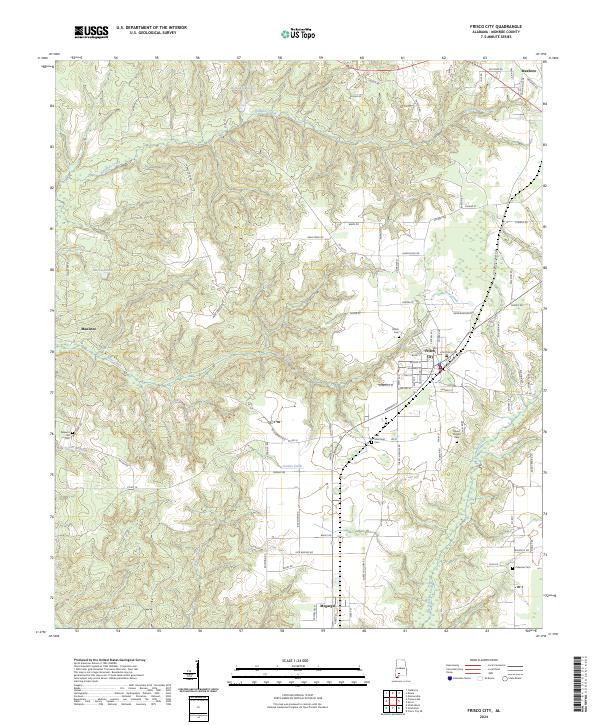 2024 Frisco City2024 Print · USGSMonroe County's timber and agricultural lands are shown in clear detail in this contemporary survey of the area around Frisco City. Genealogists can locate several family-named landmarks and burial grounds, including Mount Pisgah Cem, Megargel, and Báas Memorial Cem.
End of results
Showing maps 1-9 of 9
Top cities near Megargel
- Atmore historical maps
- Monroeville historical maps
- Frisco City historical maps
- Excel historical maps
- Uriah historical maps
- Repton historical maps
See more
Frequently asked questions
- What are the different types of historical maps available for Megargel?
- What is the oldest map of Megargel?
- Where can I purchase historical maps of Megargel for my home or office?
- Where can I download high-res historical maps of Megargel?
- Are there historical topographic maps available for Megargel?
- Is there historical aerial imagery available for Megargel?
- Where are historical maps of Megargel sourced from?