1960s Maps of Perry County, Alabama
Explore 5 historic maps of Perry County from the 1960s. These maps offer a rare glimpse into what life looked like during the 1960s — showing old roads, neighborhoods, homes, and landmarks that have changed or disappeared over time.
Whether you're researching your family's past, planning a metal detecting trip, or studying how Perry County's landscape evolved across the 1960s, these high-resolution maps are a powerful tool for exploring the history of this region.
- Focus on a specific era: All maps on this page are from the 1960s, giving you a focused view of this time period.
- See what’s changed: Compare century-old streets, trails, and buildings to today's modern landscape using overlays and satellite layers.
- Research with precision: Use these maps for genealogy, historical research, land use analysis, or educational projects.
- View, download, or print: Maps are fully viewable online in high resolution, and can be downloaded or printed for your own records.
Start exploring Perry County's history through authentic maps from the 1960s. This is your window into the past.
Perry County, AL maps
(5)- 1968 Map of Thomaston East, 1971 Print
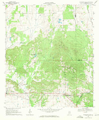 1968 Thomaston East1971 Print · USGSMarengo County during the late sixties is captured here in detail, showing a landscape of rural settlements and railroad corridors. Researchers can trace the Louisville and Nashville line and locate community landmarks like Bethel Hill Ch, St Johns Sch, and the town of McKinley.
 - 1968 Map of Uniontown West, 1971 Print
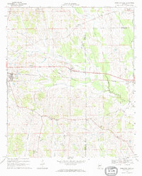
 1968 Uniontown West1971 Print · USGSUniontown and Faunsdale sit at the center of this late-sixties survey of Alabama's Black Belt, following the route of the SOUTHERN railroad. Researchers can trace family history through local landmarks like St Michaels Cem, Siddonsville, and Hatch High Sch.3 unique versions available
 - 1968 Map of Uniontown East, 1971 Print
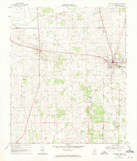
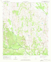
 1968 Uniontown East1971 Print · USGSThe rural borderlands of Perry and Dallas Counties come into focus in the late 1960s as a landscape of rail-side settlements and aviation history. Researchers can trace the Southern railroad through Uniontown and Tayloe or locate community centers like White Hill Sch and Trinity Ch.
 - 1968 Map of Browns, 1971 Print
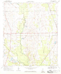 1968 Browns1971 Print · USGSThe rural landscape of Dallas and Perry Counties is captured here in the late sixties, where small rail-stop settlements like Browns and Massillon anchor the community. Researchers can trace local heritage through numerous landmarks, including St Marks Cem, Caldwell Ch, and Lake Walnutta.
 - 1968 Map of Central Mills, 1971 Print
 1968 Central Mills1971 Print · USGSDallas and Perry counties are shown here in the late sixties, where the timber and rail economy shaped rural life. Genealogists can trace family landmarks and community centers like Central Mills, Shady Grove Ch, and the small settlement of Blalock.3 unique versions available
End of results
Showing maps 1-5 of 5
Top cities of Perry County
Frequently asked questions
- What are the different types of historical maps available for Perry County?
- What is the oldest map of Perry County?
- Where can I purchase historical maps of Perry County for my home or office?
- Where can I download high-res historical maps of Perry County?
- Are there historical topographic maps available for Perry County?
- Is there historical aerial imagery available for Perry County?
- Where are historical maps of Perry County sourced from?