1970s Maps of Perry County, Alabama
Explore 11 historic maps of Perry County from the 1970s. These maps offer a rare glimpse into what life looked like during the 1970s — showing old roads, neighborhoods, homes, and landmarks that have changed or disappeared over time.
Whether you're researching your family's past, planning a metal detecting trip, or studying how Perry County's landscape evolved across the 1970s, these high-resolution maps are a powerful tool for exploring the history of this region.
- Focus on a specific era: All maps on this page are from the 1970s, giving you a focused view of this time period.
- See what’s changed: Compare century-old streets, trails, and buildings to today's modern landscape using overlays and satellite layers.
- Research with precision: Use these maps for genealogy, historical research, land use analysis, or educational projects.
- View, download, or print: Maps are fully viewable online in high resolution, and can be downloaded or printed for your own records.
Start exploring Perry County's history through authentic maps from the 1970s. This is your window into the past.
Perry County, AL maps
(11)- 1975 Map of Selma NW, 1977 Print
 1975 Selma NW1977 Print · USGSDallas County agriculture and rail infrastructure are captured in high detail in the mid-1970s. Genealogists and local historians can trace the physical layout of Marion Junction and the surrounding farmsteads during this era.
 - 1975 Map of Summerfield SW, 1977 Print
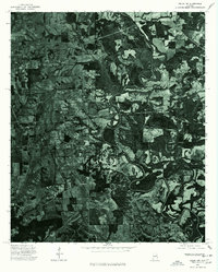
 1975 Summerfield SW1977 Print · USGSPerry County's rural landscape is captured through aerial photography in the mid-seventies, showing the intersection of timberlands and farm plots. Researchers can trace the layout of the settlement at TTLE and the meandering paths of the region's natural waterways.
 - 1975 Map of Summerfield SE, 1977 Print
 1975 Summerfield SE1977 Print · USGSDallas County is captured in mid-1970s aerial detail, documenting the rural landscape and timber tracts of the Alabama interior. Trace local land use and transit patterns along the corridor of State Route 219 as it appeared during the 1975 survey.
 - 1975 Map of Selma, 1977 Print
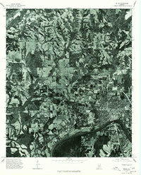 1975 Selma1977 Print · USGSSelma and the surrounding Dallas County countryside are captured in this mid-seventies aerial survey. Researchers can trace the riverfront development along the Alabama River and locate properties near Selma and the rural settlement of Potter.
 - 1979 Map of Marion North, 1980 Print
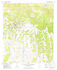
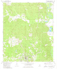 1979 Marion North1980 Print · USGSNorthern Alabama at the end of the 1970s reveals a landscape where the civic life of Marion meets the dense woodlands of the Talladega National Forest. Researchers can trace local genealogy through numerous rural landmarks like Judson College, Mt Nebo Ch, and the Campbellite Cem.2 unique versions available
 - 1979 Map of Scott Station, 1980 Print
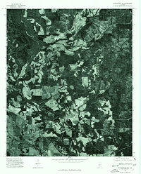
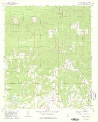
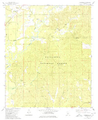
 1979 Scott Station1980 Print · USGSPerry County, Alabama, is captured in the late seventies as a landscape of rural railroad stops and scattered country churches. Genealogists can locate family landmarks like Reynolds Chapel, Scott Station, and the military presence at Vaiden Field USAF.
 - 1979 Map of Morgan Springs, 1980 Print
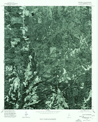
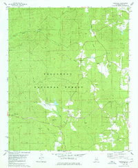
 1979 Morgan Springs1980 Print · USGSThe Alabama countryside along the Hale and Perry county line is captured here in the late seventies. Family historians can locate several burial grounds and rural congregations, including Harper Cem, Morning Star Ch, and Pineview Ch.2 unique versions available
 - 1979 Map of Marion South, 1980 Print
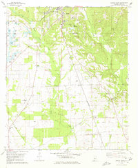 1979 Marion South1980 Print · USGSPerry County in the late seventies is centered on the historic academic grounds of Marion. Genealogists can trace rural family landmarks like Eagle Grove Cem, Healing Springs Ch, and the southern rail whistle-stop at Hamburg.
 - 1979 Map of Harrisburg, 1980 Print
 1979 Harrisburg1980 Print · USGSThe rural landscapes of Perry and Bibb Counties come into focus during the late 1970s, dominated by the timberlands of the national forest and the winding river. Genealogists can trace family roots through several local landmarks like Antioch Ch, Perkins Cem, and Paynes Chapel.2 unique versions available
 - 1979 Map of Greensboro, 1980 Print
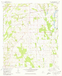
 1979 Greensboro1980 Print · USGSThe Hale County seat of Greensboro is shown in the late 1970s as a hub of rail and local commerce. Genealogists can trace family landmarks like Jenkins Place Cem, McCoy Cem, and numerous country chapels including Rising Star Ch.
 - 1979 Map of Pondville, 1980 Print
 1979 Pondville1980 Print · USGSWestern Alabama’s timberlands and rural communities are captured here in the late seventies. Genealogists can locate several family-named landmarks and old country burial grounds like Avery Cem, Elam Cem, and the cluster at Mulberry Cems.2 unique versions available
End of results
Showing maps 1-11 of 11
Top cities of Perry County
Frequently asked questions
- What are the different types of historical maps available for Perry County?
- What is the oldest map of Perry County?
- Where can I purchase historical maps of Perry County for my home or office?
- Where can I download high-res historical maps of Perry County?
- Are there historical topographic maps available for Perry County?
- Is there historical aerial imagery available for Perry County?
- Where are historical maps of Perry County sourced from?