Old Maps of Ironaton, Alabama for Metal Detecting
Plan your next treasure hunt with 14 historic maps of Ironaton. Find old homesites, ghost towns, trails, and gathering spots that may be lost to time — perfect for identifying promising metal detecting locations.
- Locate forgotten sites: Uncover places like long-lost settlements, abandoned rail lines, or gathering spots.
- Plan better hunts: Use map overlays combined with LiDAR or satellite views to narrow in on historically rich areas.
- Made for detectorists: Thousands of hobbyists use these maps to discover relics, coins, and hidden history.
Use these historic maps to boost your research and find new opportunities beneath the surface of Ironaton.
Ironaton, AL maps
(14)- 1891 Map of Ashland
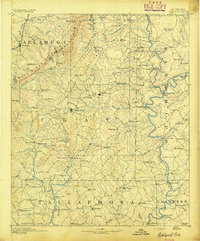 1891 Ashland1891 Print · USGSEast Central Alabama in the late nineteenth century is defined by the sharp ridges of the mountains and the vital crossings of the Tallapoosa River. Genealogists can trace family movements across Malone's Ferry or locate vanished sites like the Pine Tuckey Town Site and Ironaton.5 unique versions available
 - 1953 Map of Atlanta, 1965 Print
 1953 Atlanta1965 Print · USGSThe growing Atlanta metro and the industrial corridors of Eastern Alabama are captured here during the mid-century transition. Researchers can trace the rail-to-road shift through hubs like Anniston and La Grange or locate sites within Fort McClellan.2 unique versions available
 - 1957 Map of Atlanta
 1957 Atlanta1957 Print · USGSAtlanta and the Alabama borderlands appear here in the mid-fifties, capturing the region's post-war suburban and industrial transition. Trace the development of early transport hubs and military sites like Fort McPherson, Anniston, and the Kennesaw Mountain National Battlefield Park.
 - 1958 Map of Atlanta
 1958 Atlanta1958 Print · USGSMid-century Georgia and Alabama are shown in this regional study of the corridor between the Chattahoochee River and the Appalachian foothills. Local historians can trace the development of suburban Atlanta alongside vital landmarks like Stone Mountain, Dobbins AFB, and the Seaboard Air Line rail routes.
 - 1969 Map of Ironaton, 1974 Print
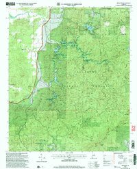
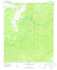 1969 Ironaton1974 Print · USGSTalladega County is shown in the late sixties as a landscape of mountain ridges and quiet settlements within the Talladega National Forest. Researchers can trace the Louisville and Nashville line past Ironaton or find family landmarks like Providence Ch and Guntertown.
 - 1975 Map of Ironaton, 1977 Print
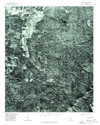 1975 Ironaton1977 Print · USGSTalladega County is captured in mid-1970s detail on this aerial-based survey. Local historians can trace the exact physical layout of the landscape around Mc Elderry and Guntertown through actual photo imagery of farms and forests.
 - 1978 Map of La Grange, 1980 Print
 1978 La Grange1980 Print · USGSThe Alabama-Georgia borderlands are captured here in the late seventies, just as the newly formed West Point Lake reshaped the eastern landscape. Local historians can trace the Seaboard Coast Line rail corridor through hubs like Roanoke, Ashland, and Lineville.
 - 1983 Map of Ironaton, 1985 Print
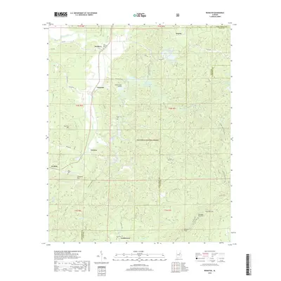
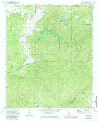 1983 Ironaton1985 Print · USGSTalladega County at the start of the eighties shows a landscape shaped by both forest conservation and industry. Genealogists can locate rural landmarks like Smith Chapel, Ironaton, and the McElderry Grave site along the abandoned rail line.
 - 2001 Map of Ironaton, 2004 Print
 2001 Ironaton2004 Print · USGSTalladega County at the turn of the millennium shows a landscape defined by forest ridges and small rural settlements. Genealogists and hikers can trace the paths of the Pinhoti Trail or locate historical community centers like Ironaton and Seay Chapel.
 - 2011 Map of Ironaton, 2011 Print
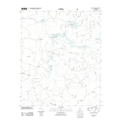 2011 Ironaton2011 Print · USGSCovers Ironaton, including Chinnabee, McElderry, and other nearby areas
 - 2014 Map of Ironaton, 2014 Print
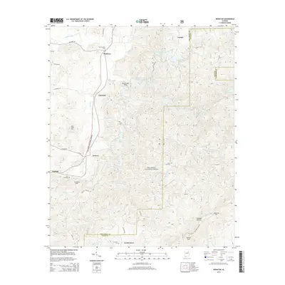 2014 Ironaton2014 Print · USGSCovers Ironaton, including Chinnabee, McElderry, and other nearby areas
 - 2018 Map of Ironaton, 2018 Print
 2018 Ironaton2018 Print · USGSCovers Ironaton, including Chinnabee, McElderry, and other nearby areas
 - 2021 Map of Ironaton, 2021 Print
 2021 Ironaton2021 Print · USGSCovers Ironaton, including Chinnabee, McElderry, and other nearby areas
 - 2024 Map of Ironaton, 2024 Print
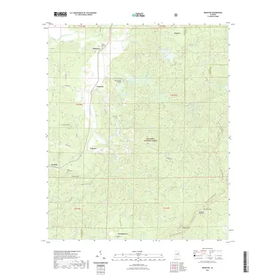
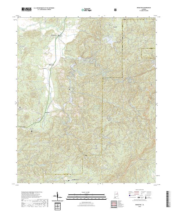 2024 Ironaton2024 Print · USGSTalladega County is shown in this contemporary survey, where the national forest meets long-established rural communities. Genealogists can trace family sites like Lackey Cem and Seay Chapel Cem or locate the historic Chief Chenneby Grave.
End of results
Showing maps 1-14 of 14
Top cities near Ironaton
- Oxford historical maps
- Anniston historical maps
- Talladega historical maps
- Pell City historical maps
- Sylacauga historical maps
- Lincoln historical maps
See more
Frequently asked questions
- What are the different types of historical maps available for Ironaton?
- What is the oldest map of Ironaton?
- Where can I purchase historical maps of Ironaton for my home or office?
- Where can I download high-res historical maps of Ironaton?
- Are there historical topographic maps available for Ironaton?
- Is there historical aerial imagery available for Ironaton?
- Where are historical maps of Ironaton sourced from?