2000s (21st Century) Maps of Pearson, Alabama
Explore 6 historic maps of Pearson from the 2000s (21st Century). These maps offer a rare glimpse into what life looked like during the 2000s — showing old roads, neighborhoods, homes, and landmarks that have changed or disappeared over time.
Whether you're researching your family's past, planning a metal detecting trip, or studying how Pearson's landscape evolved across the 2000s, these high-resolution maps are a powerful tool for exploring the history of this region.
- Focus on a specific era: All maps on this page are from the 2000s, giving you a focused view of this time period.
- See what’s changed: Compare century-old streets, trails, and buildings to today's modern landscape using overlays and satellite layers.
- Research with precision: Use these maps for genealogy, historical research, land use analysis, or educational projects.
- View, download, or print: Maps are fully viewable online in high resolution, and can be downloaded or printed for your own records.
Start exploring Pearson's history through authentic maps from the 2000s. This is your window into the past.
Pearson, AL maps
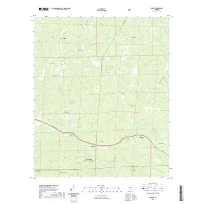
(6)- 2002 Map of Pearson, 2003 Print
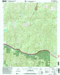 2002 Pearson2003 Print · USGSBibb and Tuscaloosa counties are shown here at the turn of the millennium as modern infrastructure met the deep woods. Researchers can locate family landmarks like Hubbard Springs Ch, trace the banks of Big Sandy Creek, or find the small community of Pearson.
 - 2011 Map of Pearson, 2011 Print
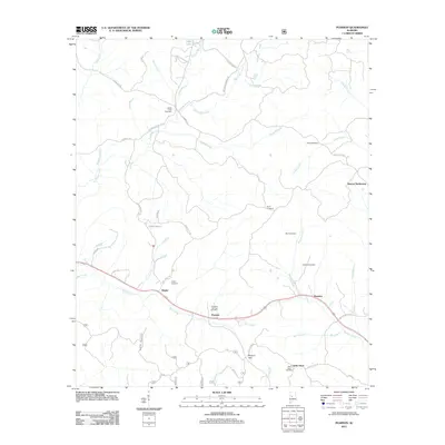 2011 Pearson2011 Print · USGSCovers Pearson, including Hagler, Harmon, and other nearby areas
 - 2014 Map of Pearson, 2014 Print
 2014 Pearson2014 Print · USGSCovers Pearson, including Hagler, Harmon, and other nearby areas
 - 2018 Map of Pearson, 2018 Print
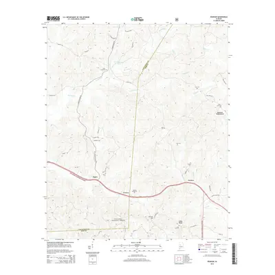
 2018 Pearson2018 Print · USGSCovers Pearson, including Hagler, Harmon, and other nearby areas
 - 2021 Map of Pearson, 2021 Print
 2021 Pearson2021 Print · USGSCovers Pearson, including Hagler, Harmon, and other nearby areas
 - 2024 Map of Pearson, 2024 Print
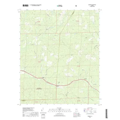
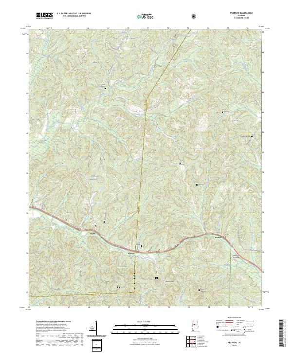 2024 Pearson2024 Print · USGSBibb and Tuscaloosa counties are documented here in the modern era as rural communities interface with the protected timberlands. Researchers can locate numerous family burial grounds and small settlements like Hagler, Pearson, and the Hubbard Springs Cem.
End of results
Showing maps 1-6 of 6
Top cities near Pearson
- Tuscaloosa historical maps
- Northport historical maps
- Holt historical maps
- Cottondale historical maps
- Brent historical maps
- Centreville historical maps
See more
Frequently asked questions
- What are the different types of historical maps available for Pearson?
- What is the oldest map of Pearson?
- Where can I purchase historical maps of Pearson for my home or office?
- Where can I download high-res historical maps of Pearson?
- Are there historical topographic maps available for Pearson?
- Is there historical aerial imagery available for Pearson?
- Where are historical maps of Pearson sourced from?