Old Maps of Rabbittown, Alabama for Genealogy
Trace your family roots with 14 historic maps of Rabbittown. These high-res maps reveal old neighborhoods, homesites, landmarks, and streets — helping you uncover where your ancestors lived and how the area evolved over time.
- Explore historic neighborhoods: Identify where your relatives may have lived in the 1800s or 1900s.
- Compare maps over time: Trace the changes in streets, buildings, and landmarks for multi-generational research.
- Perfect for genealogy & ancestry research: Used by family historians and researchers to map out lineage and migration.
These maps are an incredible resource for exploring your personal connection to Rabbittown's past.
Rabbittown, AL maps
(14)- 1936 Map of Moulton
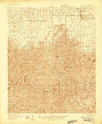 1936 Moulton1936 Print · USGSLawrence County in the mid-1930s shows a landscape of rural schools and family cemeteries clustered around Moulton. Genealogists and historians can trace the foundations of Rabbitt Town and Landersville or locate Shoemaker Cem and CCC Camp 12.2 unique versions available
 - 1940 Map of Mt Hope
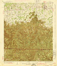 1940 Mt Hope1940 Print · USGSLawrence and Winston counties are captured here in the early 1940s as the Moulton Valley agricultural landscape meets the forest. Researchers can trace family sites at Cave Spring Ch, Heflin Cem, and the depression-era CCC Camp.3 unique versions available
 - 1956 Map of Gadsden, 1966 Print
 1956 Gadsden1966 Print · USGSNorth Alabama in the mid-1950s shows a region transformed by river engineering and federal industry. Genealogists and local historians can trace the development of the Tennessee Valley through the growth of Huntsville, the sprawling Redstone Arsenal, and the expansive Guntersville Lake.3 unique versions available
 - 1958 Map of Gadsden
 1958 Gadsden1958 Print · USGSNorth Alabama comes alive in the late 1950s as the Tennessee Valley Authority’s massive river projects and the rise of the space industry reshaped the landscape. Researchers can trace the mid-century footprints of Huntsville, Redstone Arsenal, and the riverside rail networks of the Southern railroad.
 - 1960 Map of Gadsden
 1960 Gadsden1960 Print · USGSNorthern Alabama in the mid-1950s is defined by the mighty Tennessee River and its massive reservoirs. Trace the development of Huntsville and Redstone Arsenal or explore the vast William B Bankhead National Forest.2 unique versions available
 - 1960 Map of Bee Branch, 1961 Print
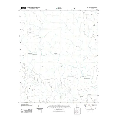
 1960 Bee Branch1961 Print · USGSThe Lawrence and Winston county line runs through these deep forest drainages at the dawn of the 1960s. Researchers can trace family sites near Rabbittown, locate the Adkins Cem, and follow the winding Sipsey River past Wolfpen Cyn.4 unique versions available
 - 1963 Map of Gadsden
 1963 Gadsden1963 Print · USGSNorthern Alabama underwent a dramatic mid-century transformation as the Tennessee Valley became a hub for defense and industry. Researchers can trace the development of the Redstone Arsenal, the route of the Natchez Trace Parkway, and long-standing rail lines like the Southern Railway.
 - 1980 Map of Haleyville, 1983 Print
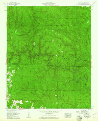
 1980 Haleyville1983 Print · USGSNorthwest Alabama at the start of the eighties shows a landscape of deep forests and new reservoirs as modern infrastructure settled into the hills. Researchers can trace the rail lines of the Southern and Illinois Central Gulf through towns like Haleyville, Moulton, and Natural Bridge.
 - 2000 Map of Bee Branch, 2003 Print
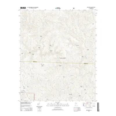
 2000 Bee Branch2003 Print · USGSThe Bankhead National Forest is documented here at the turn of the millennium, showing a preserved landscape along the Lawrence and Winston line. Researchers can locate remote family landmarks like Wolfpen Cem and Rabbitown among the drainages of the Sipsey Fork.
 - 2011 Map of Bee Branch, 2011 Print
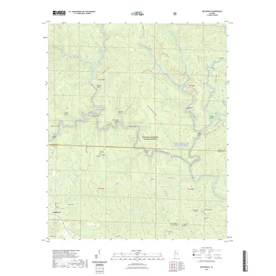
 2011 Bee Branch2011 Print · USGSCovers Rabbittown, including Lawrence County, Winston County, and other nearby areas
 - 2014 Map of Bee Branch, 2014 Print
 2014 Bee Branch2014 Print · USGSCovers Rabbittown, including Lawrence County, Winston County, and other nearby areas
 - 2018 Map of Bee Branch, 2018 Print
 2018 Bee Branch2018 Print · USGSCovers Rabbittown, including Lawrence County, Winston County, and other nearby areas
 - 2021 Map of Bee Branch, 2021 Print
 2021 Bee Branch2021 Print · USGSCovers Rabbittown, including Lawrence County, Winston County, and other nearby areas
 - 2024 Map of Bee Branch, 2024 Print
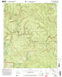
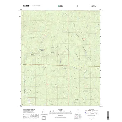
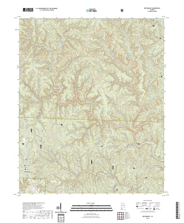 2024 Bee Branch2024 Print · USGSThe Bankhead National Forest and Sipsey Wilderness dominate this 2024 landscape at the Lawrence and Winston County border. Family historians can locate numerous rural burial sites including Johnson Cemetery West, Shiloh Cemetery, and Davenport Cemetery.
End of results
Showing maps 1-14 of 14
Top cities near Rabbittown
- Russellville historical maps
- Haleyville historical maps
- Moulton historical maps
- Double Springs historical maps
- Bear Creek historical maps
- Phil Campbell historical maps
See more
Frequently asked questions
- What are the different types of historical maps available for Rabbittown?
- What is the oldest map of Rabbittown?
- Where can I purchase historical maps of Rabbittown for my home or office?
- Where can I download high-res historical maps of Rabbittown?
- Are there historical topographic maps available for Rabbittown?
- Is there historical aerial imagery available for Rabbittown?
- Where are historical maps of Rabbittown sourced from?