Old Maps of Upshaw, Alabama for Metal Detecting
Plan your next treasure hunt with 16 historic maps of Upshaw. Find old homesites, ghost towns, trails, and gathering spots that may be lost to time — perfect for identifying promising metal detecting locations.
- Locate forgotten sites: Uncover places like long-lost settlements, abandoned rail lines, or gathering spots.
- Plan better hunts: Use map overlays combined with LiDAR or satellite views to narrow in on historically rich areas.
- Made for detectorists: Thousands of hobbyists use these maps to discover relics, coins, and hidden history.
Use these historic maps to boost your research and find new opportunities beneath the surface of Upshaw.
Upshaw, AL maps
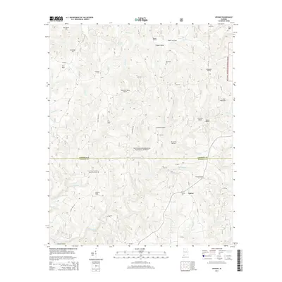
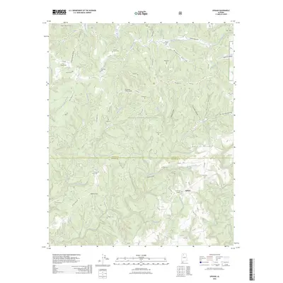
(16)- 1935 Map of Upshaw
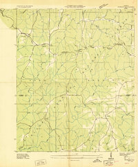 1935 Upshaw1935 Print · USGSLawrence and Winston counties are captured here in the mid-1930s, documenting a landscape of rural schoolhouses and forest management lookouts. You can trace early twentieth-century life at Upshaw, Templeton Sch, and the Friendship Cem.
 - 1935 Map of Danville
 1935 Danville1935 Print · USGSIn the mid-thirties, the borderlands of Lawrence and Morgan counties featured a landscape of remote stores and hilltop churches. Genealogists can trace family footprints at Strauge Crossroads or locate the ancient Indian Mounds near Oakville.2 unique versions available
 - 1938 Map of Danville
 1938 Danville1938 Print · USGSNorthern Alabama’s uplands are captured here in the mid-1930s, showing the early boundaries of the Black Warrior National Forest. Researchers can locate rural schools and churches like Speake Sch and Evergreen Ch or trace old crossings at McDaniel Bridge.2 unique versions available
 - 1956 Map of Gadsden, 1966 Print
 1956 Gadsden1966 Print · USGSNorth Alabama in the mid-1950s shows a region transformed by river engineering and federal industry. Genealogists and local historians can trace the development of the Tennessee Valley through the growth of Huntsville, the sprawling Redstone Arsenal, and the expansive Guntersville Lake.3 unique versions available
 - 1958 Map of Gadsden
 1958 Gadsden1958 Print · USGSNorth Alabama comes alive in the late 1950s as the Tennessee Valley Authority’s massive river projects and the rise of the space industry reshaped the landscape. Researchers can trace the mid-century footprints of Huntsville, Redstone Arsenal, and the riverside rail networks of the Southern railroad.
 - 1960 Map of Gadsden
 1960 Gadsden1960 Print · USGSNorthern Alabama in the mid-1950s is defined by the mighty Tennessee River and its massive reservoirs. Trace the development of Huntsville and Redstone Arsenal or explore the vast William B Bankhead National Forest.2 unique versions available
 - 1960 Map of Upshaw, 1961 Print
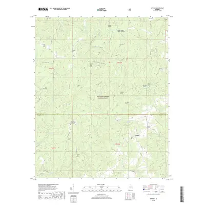
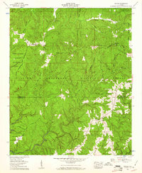 1960 Upshaw1961 Print · USGSNorth Alabama forest lands meet the Tennessee Valley in the early sixties. Genealogists and researchers can locate rural landmarks like Upshaw, the Basham Lookout Tower, and Penn Sch among the wooded hills.3 unique versions available
 - 1963 Map of Gadsden
 1963 Gadsden1963 Print · USGSNorthern Alabama underwent a dramatic mid-century transformation as the Tennessee Valley became a hub for defense and industry. Researchers can trace the development of the Redstone Arsenal, the route of the Natchez Trace Parkway, and long-standing rail lines like the Southern Railway.
 - 1980 Map of Haleyville, 1983 Print
 1980 Haleyville1983 Print · USGSNorthwest Alabama at the start of the eighties shows a landscape of deep forests and new reservoirs as modern infrastructure settled into the hills. Researchers can trace the rail lines of the Southern and Illinois Central Gulf through towns like Haleyville, Moulton, and Natural Bridge.
 - 2000 Map of Upshaw, 2003 Print
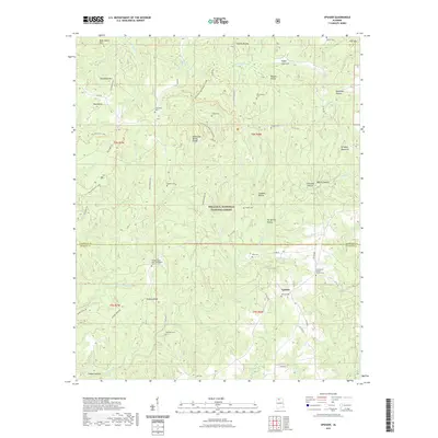
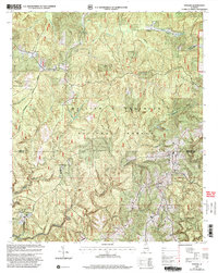 2000 Upshaw2003 Print · USGSNorthwestern Alabama's forest lands and the Tennessee Valley Divide are shown here at the turn of the century. Researchers can trace rural lineages at Friendship Cem or Hickory Grove Cem and explore the trails near the Owl Creek Horse Camp.
 - 2011 Map of Upshaw, 2011 Print
 2011 Upshaw2011 Print · USGSCovers Upshaw, including Lawrence County, Winston County, and other nearby areas
 - 2014 Map of Upshaw, 2014 Print
 2014 Upshaw2014 Print · USGSCovers Upshaw, including Lawrence County, Winston County, and other nearby areas
 - 2018 Map of Upshaw, 2018 Print
 2018 Upshaw2018 Print · USGSCovers Upshaw, including Lawrence County, Winston County, and other nearby areas
 - 2021 Map of Upshaw, 2021 Print
 2021 Upshaw2021 Print · USGSCovers Upshaw, including Lawrence County, Winston County, and other nearby areas
 - 2024 Map of Upshaw, 2024 Print
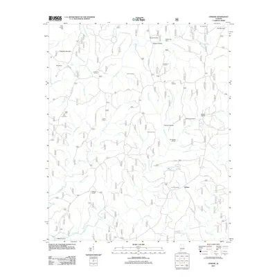
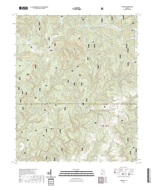 2024 Upshaw2024 Print · USGSThe North Alabama highlands near the Lawrence and Winston county line are shown here as they appeared in 2024. Researchers can trace family history through local landmarks like Corinth Cem Number 2, the settlement of Upshaw, and the ridges of Dillashaw Mountain.
 - 2026 Map of Upshaw, 2026 Print
 2026 Upshaw2026 Print · USGSCovers Upshaw, including Lawrence County, Winston County, and other nearby areas
End of results
Showing maps 1-16 of 16
Top cities near Upshaw
- Decatur historical maps
- Hartselle historical maps
- Moulton historical maps
- Double Springs historical maps
- West Point historical maps
- Addison historical maps
See more
Frequently asked questions
- What are the different types of historical maps available for Upshaw?
- What is the oldest map of Upshaw?
- Where can I purchase historical maps of Upshaw for my home or office?
- Where can I download high-res historical maps of Upshaw?
- Are there historical topographic maps available for Upshaw?
- Is there historical aerial imagery available for Upshaw?
- Where are historical maps of Upshaw sourced from?