Old Maps of Sanak, Alaska for Metal Detecting
Plan your next treasure hunt with 4 historic maps of Sanak. Find old homesites, ghost towns, trails, and gathering spots that may be lost to time — perfect for identifying promising metal detecting locations.
- Locate forgotten sites: Uncover places like long-lost settlements, abandoned rail lines, or gathering spots.
- Plan better hunts: Use map overlays combined with LiDAR or satellite views to narrow in on historically rich areas.
- Made for detectorists: Thousands of hobbyists use these maps to discover relics, coins, and hidden history.
Use these historic maps to boost your research and find new opportunities beneath the surface of Sanak.
Sanak, AK maps
(4)- 1949 Map of False Pass, 1956 Print
 1949 False Pass1956 Print · USGSThe Aleutian landscape at the end of the 1940s is defined by the vital maritime passage between the Bering Sea and Pacific. Genealogists and researchers can trace remote coastal settlements at False Pass and Morzhovoi, or locate landmarks like Shishaldin Volcano and Sanak Harbor.6 unique versions available
 - 1950 Map of False Pass
 1950 False Pass1950 Print · USGSThe western Aleutians in the mid-twentieth century are captured here, centered on the vital waters of Isanotski Strait. Trace early settlements at False Pass and Morzhovoi alongside the massive heights of Shishaldin Volcano.2 unique versions available
 - 1989 Map of False Pass B-3
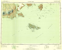
 1989 False Pass B-31989 Print · USGSThe remote Aleutian archipelago comes into focus in the late eighties, documenting the island communities of the Sanak group. Researchers can locate the settlements of Sanak and Pauloff Harbor or trace the shoreline from Chicago Harbor to Sanak Peak.
 - 2020 Map of False Pass B-3 NE, 2020 Print
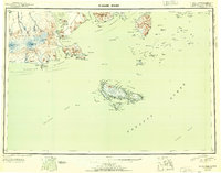
 2020 False Pass B-3 NE2020 Print · USGSSanak Island and its surrounding waters are documented here in the early twenty-first century. Researchers can locate coastal settlements like Pauloff Harbor and Sanak alongside natural landmarks such as Sanak Peak and Murphys Cove.
End of results
Showing maps 1-4 of 4
Frequently asked questions
- What are the different types of historical maps available for Sanak?
- What is the oldest map of Sanak?
- Where can I purchase historical maps of Sanak for my home or office?
- Where can I download high-res historical maps of Sanak?
- Are there historical topographic maps available for Sanak?
- Is there historical aerial imagery available for Sanak?
- Where are historical maps of Sanak sourced from?