Old Maps of Alyeska South, Anchorage for Genealogy
Trace your family roots with 9 historic maps of Alyeska South. These high-res maps reveal old neighborhoods, homesites, landmarks, and streets — helping you uncover where your ancestors lived and how the area evolved over time.
- Explore historic neighborhoods: Identify where your relatives may have lived in the 1800s or 1900s.
- Compare maps over time: Trace the changes in streets, buildings, and landmarks for multi-generational research.
- Perfect for genealogy & ancestry research: Used by family historians and researchers to map out lineage and migration.
These maps are an incredible resource for exploring your personal connection to Alyeska South's past.
Alyeska South, Anchorage maps
(9)- 1951 Map of Seward
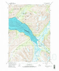
 1951 Seward1951 Print · USGSThe Kenai Peninsula and Prince William Sound come to life in the early 1950s as the rail and maritime networks linked remote coastal outposts. Genealogists and historians can trace the Alaska Railroad corridor through Seward, find the Jesse Lee Indian School, and locate isolated camps like Latouche and Chenega.4 unique versions available
 - 1951 Map of Seward D-6, 1975 Print
 1951 Seward D-61975 Print · USGSAnchorage and the Kenai Peninsula meet at the head of Turnagain Arm in the early fifties. Local historians can trace the early footprint of Girdwood, the rail siding at Portage (Site), and the facilities at Lower Engineers Camp.
 - 1952 Map of Seward D-6, 1954 Print
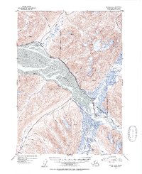 1952 Seward D-61954 Print · USGSTurnagain Arm and the surrounding Chugach mountains are captured here in the early fifties during a period of expanding coastal infrastructure. Researchers can trace the path of The Alaska Railroad past Girdwood and Portage, or locate the Twentymile Sawmill and Lower Engineers Camp in the river valleys.3 unique versions available
 - 1953 Map of Seward, 1956 Print
 1953 Seward1956 Print · USGSThe Kenai Peninsula and Prince William Sound are documented in the early 1950s as the rail and road networks expanded. Trace the route of the Alaska Railroad and find early settlements like Seward, Moose Pass, and Latouche.12 unique versions available
 - 1959 Map of Seward
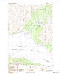
 1959 Seward1959 Print · USGSThe Kenai Peninsula and Prince William Sound are captured here during the mid-century, showing the vital transit corridor between Seward and the interior. Researchers can trace the Alaska Railroad through Whittier and locate historic coastal settlements like Chenega and Latouche.
 - 1984 Map of Seward D-6 Nw
 1984 Seward D-6 Nw1984 Print · USGSCoastal mountain life near Anchorage is captured here in the mid-eighties as the settlements at Girdwood and Alyeska expanded. Researchers can trace the drainage of Glacier Creek into the Turnagain Arm and locate the rail point at Kern.
 - 1994 Map of Seward D-6, 1998 Print
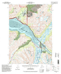 1994 Seward D-61998 Print · USGSIn the 1990s, the Kenai Peninsula and Anchorage borderlands were defined by the growing Alyeska resort and the glacial waters of Turnagain Arm. Trace the legacy of early infrastructure at Lower Engineers Camp or locate recreation sites like Moose Flats and Williwaw.
 - 2017 Map of Seward D-6 NW, 2017 Print
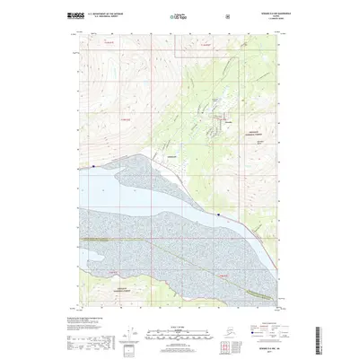 2017 Seward D-6 NW2017 Print · USGSCovers Alyeska South, including Girdwood, Alyeska, and other nearby areas
 - 2023 Map of Seward D-6 NW, 2023 Print
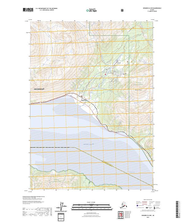 2023 Seward D-6 NW2023 Print · USGSAnchorage and the Girdwood valley are captured in this modern survey of the coastal mountains. Trace the Iditarod National Historic Trl as it winds past Alyeska or follow the Seward Highway along the shores of Turnagain Arm.
End of results
Showing maps 1-9 of 9
Frequently asked questions
- What are the different types of historical maps available for Alyeska South?
- What is the oldest map of Alyeska South?
- Where can I purchase historical maps of Alyeska South for my home or office?
- Where can I download high-res historical maps of Alyeska South?
- Are there historical topographic maps available for Alyeska South?
- Is there historical aerial imagery available for Alyeska South?
- Where are historical maps of Alyeska South sourced from?