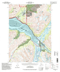
1994 Map of Seward D-6
USGS Topo · Published 1998About this map
Girdwood and the base of the Alyeska resort area serve as the northern anchors of this 1990s-era topographical study. The landscape is defined by the receding ice of Portage Glacier and the tidal expanse of the Turnagain Arm, where the Seward Highway follows the shoreline before turning inland toward Turnagain Pass. This period shows the developed recreation infrastructure within Chugach National Forest, including the Portage Work Center and multiple campgrounds such as Williwaw and Black Bear.
Find a feature on this map
53 named features on this map. Tap any name to fly to it.
Don’t see what you’re looking for? This feature index may not catch every label — zoom into the map to look around manually.
Map Details
Editions of this 1994 Seward D-6 Map
This is the sole edition of this map. No revisions or reprints were ever made.
Other maps of this area

1951 · Seward
USGS Topo · 1:250,000

1951 · Anchorage
USGS Topo · 1:250,000

1951 · Seward C-6
USGS Topo · 1:63,360

1951 · Seward D-5
USGS Topo · 1:63,360

1951 · Seward C-5
USGS Topo · 1:63,360

1951 · Seward D-7
USGS Topo · 1:63,360

1951 · Seward C-7
USGS Topo · 1:63,360

1951 · Seward D-6
USGS Topo · 1:63,360

1952 · Seward D-5
USGS Topo · 1:63,360

1952 · Seward C-6
USGS Topo · 1:63,360