Old Maps of Lignite, Alaska for Academic Research
Study the evolution of Lignite with 5 high-resolution historic maps. Whether you're teaching, researching, or modeling changes in land use, these maps provide essential visual documentation of urban, environmental, and geographic change.
- Analyze long-term change: Track patterns in development, transportation, and natural features.
- Ideal for environmental or urban studies: Support academic projects with primary historical map data.
- Use in the classroom or lab: Educators and researchers rely on these maps to bring historical context to life.
These maps are a powerful tool for teaching, research, and visualizing how Lignite has changed over the decades.
Lignite, AK maps
(5)- 1951 Map of Healy
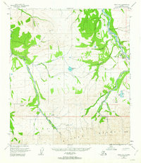
 1951 Healy1951 Print · USGSThe Alaska interior during the early fifties reveals a landscape shaped by the Alaska Railroad and the mining of the Alaska Range. Trace early settlements and infrastructure like Suntrana, the Dunkle Coal Mine, and the McKinley Park Airstrip at the edge of the wilderness.5 unique versions available
 - 1951 Map of Healy D-5, 1963 Print
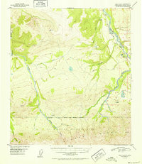
 1951 Healy D-51963 Print · USGSAlaska's interior wilderness meets the industrial frontier in the early 1950s, as the railroad and mining operations pushed into the foothills of the Alaska Range. Trace early infrastructure including the Alaska Railroad, the Diamond Coal Mine, and the Ranger Cabin near Otto Lake.4 unique versions available
 - 1952 Map of Healy D-5
 1952 Healy D-51952 Print · USGSThe Alaska interior at the dawn of the 1950s shows a rugged intersection of wilderness preservation and coal mining. You can trace the Alaska Railroad along the Nenana River to find the Diamond Coal Mine and the rail-stop at Lignite.2 unique versions available
 - 1956 Map of Healy, 1966 Print
 1956 Healy1966 Print · USGSThe interior of Alaska is shown during a period of industrial and recreational expansion in the mid-fifties. Genealogists and historians can trace the Alaska Railroad corridor through Healy and mining sites like Usibelli Mine.4 unique versions available
 - 2016 Map of Healy D-5 NE, 2016 Print
 2016 Healy D-5 NE2016 Print · USGSDenali's northern reaches and the Nenana River valley are captured in detail here during the mid-2010s. Trace the remote settlement of Ferry, the infrastructure around Healy, and the paths of Stampede Road and Lignite Road.
End of results
Showing maps 1-5 of 5
Top cities near Lignite
Frequently asked questions
- What are the different types of historical maps available for Lignite?
- What is the oldest map of Lignite?
- Where can I purchase historical maps of Lignite for my home or office?
- Where can I download high-res historical maps of Lignite?
- Are there historical topographic maps available for Lignite?
- Is there historical aerial imagery available for Lignite?
- Where are historical maps of Lignite sourced from?