Old Maps of Lignite, Alaska for Metal Detecting
Plan your next treasure hunt with 5 historic maps of Lignite. Find old homesites, ghost towns, trails, and gathering spots that may be lost to time — perfect for identifying promising metal detecting locations.
- Locate forgotten sites: Uncover places like long-lost settlements, abandoned rail lines, or gathering spots.
- Plan better hunts: Use map overlays combined with LiDAR or satellite views to narrow in on historically rich areas.
- Made for detectorists: Thousands of hobbyists use these maps to discover relics, coins, and hidden history.
Use these historic maps to boost your research and find new opportunities beneath the surface of Lignite.
Lignite, AK maps
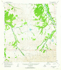
(5)- 1951 Map of Healy
 1951 Healy1951 Print · USGSThe Alaska interior during the early fifties reveals a landscape shaped by the Alaska Railroad and the mining of the Alaska Range. Trace early settlements and infrastructure like Suntrana, the Dunkle Coal Mine, and the McKinley Park Airstrip at the edge of the wilderness.5 unique versions available
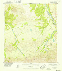
 - 1951 Map of Healy D-5, 1963 Print
 1951 Healy D-51963 Print · USGSAlaska's interior wilderness meets the industrial frontier in the early 1950s, as the railroad and mining operations pushed into the foothills of the Alaska Range. Trace early infrastructure including the Alaska Railroad, the Diamond Coal Mine, and the Ranger Cabin near Otto Lake.4 unique versions available
 - 1952 Map of Healy D-5
 1952 Healy D-51952 Print · USGSThe Alaska interior at the dawn of the 1950s shows a rugged intersection of wilderness preservation and coal mining. You can trace the Alaska Railroad along the Nenana River to find the Diamond Coal Mine and the rail-stop at Lignite.2 unique versions available
 - 1956 Map of Healy, 1966 Print
 1956 Healy1966 Print · USGSThe interior of Alaska is shown during a period of industrial and recreational expansion in the mid-fifties. Genealogists and historians can trace the Alaska Railroad corridor through Healy and mining sites like Usibelli Mine.4 unique versions available
 - 2016 Map of Healy D-5 NE, 2016 Print
 2016 Healy D-5 NE2016 Print · USGSDenali's northern reaches and the Nenana River valley are captured in detail here during the mid-2010s. Trace the remote settlement of Ferry, the infrastructure around Healy, and the paths of Stampede Road and Lignite Road.
End of results
Showing maps 1-5 of 5
Top cities near Lignite
Frequently asked questions
- What are the different types of historical maps available for Lignite?
- What is the oldest map of Lignite?
- Where can I purchase historical maps of Lignite for my home or office?
- Where can I download high-res historical maps of Lignite?
- Are there historical topographic maps available for Lignite?
- Is there historical aerial imagery available for Lignite?
- Where are historical maps of Lignite sourced from?