Old Maps of Pleasant Valley, Alaska for Metal Detecting
Plan your next treasure hunt with 9 historic maps of Pleasant Valley. Find old homesites, ghost towns, trails, and gathering spots that may be lost to time — perfect for identifying promising metal detecting locations.
- Locate forgotten sites: Uncover places like long-lost settlements, abandoned rail lines, or gathering spots.
- Plan better hunts: Use map overlays combined with LiDAR or satellite views to narrow in on historically rich areas.
- Made for detectorists: Thousands of hobbyists use these maps to discover relics, coins, and hidden history.
Use these historic maps to boost your research and find new opportunities beneath the surface of Pleasant Valley.
Pleasant Valley, AK maps
(9)- 1950 Map of Big Delta, 1956 Print
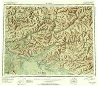 1950 Big Delta1956 Print · USGSAlaska's interior corridors reveal a landscape of military outposts and river-valley lodges in the mid-twentieth century. Trace historic routes along the Richardson Highway to find Big Delta, Fort Greely, and Shaw Creek Lodge.2 unique versions available
 - 1950 Map of Big Delta D-6, 1961 Print
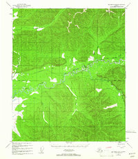 1950 Big Delta D-61961 Print · USGSInterior Alaska near the Chena River is captured here in the early fifties during a period of infrastructure expansion. Researchers can trace early transportation routes like the Winter Trail and identify remote landmarks including Hot Springs and several pioneer cabins.2 unique versions available
 - 1951 Map of Big Delta
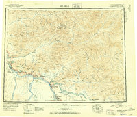 1951 Big Delta1951 Print · USGSThe interior of Alaska is captured at a critical junction during the post-war era as the highway system expanded. Genealogists and historians can trace early roadside landmarks like Aurora Lodge, Tenderfoot, and the original settlement layout of Big Delta.4 unique versions available
 - 1952 Map of Big Delta D-6
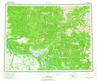
 1952 Big Delta D-61952 Print · USGSAlaska's interior wilderness in the early fifties is defined here by the winding Chena River and its remote valley outposts. Trace the early transportation routes of the territory through isolated Cabin sites, a local Airstrip, and the path of an old Sled Road.2 unique versions available
 - 1958 Map of Big Delta, 1966 Print
 1958 Big Delta1966 Print · USGSInterior Alaska at the height of the mid-century expansion reveals a landscape of strategic military outposts and remote river settlements. Trace the junction of the Tanana River and the Richardson Highway near Big Delta and the Healy Lake Indian Village.6 unique versions available
 - 1992 Map of Big Delta D-6 NW
 1992 Big Delta D-6 NW1992 Print · USGSThe Fairbanks North Star Borough in the early nineties remained a wilderness of river valleys and seasonal paths. Researchers can trace the development of the Chena River State Recreation Area and historical access routes like the Winter Trail and Pack Trail.
 - 2016 Map of Big Delta D-6 NW, 2016 Print
 2016 Big Delta D-6 NW2016 Print · USGSCovers Pleasant Valley, including Fairbanks North Star, United States, and other nearby areas
 - 2021 Map of Big Delta D-6 NW, 2021 Print
 2021 Big Delta D-6 NW2021 Print · USGSCovers Pleasant Valley, including Fairbanks North Star, United States, and other nearby areas
 - 2024 Map of Big Delta D-6 NW, 2024 Print
 2024 Big Delta D-6 NW2024 Print · USGSThe Tanana Valley near the turn of the 21st century shows a landscape transitioning from wilderness to established rural communities. Researchers can trace local lineage at Pleasant Valley Cem or map the routes of Chena Hot Springs Road and the Chena Hot Springs Winter Trl.
End of results
Showing maps 1-9 of 9
Frequently asked questions
- What are the different types of historical maps available for Pleasant Valley?
- What is the oldest map of Pleasant Valley?
- Where can I purchase historical maps of Pleasant Valley for my home or office?
- Where can I download high-res historical maps of Pleasant Valley?
- Are there historical topographic maps available for Pleasant Valley?
- Is there historical aerial imagery available for Pleasant Valley?
- Where are historical maps of Pleasant Valley sourced from?